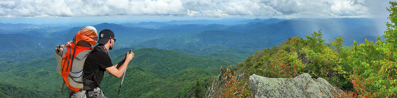
Best Hikes in the Smokies
Learn all about the best hikes in Great Smoky Mountains National Park
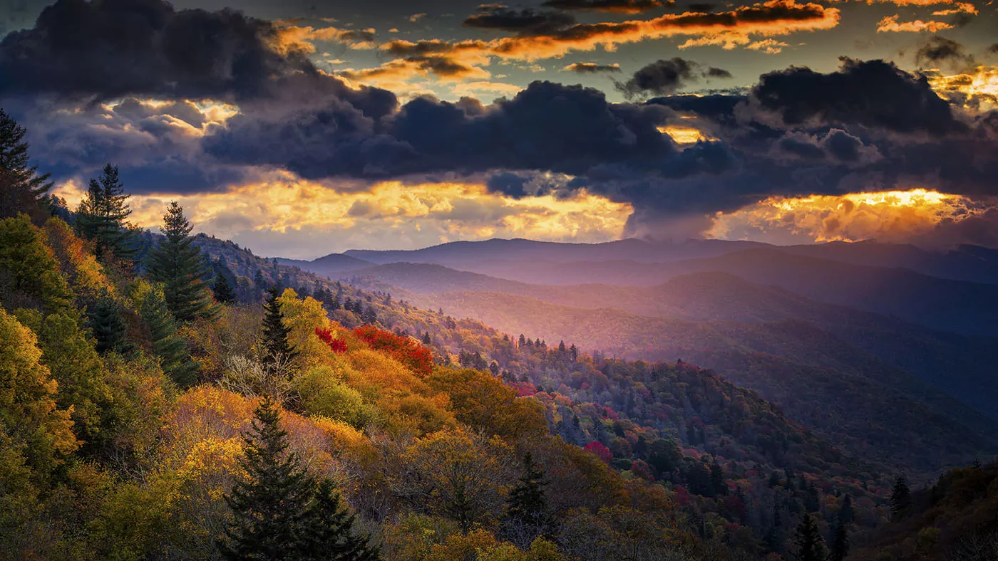
With over 850 miles of trails, Great Smoky Mountains National Park offers many extraordinary hikes that reward you with expansive views, old-growth forests, wildflowers, meadows, waterfalls and more. There is truly something for everyone in this diverse National Park. Whether you are a seasoned hikers, or a beginner, the Smokies have trails that vary in distance and difficulty, so all levels of ability can find a trail to explore and enjoy.
While Great Smoky Mountains is the busiest National Park in the United States, once you take a few steps from the busy overlooks, and past the popular day hike destinations, the crowds thin, and you may get to experience the diversity of the park to yourself. Below we have listed our favorite hikes in the Smokies with a description of each to help you find the trail that is best for you!
1. RAMSEY CASCADES
- Trailhead: Ramsey Cascades Trailhead
- Roundtrip Distance: 8 miles
- Elevation Gain: 2190 feet
The trail to Ramsey Cascades begins on an old gravel road, and soon leads to one of the largest old-growth forests in the Great Smoky Mountains. Some of the tallest and oldest trees in the park are along this trail, including eastern hemlocks, yellow birch and silverbells. The trail is moderate in difficulty until the last half of a mile, when the terrain becomes very rocky and uneven, and stable footing is essential. At 4 miles from the trailhead, you will finally reach Ramsey Cascades. This impressive 100-foot waterfall is the tallest in the park, dropping water over multiple tiers. There are many great spots along the shore of the water for a picnic and a well-deserved break. This unforgettable hike helps you understand the diverse ecosystem of Great Smoky Mountains National Park. When you are satisfied, simply turn around and hike back to the trailhead.
2. ANDREWS BALD
- Trailhead: Clingmans Dome
- Roundtrip Distance: 3.5 miles
- Elevation Gain: 900 feet
Starting at Clingmans Dome, you will begin on the Forney Ridge Trail. The first section of this trail is through a dense spruce-fir forest, with wildflowers blooming along the path. Continue on the Forney Ridge Trail as you pass multiple trail junctions. At just 1.7 miles, you will reach the edge of the grassy bald. This open meadow, Andrews Bald, is one of two balds that are maintained by the National Park Service. It provides expansive views, and on clear days, you are able to see to Fontana Lake and the North Carolina Smokies. The bald itself is also very impressive, with remarkable and unforgettable rhododendrons and flame azaleas blooming in the summer. This is an out-and-back hike, so when you are ready, head back down the trail the same way you came up.
3. CHARLIES BUNION
- Trailhead: Newfound Gap parking area
- Roundtrip Distance: 8.1 miles
- Elevation Gain: 1640 feet
This 8-mile roundtrip hike starts at Newfound Gap, which straddles North Carolina and Tennessee, and travels east on the Appalachian Trail. A variety of colorful wildflowers bloom along the trail in early spring and summer, and you are rewarded with panoramic views of the North Carolina Smokies throughout the hike, as well as views of Mount LeConte and Myrtle Point. At four miles, you will reach a fork in the trail, make sure you stay left here to go to Charlies Bunion. Once atop, you are rewarded with a remarkable and expansive vista on the rocks of Charlies Bunion (named for Charlie Conner, who went hiking with one of the early park pioneers; he rested on the rocks and took off his shoe to expose a bunion that looked similar to the rock outcropping). If you have saved some energy for the hike down, you may want to take a side trip to Jump Off. Take a right on the Boulevard Trail as you are headed down, and shortly after the trail junction, you will reach the trail for the Jump Off. From this vantage point you have incredible views of Charlies Bunion, Mount Guyot and the Appalachian Trail.
Whether you visit the Jump Off or not, simply follow the trail back down to the trailhead, the same way you came up.
4. MOUNT LECONTE
There are multiple ways to reach Mt. LeConte; the Alum Cave Trail and Trillium Gap Trail are two of the most popular routes. Below is a description for both routes:
VIA ALUM CAVE TRAIL:
- Trailhead: Alum Cave Trailhead
- Roundtrip Distance: 11 miles
- Elevation Gain: 2763 feet
The first section of this trail takes you on a gently grade to Arch Rock, at 1.3 miles. This arch was created over time as erosion chiseled away soft limestone rock. Continue past Arch Rock, and at approximately 2 miles, you will reach aptly named Inspiration Point, where you will have extraordinary views of Peregrine Peak—and it’s subsequent Little Duck Hawk Ridge and Eye of the Needle. A bit after Inspiration Point, you will come to Alum Cave, an 80-foot by 500-foot concave bluff. Above Alum Cave, the trail becomes narrow and exposed, with handrails drilled into the cliff for help. After this section, the trail levels out, and you will come to the Rainbow Falls Trail junction; take a right to the summit of Mount LeConte. First, you will come across LeConte Lodge, a historic backcountry lodge (and the highest guest lodge in the eastern United States); as you continue past it for .2 miles, you will come to Cliff Top, offering remarkable panoramic views of the Smokies. For the best vantage point, you can travel another .4 miles to Myrtle Point, and your efforts are rewarded with 360° views of mountains as far as the eye can see. This is an out-and-back trail, so when you are ready, follow the signs and head down the trail.
VIA TRILLIUM GAP TRAIL:
- Trailhead: Trillium Gap Trailhead
- Roundtrip Distance: 13.9 miles
- Elevation Gain: 3401 feet
Begin on Trillium Gap Trail, and you will continue on this trail for a majority of the hike to Mount LeConte. The first section of the trail traverses through an old-growth forest speckled with vibrant wildflowers. At 1.3 miles, you will reach Grotto Falls—the only waterfall in Great Smoky Mountains National Park that you can stand behind. As you continue past Grotto Falls, the crowds thin, and the trail climbs upward. You will come to a trail junction for Brushy Mountain Trail; continuing straight will actually lead you to Brushy Mountain and Greenbrier, so you will want to take a right, continuing on the Trillium Gap Trail. At 6.6 miles, you will reach LeConte Lodge, but for the best views you should travel past the lodge for .3 miles to Cliff Top, or .7 miles to Myrtle Point. Mount LeConte is the third tallest peak in the Smokies, but from it’s base in Gatlinburg, it rises 5301 feet, making it one of the tallest peaks in the eastern United States.
5. DEEP CREEK LOOP
- Trailhead: Deep Creek Trailhead
- Roundtrip Distance: 4.6 miles
- Elevation Gain: 579 feet
This short and sweet hike offers rewarding views along the entire trail. Almost right off the bat, at .3 miles from the trailhead, you will reach Toms Branch Falls, an impressive 80-foot waterfall. Follow signs for Deep Creek Loop, as you reach the junction of the Indian Creek Trail. Another waterfall, Indian Creek Falls, is located .1 miles on a spur trail, just one mile past the trailhead. Once back on the main trail, you will reach the Indian Creek valley, where rhododendrons will surround your sights. The trail begins an uphill climb to Sunkota Ridge, the highest point along the trail, alive with mountain laurel and other flowering bushes. Follow all the signs toy take you from the ridge down to Deep Creek again, and back to the trailhead.
6. GREGORY BALD
- Trailhead: Gregory Ridge Trailhead
- Roundtrip Distance: 11.3 miles
- Elevation Gain: 2030 feet
Start at the trailhead for Gregory Ridge trail, at Cades Cove. This trail is world-renown for it’s flame azaleas—a vibrant and fiery flowering bush that blooms exuberantly during the summer months. At 2.4 miles, the trail, which started off easygoing and smooth, becomes relentlessly uphill, gaining about 2000 feet in just over 3 miles. When you reach the Gregory Bald Trail, take a right, with another steep uphill until the trail flattens out for the last section. Gregory Bald, a 10 acre grassy meadow, is one of two balds maintained by the National Park Service (meaning, they keep it groomed and “bald”, while letting the others return to a wild state). Atop Gregory Bald on a clear day, you have incredible view of Cades Cove, Fontana Lake, Clingmans Dome and Thunderhead Mountain. If you are lucky enough to be hiking in June, you will be blown away by the fantastic pink, red, orange and white flame azaleas—pioneer naturalist William Bartram calling them “certainly the most gay and brilliant flowering shrub yet known”.
EXPERT-LED APPALACHIAN HIKING ADVENTURES

7. CHIMNEY TOPS
- Trailhead: Chimney Tops Trailhead
- Roundtrip Distance: 3.3 miles
- Elevation Gain: 1487 feet
This short, but steep trail takes you from Newfound Gap to Chimney Tops, and is one of the most popular hiking destinations in the park. It is popular for a reason, as the views from the top are out-of-this-world, giving you a great vantage point on Mount LeConte and the Chimney Tops pinnacles. The newly renovated trail contains rock steps and raised structures, and hosts an observation point at the top, giving you unforgettable views. From the trailhead to the top, and back is 3.3 miles. It should be noted, however, that just because this trail is short and contains steps, it gains a lot of elevation in a very short amount of time—similar to the elevation gain of hiking a Colorado 14er.
8. BRUSHY MOUNTAIN
There are multiple ways to reach the top of Brushy Mountain; Trillium Gap Trail and Porters Creek Trail are two of the most popular routes. Below is a description for each route:
VIA TRILLIUM GAP TRAIL
- Trailhead: Trillium Gap Trailhead
- Roundtrip Distance: 6.8 miles
- Elevation Gain: 1745 feet
Begin on the Trillium Gap Trail, where you will travel into the past through an old-growth forest, comprised of large eastern hemlocks, and scattered with a variety of wildflowers. At 1.5 miles, you will reach cascading waterfall, Grotto Falls, which is unique and impressive because it is the only waterfall in the park that you can stand behind. It provides a great respite from the sun on a hot summer day, and is a great place to see salamanders. Continue past Grotto Falls, and you will be rewarded with your first sight of your destination, Brushy Mountain. At 3 miles, you will reach the junction for Brushy Mountain Trail, taking a left here will lead you to the summit. The last section of the trail is through a tunnel of rhododendron and mountain laurel, and finally, takes you to the summit, where you can look out and see Mount LeConte, Charlies Bunion, Mount Guyot and Mount Chapman. If you continue a little further past this first vantage point, you can peer down on Pigeon Forge and Greenbrier Valley. This is an out-and-back trail, so once you are ready, head back down to the trailhead.
VIA PORTERS CREEK TRAIL
- Trailhead: Porters Creek Trailhead
- Roundtrip Distance: 11.7 miles
- Elevation Gain: 3000 feet
Begin on the Porters Creek Trail—this portion of the trail is along an old gravel road that follows Porters Creek. You will traverse under moss-covered trees, and pass the remnants of the Elbert Cantrell farmstead. At one mile, you will hit a fork in the trail (a short, 250 yard, side trail at this junction will take you to the John Messer homestead), to reach Brushy Mountain, take a left at the junction. Shortly up the trail, you will reach another trail junction, follow the signs and head right. You will climb over 2500 feet in the next 4.5 miles. At the junction of Trillium Gap, you can take a left toward the summit of Mt. LeConte, or a right and continue to Brushy Mountain. The last climb to the summit takes you through dense bushes, displaying vibrant wildflowers most of the year. Once at the summit of Brushy Mountain, you are rewarded with incredible views of the eastern Smokies, and have a great vantage point of Mount LeConte, Charlies Bunion and Mount Guyot. When you are ready, simply turn around and follow the signs back to the Porters Creek Trailhead.
9. BOOGERMAN TRAIL
- Trailhead: Caldwell Fork Trail
- Roundtrip Distance: 7.4 miles
- Elevation Gain: 1040 feet
The Boogerman Trail leads you through a dense and lush old-growth forest. Begin on the Caldwell Fork Trail, and at 8/10 mile, you will reach the Boogerman Trail. Once on the trail, you will be dwarfed by white pines, hemlocks and yellow poplars towering over you. The trail is named after Robert Palmer, who had the nickname “Boogerman”, and it is solely because of Palmer that these old-growth trees are still alive today. He was very protective of his forest and rejected any offer from the lumber industry. Thanks to him, some of the largest trees in Cataloochee are along the Boogerman Trail. At 2.3 miles, you will pass remnants of the Palmer homestead, and the trail will become a very enjoyable walk in the woods. This is a loop trail, so at 4.7 miles, you will reach the junction for the Caldwell Fork Trail, take this to complete the loop back to your car at the trailhead.
10. SPENCE FIELD
There are multiple ways to reach Spence Field; the Anthony Creek Trail, and Lead Cove Trail are two of the most popular routes. Below is a description for each route:
VIA ANTHONY CREEK TRAIL
- Trailhead: Anthony Creek Trailhead
- Roundtrip Distance: 10.3 miles
- Elevation Gain: 2342 feet
Spence Field is a large grassy bald, known for it’s spectacular views of the North Carolina Smokies. To reach Spence Field, begin on the Anthony Creek Trail in Cades Cove. You will follow Abrams Creek for the first section of trail, traversing through lush rhododendron growth. At 3.7 miles, you will reach the junction for Bote Mountain Trail, follow the signs for Spence Field and take a right at the junction. Stay on Bote Mountain Trail for 1.8 miles, until you reach the Appalachian Trail; Spence Field is located just past the junction. Once you get to the grassy bald, you will be blown away with the beauty of the ridgelines in the distance and the wildflower display around you. This is one of the best views in the entire park. Take as long as you need here, and when you are ready, head down the mountain to the trailhead the same way you came up.
VIA LEAD COVE TRAIL
- Trailhead: Lead Cove Trailhead
- Roundtrip Distance: 9.4 miles
- Elevation Gain: 3140 feet
Begin at the Lead Cove Trailhead, where you will pass an old homestead, and follow along the Sugar Cove Prong. After ¾ mile, you will be lead away from the creek and start a steep climb to the Bote Mountain Trail junction. Once you reach the junction, at 1.8 miles, you will have climbed 1300 feet. Follow the signs posted on the trail and take a right at the junction. As you continue hiking, there will be a section where rhododendron have formed a tunnel along the trail. Stay on Bote Mountain Trail for 4.7 miles until you reach the Appalachian Trail, just past the junction is Spence Field. Named after James Spence who set up a homestead in this area in 1830—he picked an absolutely breathtaking place to call home. Spence Field provides remarkable views of the North Carolina Smokies. And, in June, the wildflowers are fantastic; you will be surrounded by exuberant mountain laurel, painting the field pink and white. Take a rest for as long as possible in the field, as a way to take in the scenery and take a well-deserved break from the mountain you just climbed.
If you have the energy, you can continue 1.2 miles on the Appalachian Trail to Rocky Top—one of the three summits of Thunderhead Mountain. If not, you can turn around and head down Bote Mountain Trail to Lead Cove Trail, the same way you came.
11. RAINBOW FALLS
- Trailhead: Rainbow Falls Trailhead
- Roundtrip Distance: 5.4 miles
- Elevation Gain: 1685 miles
Rainbow Falls is known for it’s colorful rainbow that is displayed in the falls’ mist on a sunny day. The trail to Rainbow Falls is a steady uphill through a large boulder field for the first 2/3 mile, and you will see LeConte Creek cascading down the mountainside. After the initial uphill, the terrain is more even. Two footbridges along the route help you cross LeConte Creek, and at 2.8 miles, you will reach Rainbow Falls, standing tall at 80-feet. This is the tallest single-drop waterfall in the park. As with most waterfalls, it is best after a big rain, and since this is a fairly popular hiking destination, it is best to get started early in the morning.
The trail continues 4.2 miles to the summit of Mount LeConte. Otherwise, simply back and head down the way you came.
12. ABRAMS FALLS
- Trailhead: Abrams Falls Trailhead
- Roundtrip Distance: 5.2 miles
- Elevation Gain: 675 feet
This moderate trail leads you to one of the most spectacular waterfalls in the park. Starting at the trailhead, you will cross a footbridge over Abrams Creek, and follow along the creek for most of the hike. The trail has little elevation gain, but the terrain is rocky and uneven in some sections. You will be hiking through a pine-oak forest along the ridge, and in hemlock forest, with thick, vibrant rhododendron growth along the creek. At 2.6 miles you will reach a fork, take a left here to reach the base of the falls. Standing at only 20 feet tall, Abrams Falls is impressive because of the sheer volume of water cascading off it’s cliff. The long and deep pool at the base of the falls is picturesque, and worthy of a picnic or snack break along its shore. This is an out-and-back trail, so when you are ready, turn around and head back to the trailhead the same way you came.
JOIN A GUIDED HIKING ADVENTURE
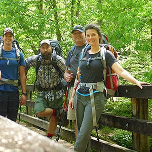 Great Smoky Mountains National Park is a rich, pristine wilderness with abundant wildlife, amazing views and unforgettable opportunities for hiking vacations. Wildland Trekking offers a variety of ways to enjoy the Smoky Mountains, including backpacking trips, portered treks, inn-based tours and day hikes.
Guided Smoky Mountain treks are all-inclusive meaning the following is included: local round trip transportation from Asheville; wonderful meals; top-of-the-line equipment; risk management systems; professional hiking/wilderness guides and more.
SMOKIES ADVENTURE TOURS
- GUIDED BACKPACKING TRIPS: these adventures are opportunities to explore the deep wilderness and extraordinary beauty of the Smokies.
- PORTERED HIKES: hike and camp far in the backcountry of the Appalachian Mountains with the convenience of light day packs and expert guides.
- INN-BASED HIKING TOURS: discover the magic of the Smoky Mountains on amazing daily hikes and enjoy wonderful Appalachian accommodations at night.
- DAY HIKE TOURS: make the most of your time in Great Smoky Mountains National Park with our expert guides and all-inclusive tours!
- ASHEVILLE AREA HIKING ADVENTURES: explore the stunning Blue Ridge Mountains around Asheville on backpacking, portered, and inn-based tours!
Related Pages