
3 Epic South Rim Backpacking Trips
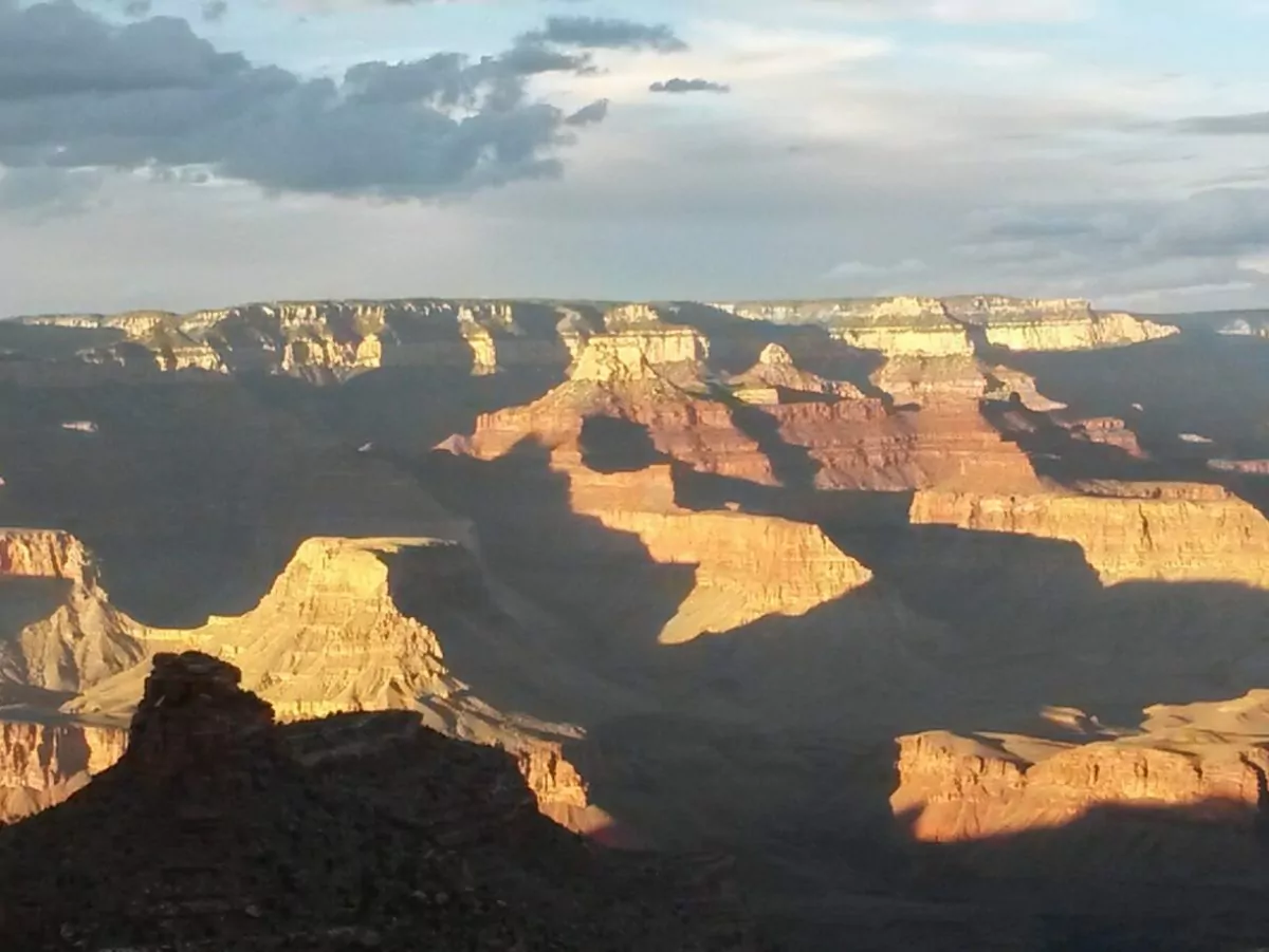
The Grand Canyon. It’s one of the 7 Natural Wonders of the World and can inspire dreams of epic adventure. Fortunately, the Grand Canyon more than delivers on that promise.
From the endless expanse of the Tonto Platform to the remote and rarely visited side canyons, I’ve picked the top 3 epic South Rim Grand Canyon backpacking trips for your next desert adventure. Read on, find the trip you want, and start planning today.
Award Winning Grand Canyon Backpacking Adventures
| Trip | Difficulty | Miles | Days |
| The Escalante Route | Strenuous | 25.0 or 27.6 | 4-6 |
| The Tonto Trail | Strenuous | 104.4 | 9-12 |
| The Royal Arch Loop | Strenuous | 24+ | 5 |
1. The Escalante Route
The Area
The Grand Canyon is much more than the South Rim Village and the Rim To Rim trails. At river level, the canyon is 277 miles long. Most of the canyon is completely empty wilderness. The Escalante route explores a stretch of this wilderness along the upper reaches of the canyon. Expect slot canyons, deserted riverside beaches, and expansive views of the canyon rising all around you. Stretches of this trail barely deserve to be called a trail, including a short class 4 rock climb.
Getting There
Hikers usually start the Escalante Route from the Lipan Point trailhead in Grand Canyon National Park. Lipan Point is on Desert View Drive close to the park’s east entrance. Plan on spending the night before your hike either in the South Rim village or Cameron. Both are less than an hour from the trailhead. Because of the length of the first day’s hike an early start is a good idea.
The Trail
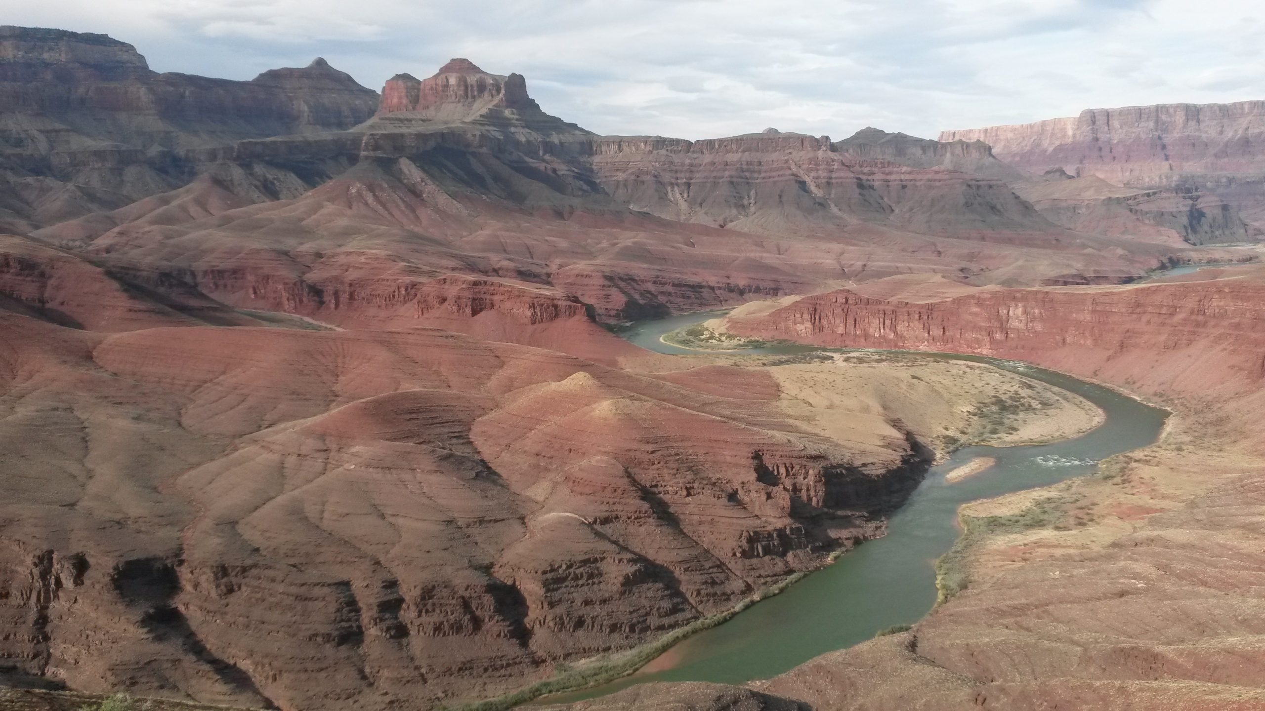
Tanner Trail To 75 Mile Canyon
The actual Escalante Route begins at the bottom of the canyon, where the Tanner Trail meets the Colorado River. Consequently hikers have a long day of hiking before the trail even starts. The Tanner begins at Lipan Point and descends 7.6 miles down to the river at Tanner Beach.
From Tanner Beach, the Escalante Route heads west (downstream) along the river for a couple miles before turning away from the river. Here the trail climbs about 1,300 feet to go around some river level cliffs and enters Escalante Canyon from above. A fun little jaunt down this canyon leads to the beach at the mouth of Escalante Creek.
This is where the trail gets really interesting. A few miles downstream from Escalante Canyon the route turns away from the river again to follow a shelf above Seventy-Five Mile Canyon. The canyon quickly rises to meet the trail. When the trail meets the canyon bottom be sure to descend into the canyon. Don’t follow the trail to nowhere on the other side of the canyon. As the unmarked route descends back toward the river, the canyon walls rise quickly to form a beautiful (almost) slot canyon. Follow the slot back to the river.
75 Mile Canyon To Hance Rapid
From Seventy-File Mile beach to Papago Creek the route stays near the river. This portion is very rough and some route-finding is necessary. Expect to use hands and feet occasionally until you arrive at lovely Papago Creek, the site of the famous Papago Wall. To continue on the route you must climb this wall on the downstream side of Papago Creek. It’s a straightforward class 4 climb of about 40 vertical feet. As a result, a rope for lifting packs can be very useful. However, once on top, the challenges aren’t over. The trail climbs a couple hundred feet before descending down the rockslide, a very loose, very steep descent back to river level. This section requires careful hand and foot scrambling. After that just a couple more miles along the river the trail leads to Hance Creek and the end of the route.
Careful readers will notice the Escalante Route ends here, but hikers are still at the bottom of the Grand Canyon. There are two options for getting back to the rim. One option is following the The New Hance Trail. This trail is only 7.4 miles long, but it is very steep and completely dry. The other option is taking the Tonto Trail to the Grandview Trail. This route is 10 miles long, but it is less steep and has 2 reliable water sources.
Camping and Water
There are a couple ways to tackle the Escalante so a little advance planning is a good idea. The first and most obvious camp site is Tanner Beach. Tanner Beach is located where the Tanner Trail meets the Colorado River. The river is your water source. It is also possible to do the first 2 miles of the Escalante and spend the first night at Cardenas Creek. Once again using the Colorado River as your water source. From Cardenas Creek it’s a long hike to the next water source and good camp site: back on the Colorado at Escalante Creek.
After Escalante, good sites with access to the Colorado River occur at Seventy-Five Mile Creek, Papago Creek, and Hance Creek. There is often good access to the river along this stretch for mid-day water fill-ups. The ascent up the New Hance trail is dry, but water is available along the Tonto/Grandview ascent route at Hance Creek and Miner’s Spring. If hiking this route, both Hance Creek and Horseshoe Mesa make great overnight stops. Horseshoe Mesa is dry; however, the views from the designated camping area are well worth the effort of carrying water up from Miner’s Spring.
Permits And Fees
Like most Grand Canyon backpacking permits, this one can be tough to get. Be sure to apply during the appropriate window by faxing in your request any time between the 20th of the month 5 months before your trip month to the 1st of the month 4 months before. Offering several itinerary options and potential start dates can greatly increase chances of success. Permits cost $10 per permit plus $8 per person per night.
Special Considerations
This hike requires some hand and foot scrambling and has one short rock climb. Hikers should be comfortable with class 3 and easy class 4 terrain. Your main water source is the Colorado River which may be very silty. Plan ahead and be conservative. Always share your hiking itinerary with others and ensure that you’re prepared for whatever weather the canyon throws at you.
Guided Trekking Options
Wildland Trekking offers a guided Escalante Route trek for a stress-free, exciting way to explore this beautiful mountain range. Let us handle permits, gear, transportation, meals, and provide a professional guide so you can focus 100% on enjoying your adventure. Read more.
All-inclusive USA Hiking Vacations
2. The Tonto Trail
The Area
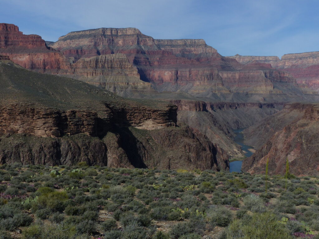
While most of the Grand Canyon is an impassable wilderness of sheer cliffs, there are a few places that allow for long-distance hiking without being a mountain goat. The Tonto Platform is one of those. It begins in the upper reaches of the Canyon and continues as a mostly flat shelf, 1000 – 1500 feet above the river, for about 75 miles. The Tonto Trail traverses this vast inner canyon expanse for its entire length. Expect stunning inner canyon landscapes and few other people for most of this unsurpassed trail.
Getting There
This hike starts at the New Hance trailhead, 13.5 miles east of South Rim Village on Desert View Drive. The trailhead is not very well signed and has no parking. If you get to Moran Point you went too far.
The Trail
The Tonto Trail, like most Grand Canyon trails that parallel the river, starts and ends at the bottom of the canyon. The upstream end is at Hance Rapids. The downstream end is at Garnet Canyon. That means the first day is a descent down either the New Hance Trail or the Bass Trail. This description assumes hikers are starting at New Hance and heading downstream.
Hance Rapid to Havasupai Garden
From Hance Rapid, the trail (and the Tonto Platform) rises up out of the earth just above the Grand Canyon basement layer. This first stretch, up from the beach, past the reliable water at Hance Creek, and around Horseshoe Mesa is fairly well traveled so expect to see a few other hikers for your first few days. However, once west of Horseshoe Mesa expect to mostly have the trail to yourself for a while.
From Horseshoe Mesa, the trail continues west paralleling the river about 1,000 to 1,500 feet above it. Here, the trail begins the pattern it follows for the rest of its length. From a spot above the river the trail turns sharply away from the river back toward the South Rim, paralleling a side canyon to a point where it can cross the side canyon without descending too much. Next, it turns sharply away from the rim and back toward the river in order to go around the next point without ascending too much. The lack of big elevation changes makes for easy walking but makes for slow progress downstream.
In this manner, over the next 20 miles the trail crosses Cottonwood, Grapevine, Boulder, Lone Tree, and Cremation Canyons before reaching the Tipoff. At the Tipoff is the junction with the South Kaibab trail. Here there is a toilet and the opportunity to pop down the South Kaibab to the river and Phantom Ranch for water or a cold drink. From the Tipoff, it is another 4.2 miles to bathrooms, reliable water, and lots of people at Havasupai Garden. At Havasupai Garden, many Tonto hikers choose to hike the 4.5 miles up to the South Rim Village to resupply food and fuel (and maybe have a little pizza).
Havasupai Garden To Garnet Canyon
After Havasupai Garden comes a very nice but well-traveled section of the trail, 11.5 miles to the Hermit Trail junction. There’s reliable water at Monument Creek (mile 10.7). Another 1.1 miles past the junction brings the developed campground and reliable water at Hermit Creek. Past Hermit Creek is the longest, driest, and most remote section of the trail. Past the reliable water at Boucher Creek (5.3 miles from Hermit) it’s 27.7 miles to the South Bass Trail junction. The South Bass offers the only chance for water along this stretch via a 3.6 mile detour down to the Colorado and back up. Again the trail goes around several major side canyons along this section including Slate, Ruby, Turquoise, and Serpentine.
After the South Bass junction comes the final section of the Tonto: 11.4 miles to Garnet Canyon and the beginning of the Royal Arch Route. However, hikers who reach the end are still at the bottom of the canyon with two options for getting back to the top. While it is possible to continue downstream along the Royal Arch Route and ascend to the South Bass trailhead this involves a challenging 20 foot free climb. It is not recommended. The better option is to backtrack to the South Bass Trail and ascend via the South Bass.
Camping
The Tonto passes through several Grand Canyon camping zones, each with its own set of rules. Hikers need to plan carefully and make sure they are aware of where they are and which rules apply. Water supplies are few and far between so planning to camp at reliable water sources makes sense. From east to west these are the Colorado River at Red Canyon, Hance Creek, Havasupai Garden, Monument Creek, Hermit Creek, and Boucher Creek. Other good options include short detours down to the Colorado River for water and camping at the Bright Angel campground, Monument Canyon, Hermit Canyon, Boucher Canyon, the Bass Trail, and Garnet Canyon.
If not near water camping is mostly at large near the trail. There are numerous nice flat camp sites with amazing inner canyon views along the route. Carrying two or three days worth of water is almost always a necessity on this trail. Count on it between Hance Creek and Havasupai Garden and between Boucher Creek and the end of the trail at Garnet Canyon. Some years there may be water in other places early in the season, but it is not wise to count on these sources.
Permits And Fees
The permit to start at the Bass Trail end is a little easier to get than for the New Hance end, but neither is too bad by Grand Canyon standards. Still, be sure to apply during the appropriate window by faxing in your request any time between the 20th of the month 5 months before your trip to the 1st of the month 4 months before. Offering several itinerary options and potential start dates can greatly increase chances of success. Permits cost $10 per permit plus $8 per person per night.
Special Considerations
The Tonto Trail is pretty flat for most of its length and makes for pleasantly easy walking. However, portions of this hike are very remote. You may go days without seeing any other hikers. Water sources can be few and far between. Plan ahead and be conservative. Always share your hiking itinerary with others and ensure that you’re prepared for whatever weather the canyon throws at you.
Assisted Trekking Options
Wildland Trekking offers guided treks along portions of the Tonto Trail for a stress-free, exciting way to explore this beautiful trail. Let us handle permits, gear, transportation, meals, and provide a professional guide so you can focus 100% on enjoying your adventure. Read more.
Inspired Exploration with Wildland Trekking
3. The Royal Arch Loop
The Area
The Royal Arch route is a spectacular, technical, demanding, and remote route on the western end of Grand Canyon National Park. It’s an area of dramatic natural features, rich history, and unmaintained trails requiring route-finding and climbing skills.
Getting There
Even the trailhead for this hike, the South Bass Trailhead, is a long way from anywhere. It’s located west of South Rim Village at the end of 25 miles of unmaintained roads. When the road is in good shape, a high clearance 2WD vehicle is usually enough to reach the trailhead. But if there has been rain or snow, 4WD is definitely necessary. The road is even completely impassable at times. Expect to pay a $25 fee where the road crosses a small section of the Havasupai Reservation.
The Trail
South Bass Trailhead To Royal Arch
This hike is almost always done in a clockwise direction to avoid a challenging 20 foot free climb near the river. Hikers start by descending the first 1.5 miles of the South Bass Trail to the Royal Arch Route junction. Leaving a water cache here, to be available after a long dry ascent up the South Bass, is a good idea. From here, the trail traverses a deceptively easy 6.5 miles across the Esplanade to the eastern branch of Royal Arch Canyon. This section is nearly flat and generally easy to follow.
At this point (mile 7.6) things get trickier. The route descends into the eastern arm of Royal Arch Canyon. About 1.5 miles, after the beginning of the descent, the route hits an impassable 200 foot pour off. Routes around this obstacle are available on either side of the canyon, but the north side is generally better and often marked. Once past the pour off, the route soon enters the main channel of Royal Arch Canyon. At this point, the descent becomes very rough, requiring boulder scrambling. Using rope to lower packs can often be helpful. Soon, spring water appears in the canyon, then pools depending on recent weather. In fact, some years it is necessary to wade or even swim through parts of this section.
About 1 3/4 miles down the main arm of the canyon, note the cairned trail heading up the east side of the canyon but for now continue downstream. About a half mile down is the misnamed but spectacular Royal Arch. It’s actually a natural bridge. This is the largest natural bridge in the Grand Canyon and well worth the short detour. After enjoying the arch and filling up with water, backtrack to the trail heading up out of the canyon.
Royal Arch To South Bass Trailhead
Once out of the canyon, the trail is easy to follow here. It crosses a relatively flat section for about a mile before coming to the top of the infamous rappel. Here hikers must rig an anchor and rappel the 20 foot nearly vertical descent. Once past this obstacle, it’s a steep and sandy but short descent to the Colorado River at Toltec Beach. From here, the trail follows the river upstream; however, the rough 1.5 miles downstream to unique and stunning Elves Chasm is an essential side trip.
From Toltec Beach, the trail meanders 13.1 dry miles along the slowly ascending Tonto Bench. It rounds Fiske and Wallace Buttes before arriving at the junction with the South Bass Trail. Note that, although hikers won’t really notice any difference, at mile 1.7 of this section the Royal Arch Route officially ends and the Tonto Trail begins. From the junction a rough and challenging 3.5 mile ascent brings hikers back to the Royal Arch/South Bass junction and some dry but excellent campsites on the Esplanade. From the Esplanade only a steep 1.3 miles separate hikers from the end of the hike at the South Bass Trailhead.
Camping
Like many Grand Canyon hikes, camp site choices depend heavily on water availability. The first water on this hike is usually around mile 11 in Royal Arch Canyon. While it’s possible to reach this in one day, a more realistic plan is to dry camp the first night on the Esplanade or in the upper reaches of Royal Arch Canyon. Toltec Beach and the Colorado River make a good spot for camp sight two. While it is possible to follow the South Bass to the river for camp three, that makes for a 15 mile hiking day. Therefore, a dry camp near the Tonto/Bass junction makes sense for camp three. A water cache on the Esplanade is a good choice for camp four leaving a short hike and long drive back to civilization for the last day.
Permits And Fees
The Bass Trail is one of the easier permits to get on the South Rim but, like any Grand Canyon permit, plan ahead. Be sure to apply during the appropriate window by faxing in your request any time between the 20th of the month 5 months before your trip to the 1st of the month 4 months before. Offering several itinerary options and potential start dates can greatly increase chances of success. Permits cost $10 per permit plus $8 per person per night.
Special Considerations
The Royal Arch Loop is remote, demanding, and technical. It is a highly rewarding trek for experienced canyon hikers. However, those without well-developed navigation and climbing skills may easily find themselves in serious trouble. In addition, the ability to rig and execute a 20 foot rappel is a must.
Guided Trekking Options
Wildland Trekking offers guided treks along portions of this route for a stress-free, exciting way to explore this beautiful and remote area. Let us handle permits, gear, transportation, meals, and provide a professional guide so you can focus 100% on enjoying your adventure. Read more.
Wildland Trekking Hiking Adventures
As the world’s premier hiking and trekking company, Wildland believes in connecting people to fantastic environments in amazing ways. Peru features an array of incredible hiking and trekking experiences, and Wildland Trekking offers several Grand Canyon hiking adventures to different destinations within this fantastic region. From luxurious inn-based trips to the stunning & remote backcountry backpacking, we’re sure to have a trip for you.
To learn more about our guided Grand Canyon hiking trips and all of our award-winning global hiking vacations, please visit our website or connect with one of our Adventure Consultants: 800-715-HIKE

