
5 Terrific Hikes Around Asheville
The city of Asheville is the perfect launching point for your outdoor adventures. Asheville is located in the heart of the Blue Ridge Mountains; therefore, your perfect hike is less than two hours away. You have so many options to choose from, so where should you go hiking and discover the beauty of the Blue Ridge Mountains? Here are five suggestions for terrific hikes around Asheville to match your wants and needs.
| Shining Rock Loop | Stunning View | Moderate | 9.7 miles |
| Panthertown Valley Loop | Waterfalls | Moderate | 4.2 miles |
| Pinnacle Park | Workout | Most Difficult | 7 miles |
| Graveyard Field Loop | Dog Friendly | Easy-Moderate | 3.3 miles |
| Big Creek Trail | Family Friendly | Easy | 4 miles |
Award Winning Appalachian Hiking Adventures
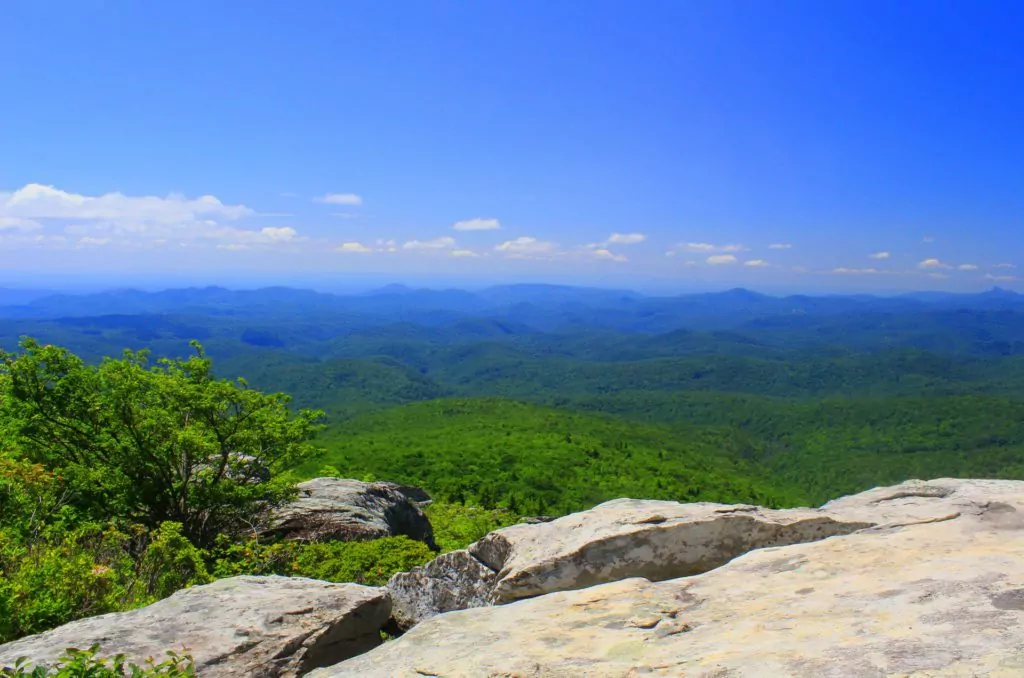
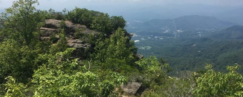
1. For A Stunning View: Shining Rock via the Art Loeb Trail
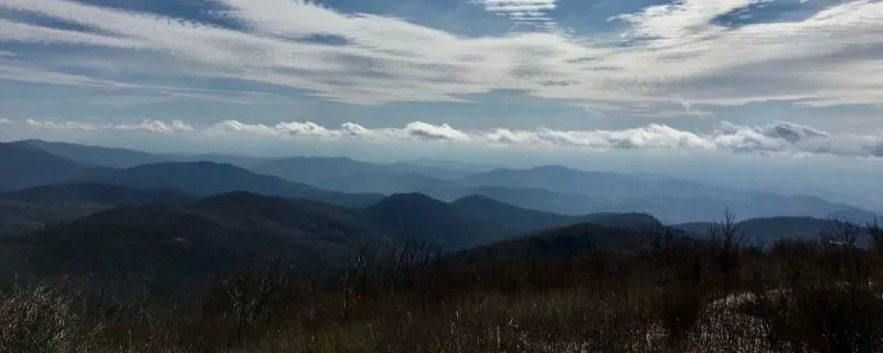
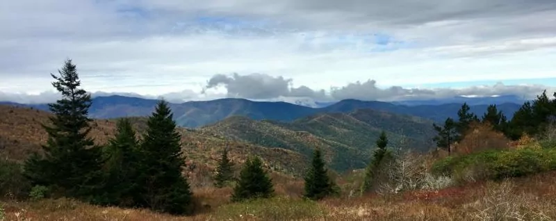
Blue Ridge Parkway
Stunning views can be found throughout the Blue Ridge Mountains. A drive along the Blue Ridge Parkway will have you stopping at every pull-off to capture that perfect photo of an amazing view. If you are looking for stunning views by foot instead of by car, I recommend visiting Shining Rock Mountain via the Art Loeb Trail. This area is located in the Shining Rock Wilderness in Pisgah National Forest. While hiking to Shining Rock, you will have multiple opportunities to capture a simply stunning 360-degree panoramic photo.
Trip Overview
My preferred route is a 9.7-mile loop:
- Depart from the Black Balsam Knob Trailhead Parking Lot off of the Blue Ridge Parkway.
- Hike northbound climbing over Black Balsam Knob and Tennent Mountain on Art Loeb Trail to Ivestor Gap.
- From Ivestor Gap, continue on the Art Loeb Trail, passing over Grassy Cove Top through Flower Gap to Shining Rock.
- Return to the parking lot by hiking the 101 southbound (also called Ivestor Gap Trail).
Geology
Shining Rock is a large white quartz formation that can be seen for miles sparkling in the sun. On your hike to this geologic wonder, you’ll walk over grassy peaks and through rhododendron tunnels and balsam fir forests. Once you arrive at the quartz outcropping, tread with caution when climbing up the quartz for a specular view. The quartz outcrops are slippery when wet, and a fall from here would be dangerous.
Wildlife
Be on the lookout for black bears, as there is a healthy population living in these woods.
Weather
The weather in the Blue Ridge Mountains is ever-changing and unpredictable. Be sure to pack warm layers and rain gear, even when hiking in the summer. The maximum elevation on this trek is 6200 feet, so you could see drastically different weather at the top than at the trailhead. I recommend hiking this trail in waterproof shoes with trekking poles; portions of the trail are rocky and slippery.
Day Hike or Camping Trip?
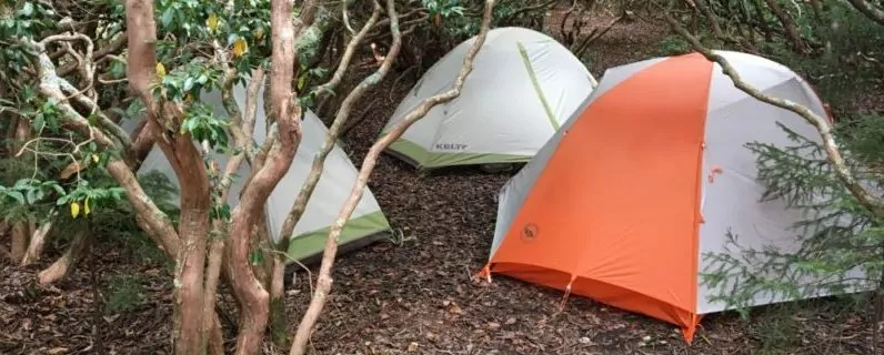
This hike makes an excellent day hike as well as a great backpacking trip with plenty of camping sites to choose from near Shining Rock. If you do stay overnight, climb up Shining Rock for a fantastic view of the stars. Bear canisters are required in this area, and fires are prohibited.
Gear Recommendations:
- Waterproof shoes
- Trekking poles
- Map
- Compass
- Camera
- Bear canister if camping
Getting There
If you are ready for non-stop stunning views while trekking on foot through the Blue Ridge Mountains, the Shining Rock Loop should be put on your bucket list when you visit the Asheville area.
Free parking is available at the trailhead, located off the Blue Ridge Parkway at MP 420.
31.1 miles
- Take I-240 W/U.S. 70 W to I-26 E
- Take exit 33 NC-191 toward Blue Ridge Parkway
- Turn right onto Blue Ridge Parkway in 2.4 miles
- Continue on the Blue Ridge Parkway for 18.4 miles
- Turn left onto US-276 N
- Shining Rock Trail Head parking will be on the left in 2.8 miles
Permits
Permits are not required for hiking or camping in the Shining Rock Wilderness area; however, group size is limited to a maximum of 10.
Hike Shining Rock with a Guide
Guided Shining Rock Loop Day Hikes, Shining Rock Wilderness backpacking trips, and Portered Shining Rock trips are available. They are a stress-free, exciting way to get into the wilderness. Wildland Trekking handles permits, gear, transportation, meals, and a professional guide so you can focus 100% on enjoying your adventure.
All-inclusive Shining Rock Backpacking Trips
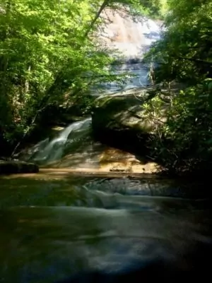
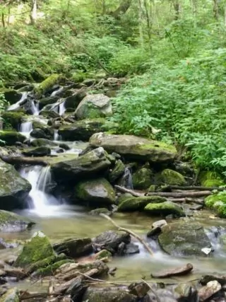
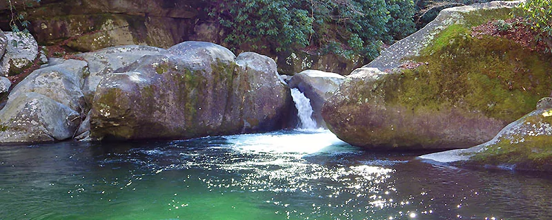
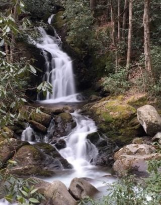
2. For Waterfalls: Panthertown Valley Loop
Western North Carolina has an abundance of waterfalls hidden throughout its woods. In fact, Transylvania County, located near the city of Asheville, is known as the “Land of Waterfalls.” But I recommend exploring Panthertown Valley and discovering some lesser-visited waterfalls while in the Asheville area. Panthertown Valley is referred to as the “Yosemite of the East” and is located in the Nantahala National Forest. It is a hop, skip, and a jump away from the city of Asheville, and definitely worth the few extra minutes of driving. Panthertown Valley Loop Trail from Salt Rock Gap is a 4.2-mile trail that has three distinct waterfalls along this trek. This loop makes a fantastic day hike with overnight camping options along the way.
The Area
A map and compass are highly recommended when venturing out in Panthertown Valley. Although there are plenty of trail signs along the way, it is easy to take a wrong turn and miss one of these hidden falls. My first hike in this area was with a guide. My second hike was with a map on my phone and a hiking partner that had never hiked in this area. Granny Burrell Falls was elusive for us that day. As we hiked up and down the same trail multiple times, we asked other hikers for directions. We even interrupted a fly fisherman to take a peek at his paper map before we finally located Granny Burrell Falls. So take it from me, you’ll want to bring a map.
This hike is lined with wildflowers, blueberries, and blackberries in the summer. You will walk through rhododendron tunnels as well as pine forests. Be sure and take the detour to see the Great Wall, a spectacular rock wall that goes on for as long as the eye can see.
Trip Overview
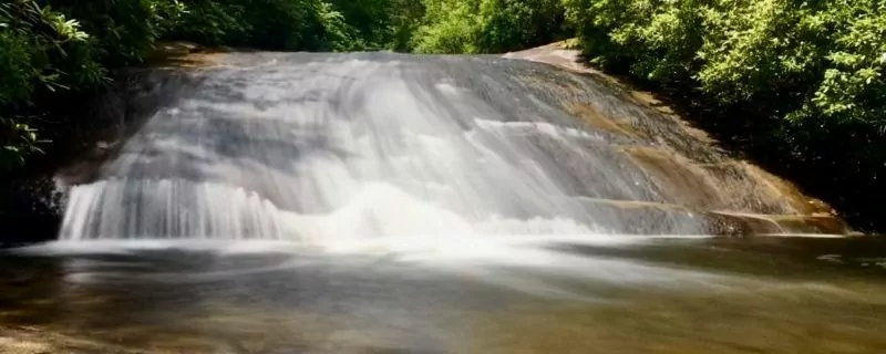
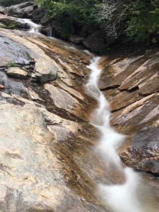
Once a map is in hand (and hopefully a compass too), begin your hike by taking the Panthertown Valley Trail #474 from the Salt Rock Gap Parking area. Look out for the Wilderness Falls Trail #490 on your right. As you follow Wilderness Falls Trail, watch for the trail to turn sharply left. Here, listen and look on your right for Wilderness Falls, a 60-70 foot waterfall.
Wilderness Falls
From Wilderness Falls, continue along the Wilderness Falls Trail #490 until it dead-ends into Deep Gap Trail #449. Frolictown Falls will be on your right at this intersection. Frolictown Falls is smaller than Wilderness Falls; however, it is popular with photographers.
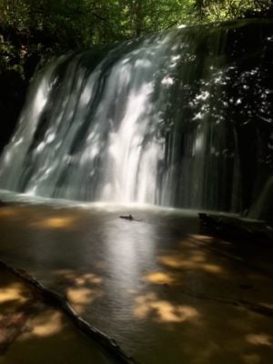
Frolictown Falls
From Frolictown Falls, continue on Deep Gap Trail #449, passing Wilderness Falls Trail on your left. Take Deep Gap Trail until the Granny Burrell Falls Trail #486 intersects on your right. Follow Granny Burrell Falls Trail across Panthertown Creek. Here you have two options. First, continue down Granny Burrell Falls Trail and in 1/4 mile find Granny Burrell Falls on your left. The falls itself is only about 10 feet tall, but it has a great swimming hole and beach for a picnic lunch. The second option is to turn right and take the Great Wall Trail #489. This trail leads to a giant rock wall formation. Hike past the camping shelter and primitive camps then start looking to your right for the Great Wall. Take one of the game trails (paths created by animals) among the grasses to the base of the Wall.
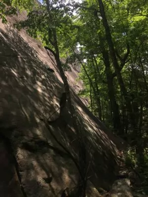
Great Wall
After viewing the Great Wall, retrace your steps back to the Granny Burrell Falls Trail. Be sure to turn right at the intersection; Granny Burrell Falls will be about 1/4 miles down the trail.
To complete this loop after picnicking at Granny Burrell Falls, continue down Granny Burrell Falls Trail (the opposite way you walked in). Granny Burrell Falls Trail will dead-end at Mac’s Gap Trail #482. Turn left and follow this trail over a creek and through a pine forest and another primitive camping area. Mac’s Gap Trail will intersect with Panthertown Valley Trail #474. Turn left here and begin the uphill hike back to Salt Rock Gap Parking area. Be sure to stop to catch your breath and view Panthertown Valley at the overlook on your right.
Camping/Permits:
Permits are not required for hiking or camping in Panthertown; however, group size is limited to a maximum of 12.
Weather
Spring and Fall temperatures: 40-60’s Fahrenheit
Summer temperatures: 50-80’s Fahrenheit
Winter temperatures: 20-40’s Fahrenheit
Gear Recommendations
- Waterproof shoes
- Trekking poles
- Map
- Compass
- Camera
- Picnic
Getting There
66.9 miles
- Take I-240 West to I-26 East to the Asheville Airport, exit 40.
- Turn right onto NC 280 for 16 miles to Brevard.
- At the intersection with US 64/276, continue straight on US 64.
- Follow US 64 for about 23 miles.
- Turn right on Cedar Creek Road (from the stoplight in Cashiers take US 64 east for 2 miles to Cedar Creek Road).
- Drive 2.3 miles on Cedar Creek Road.
- Turn right on Breedlove Road and continue 4 miles to the Salt Rock Gap parking area.
Hike Panthertown Valley with a Guide
Guided Blue Ridge Hiking trips are available. They are a stress-free, exciting way to do this trip. The tour company handles permits, gear, transportation, meals, and a professional guide so you can focus 100% on enjoying your adventure. Read more…
3. For A Workout: The Pinnacle via West Fork Trail
Interested in a hike to offset all the glorious food and libations that you have consumed while visiting the foodie town of Asheville? Are you looking to take on a challenge? Do you want to feel your body work for a reward, to feel your lungs breathe in the clean air of the Appalachian Mountains, to feel your muscles burn as you are using them to their max? If so, then I suggest you head west of Asheville to climb West Fork Trail to the Pinnacle at Pinnacle Park. The West Fork Trail to the Pinnacle is a 7-mile hike that is rated most difficult/strenuous. After the hike, drive a mere 10 minutes and visit one of Sylvia’s local eateries and breweries.
The Area
Pinnacle Park is located in Jackson County near Sylvia, North Carolina. The Pinnacle, for which Pinnacle Park gets its name, is a craggy outcrop that offers specular 360-degree views. It stands at an elevation of 5008 feet and can be seen from the Great Smoky Mountain Expressway. Pinnacle Park is an 1100 acre park owned and operated by the town of Sylvia. In fact, this land was originally the town’s watershed. The trails were created in 1991 and are maintained by the Pinnacle Park Foundation.
Trip Overview
West Fork Trail leaves from the Pinnacle Park Parking area. The trailhead is located left of the information kiosk. Follow the purple and gold trail blazes which happen to be Western University’s school colors. From step one of your hike, the trail is uphill to Plott Balsam Ridgeline where the Pinnacle is located approximately 3.5 miles away. Be prepared for an elevation gain of 2000 feet. The trail starts off as a double-track, rocky trail and ends as a grassy, single-track trail along Plott Balsam Ridgeline.
Fisher Creek will accompany you for the first mile or so of the hike. You will hear the sound of rushing water, catch glimpses of Fisher Creek cascading over river rocks, and rock-hop across an endless number of tributaries as you hike towards the summit. The trail is muddy and slippery in spots.
Be on the lookout for a small pond and dam located near the beginning of the trail. This once was storage for the town of Sylva’s drinking water.
Also, along this hike, you will see a mixed hardwood forest, ferns, and moss taking over everything. In the correct season, you’ll see plentiful wildflowers and blueberries. Wildlife thrives in these woods. You may encounter some bear scat (and maybe even a bear), so be sure to make your presence known.

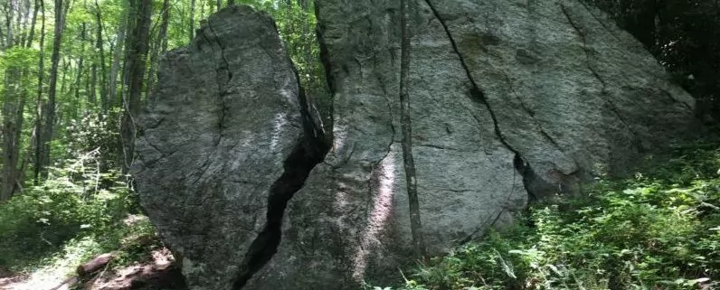
About 1/2 mile in, you will pass Split Rock (or Split Boulder), a huge structural marvel of rock, on your right. At the East Fork Junction, about 2 miles from the trailhead, be sure to take a left and follow The Pinnacle Trail westward. There is a sign at this junction. The trail now turns from rocky and uphill to a grassy, ridge-line single-track trail. Campsites are located at the 3-mile mark.
Nearing the Pinnacle, the trail narrows and becomes a rhododendron and mountain laurel tunnel that leads to the summit. The summit itself is a semi-heath bald with sheer cliffs and drop-offs. Use caution when moving about these craggy boulders. The views are simply amazing. At the summit, you will gaze upon Blackrock Mountain, the Plott Balsams, the town of Sylvia, the Blue Ridge Parkway, and the Great Smoky Mountains. Many days you will find yourself alone at the summit as few make it all the way to the Pinnacle.
Weather
Gear Recommendations
- Waterproof shoes
- Trekking poles
- Map
- Camera
- Snack
Getting There
48 miles
- Pinnacle Park is a beautiful 47 mile drive from Asheville.
- Take I-40 West to Exit 27.
- Follow US 74 West to Sylva.
- Turn right on Steeple Road.
- Go about 1/3 mile and turn left onto Skyland Drive.
- Go one half mile and turn right onto Fisher Creek.
- In 2.5 miles, Fisher Creek dead ends into the Pinnacle Park parking area.
Permits, Fees, Camping
- Free parking available at the trailhead
- Donations accepted (and encouraged)
- Permit required – free, available at the trailhead kiosk
- Camping allowed at designated campsites (Hang food or use bear canisters as bears are active and present in this area.)
When to do this Trip
This trail is open in all seasons. However, use caution in the winter. You may want to bring some microspikes if the area is icy!
Hike Shuckstack Fire Tower with a Guide
Guided strenuous hiking trips are available. The Smokies Paddle and Hike trip is a guided hike to Shuckstack Fire Tower in Great Smoky Mountains National Park. This trip is a stress-free and exciting way to do a trip similar in effort to The Pinnacle. The tour company handles permits, gear, transportation, meals, and a professional guide so you can focus 100% on enjoying your adventure. Read more…
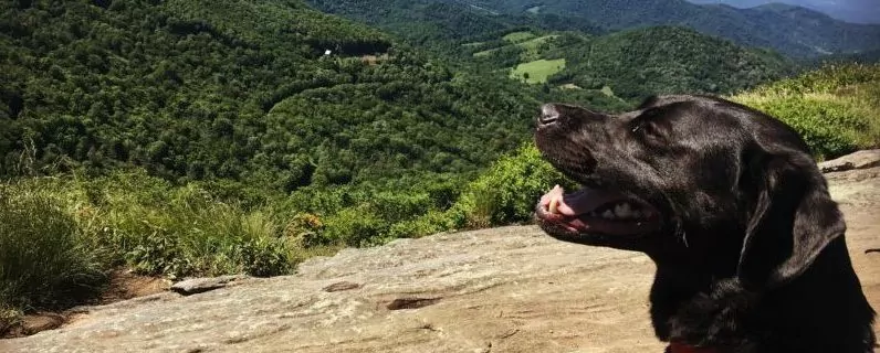
4. Dog Friendly: Graveyard Fields Loop
The Blue Ridge Parkway
If you are visiting the Asheville area, a drive along the Parkway needs to be at the top of your to-do list. It doesn’t matter whether the sun is shining or the clouds are crying, the views and scenery are magnificent. If your traveling with a four-legged companion, bring the pup along on this outing. Be sure to stop at Graveyard Fields (mile marker 418.8) so everyone can stretch their legs.
The Area
Graveyard Fields is a flat valley located at an elevation of 5320 feet. It is found along the Blue Ridge Parkway at mile marker 418. Local legend points to two theories on how this area received such a morbid name:
- A great wind storm felled all the trees in the area, leaving only their stumps. These stumps looked like a field of tombstones.
- Logging was big business in the early 1900s in this area. The trees were harvested, leaving only their stumps. These stumps looked like a field of tombstones.
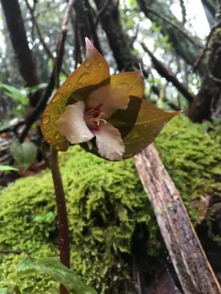
Regardless of which naming story you choose to believe, a great fire did ravage the area in 1925, destroying all plant life and soil. The forest is slowly recovering. Today, you will find a young hardwood forest, plentiful rhododendron and mountain laurel, and wildflowers (including the elusive Trillium). Blueberries are abundant in July and August.
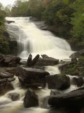
Upper and lower falls
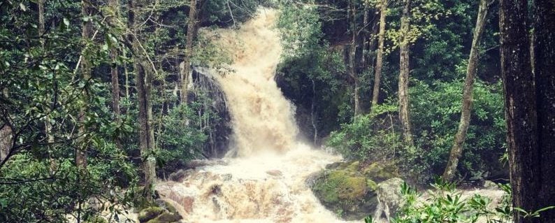
Graveyard Fields incorporates two waterfalls: Upper Falls and Lower Falls. These waterfalls are fed by the Yellowstone Prong River. Lower Falls has a great swimming hole, so it is a popular place to cool off in summer. Just remember that the rocks may be slick; don’t climb either of the waterfalls. In fact, during my last visit to Upper Falls, I witnessed a young man take a great fall and slide down the entire waterfall. Luckily, he walked away; his arm, however, did appear to be broken.
bringing the pup
Leashed dogs are welcome at Graveyard Fields, and they are plentiful. During my last hike, I lost count of the number of dogs I passed. Please be sure you are able to control your dog at all times as this area is popular with families. Also, if your pooch does not play well with other dogs, this is not the best hike for your furry companion.
Trip Overview
From the moment that you park and step out of your vehicle, views of Black Balsam and Tennent Mountain greet you. Take a moment and gaze in amazement before setting out on your 3.3-mile hike. After a moment of reflection, walk over to the kiosk and snap a photo of the area map. Then before heading out into the woods, stop and check out the restrooms. Yes! This trailhead has multiple pit toilets and hand sanitizer. A huge relief: finding a private place to use the “facili-trees” at this popular destination is difficult.
My preferred hike is not actually the loop hike. My hike looks like this and is 3.1 miles long:
- From the parking lot, head down the trail taking the bridge across the river.
- After crossing the river, turn left.
- Follow the signs and your map to Upper Falls (just over a mile from the parking lot).
- Have a bite to eat while viewing Upper Falls.
- Hike back in reverse.
- Pass the bridge crossing the river on your right.
- Look for and follow the signs to Lower Falls (0.5 miles from the parking lot).
- If it is summer, take a dip and cool off in the cold waters of the Yellowstone Prong River.
- Retrace your steps back to the parking lot.
gear Recommendations
- Water
- Swimwear and towel in the summer
- Map
- Camera
- Picnic
Weather
Graveyard Fields, Milepost 418.8
Permits
No permits are required to hike in Graveyard Fields.
Parking
Free (limited) parking is available at the parking area and the overlook at MP 418 on the Blue Ridge Parkway.
If the Graveyard Fields overlook is full, don’t park on the grass. You will be ticketed.
When to do this Trip
This section of the Parkway is closed in the winter because of ice and snow.
Camping
No camping is allowed in Graveyard Fields.
Hike Blue Ridge Hiking Tours with a Guide
Guided Blue Ridge Hiking Tours are available and are a stress-free, exciting way to do this trip. The tour company handles permits, gear, transportation, meals, and a professional guide so you can focus 100% on enjoying your adventure. Read more…
5. Family Friendly: Mouse Creek Falls via Big Creek Trail
If you are visiting Asheville with the family, load the kids, grandparents, cousins, aunts, and uncles into a vehicle and head to Big Creek. Big Creek is located in the Great Smoky Mountain National Park about 55 miles from Asheville. Great Smoky Mountains National Park is the most visited national park in the country and does not have an entrance fee.
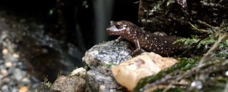
Big Creek is a perfect place to bring the family for the day to enjoy nature. The area has not only hiking trails, multiple swimming holes, and salamanders a plenty but also a picnic area complete with 10 tables and grills. There are also restrooms with flushable toilets.
The Area
Big Creek was a lumber mill and settlement in the late 1800s to early 1900s before the National Park was formed. The Big Creek Trail itself is effectively a rails-to-trails trail. The trail was originally a narrow gauge railroad used to pull logs from the forest to the mill. The parking lot contains bits and pieces of the foundation where the mill once stood. If you traipse off-trail in Big Creek, you will find remains of the mill, settlements, rails, and tools. Just remember that you should leave everything as you found it. It is a crime to disturb these remnants located in the National Park.
Trip Overview
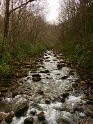
Big Creek Trail hike to Mouse Creek Falls is an easy 4-mile out-and-back hike along the river’s edge. The trailhead is actually before the parking lot on the right. The trail is wide enough to walk side by side, holding your little one’s hand.
After 1.5 miles, you will cross over a wooden bridge. Start looking on your left for paths that lead to the river. There are no signs marking Midnight Hole; however, these short trails lead to the perfect spot for swimming on a hot summer day. You will know you are in the right place because you will be accompanied by many others enjoying the refreshing waters of Big Creek.
Continue walking another half a mile and feast your eyes upon Mouse Creek Falls, a 40+ foot waterfall flowing into Big Creek. Again, you won’t see any sign indicating that you have arrived, but there are hitching posts on your left before the side trails lead to the water’s edge.
If you find Midnight Hole to be too crowded after viewing the falls, continue hiking another 1/4 mile. Cross over the first of two carriage bridges. You will find another excellent swimming hole to the left of the bridge. This is a perfect place for a picnic.
When To Do This Trip
Big Creek Trail is fantastic no matter the season or weather. On rainy days, the river does grow greatly in size and power. At this point, the river is no longer safe to play in. After a snowstorm, this area is transformed into a winter wonderland with icicles dangling from the rocks, cascades, and waterfalls. In the spring, wildflowers are abundant.
Camping/Campsites
If you are interested in camping at Big Creek, there is a backcountry campsite (campsite #37) just after crossing the second carriage bridge on this hike. This is Walnut Bottom, the site of an old logging camp. It is a 3-mile trek from Mouse Creek Falls to campsite #37. Big Creek trail ends here. Bears are extremely active in this area. Remember that a fed bear is a dead bear, so please review how to keep the bears safe.
Weather
Gear Recommendations
- Water
- Swimwear and towel in the summer
- Map
- Camera
- Picnic supplies
Getting There
54.9 miles
- Take I-40 west into Tennessee.
- Take exit 451, Waterville Road (the first exit in TN).
- Take a left at the bottom of the ramp.
- Go under I-40.
- Follow the road around to cross the Pigeon River.
- Take a left after the bridge on the road that follows the river.
- Pass the dam/power station on your left.
- At the stop sign, keep straight and enter into the Great Smoky Mountain National Park.
- This gravel road ends in the Big Creek Parking area.
Permits, Fees, and Regulations
- No permit is needed for day hikes.
- Backcountry camping requires a permit for a fee of $4.00/person, maximum fee of $20.00.
- Dogs are not allowed on the Great Smoky Mountain National Park trails.
Hike the Great Smoky Mountain National Park with a Guide
Guided Great Smoky Mountain hikes are available and are a stress-free, exciting way to do this trip. The tour company handles permits, gear, transportation, meals, and a professional guide so you can focus 100% on enjoying your adventure. Read more…
Wildland Trekking Hiking Adventures
As the world’s premier hiking and trekking company, Wildland Trekking believes in connecting people to fantastic environments in amazing ways. North Carolina offers an array of incredible hiking and trekking experiences. Wildland Trekking provides numerous hiking and backpacking adventures in the Blue Ridge Mountains and Great Smoky Mountain National Park. Read more about our North Carolina Hiking and Backpacking Adventures.
To learn more about our guided backpacking trips and all of our award-winning hiking vacations, please visit our website or connect with one of our Adventure Consultants: 800-715-HIKE

