
John Muir Trail: Florence Lake to Yosemite
12 Days, 11 Nights
118MI / 190KM
Trip Highlights
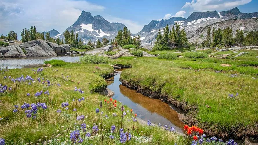
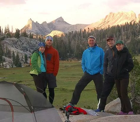
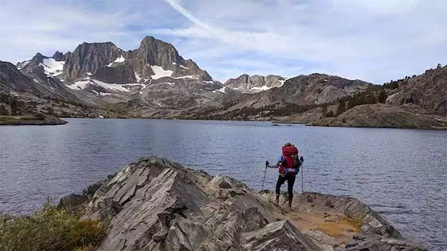
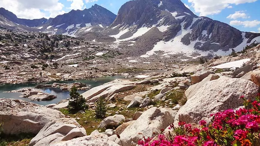
California’s John Muir Trail is one of the most well known and sought after hiking trails in the world. It traverses the jagged spine of the Sierra Nevada Mountain Range, passing by breathtaking alpine lakes, lush meadows blanketed with wildflowers, mountain cirques sliced by snow-fed cascades and towering glacial-carved peaks. The full John Muir Trail starts at Mount Whitney and finishes in Yosemite Valley. On this trip we hike from the south-north center of the trail at Florence Lake and head north, ending in Yosemite Valley. We conquer multiple challenging and fulfilling mountain passes on our journey, including Selden Pass (10,800′), Silver Pass (10,350′), Donahue Pass (11,066′) and more. We visit Yosemite’s dramatic Cathedral Lakes before our hike ends at the northern terminus of the John Muir Trail, famous Yosemite Valley. This trip is one for the books – don’t miss it!
-
 Famous John Muir Trail
-
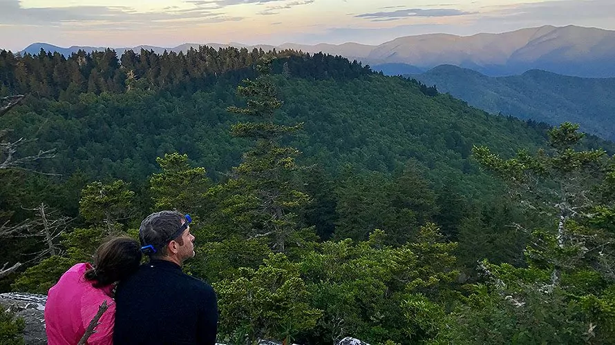
Stunning Mountain Scenery
-
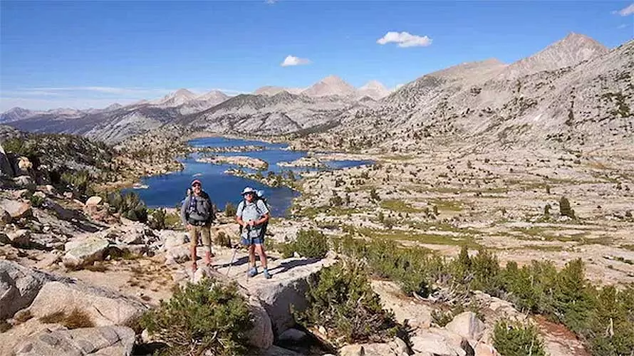
Extended Adventure
-
Alpine Lakes
-
Towering Peaks
-
Mountain Solitude
Book This Trip
Trip Details
-

Trip Length
12 Days, 11 Nights -

Daily Hiking Distance
Up to 13 miles -

Group Size
4-12 Guests
Receive a PDF info packet via email which includes:
- day by day itinerary
- logistical and travel information
- gear and clothing lists and more
"*" indicates required fields
Is This Trip Right For me?
This trip features long daily hiking distances with moderate to severe elevation gains and losses for multiple days in a row. Backpack weight is 45+ pounds, and elevations go up to 11,000 feet. All of these details combined make this trip a clear Level 5 difficulty expedition. Be prepared for long, challenging days of hiking through absolutely gorgeous country day after day for 12 days.
Difficulty Level
Solitude Level
Trip Itinerary
Please Note: We always do everything in our power to follow the set itinerary, however it can change occasionally based on temporary access restrictions, weather, lodging/campground availability, guest ability/injury, natural events like fires and flooding, and other potential causes. Normal terms and conditions apply to trips with itinerary changes.
Day 1
Shuttle to Trailhead: 3 hours
Hiking Distance: 4.5 miles
Elevation Gain: 920 feet
Elevation Loss: 460 feet
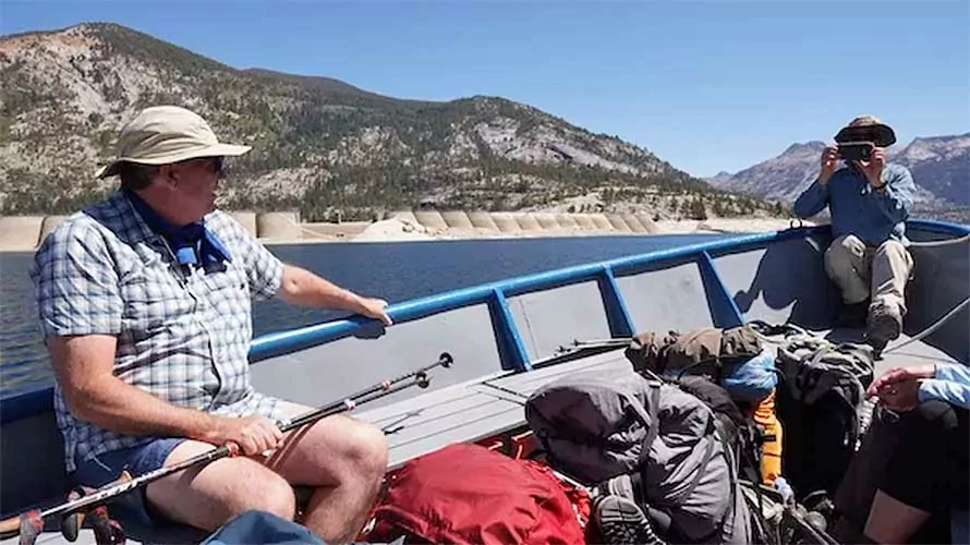
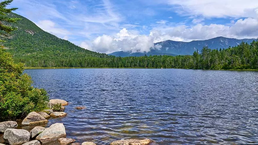
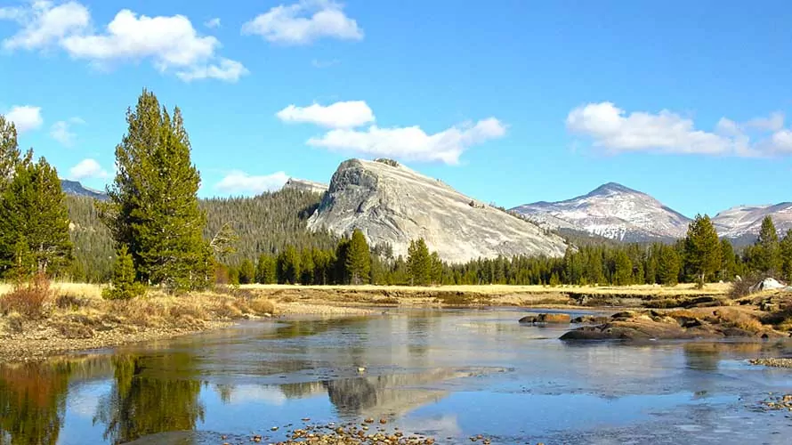
Day 1 begins with pick-up at the Fairfield Inn and Suites in Fresno, California and a 3-hour shuttle into the mountains. Our trailhead is near a prominent lake recognized by many to be the half-way point of the John Muir Trail, close to equidistant from Mount Whitney and Yosemite Valley. At the lake we’ll take a boat shuttle into the John Muir Wilderness and enjoy a light day of hiking to get our legs warmed up. We’ll celebrate our first night in the mountains with a delicious dinner.
Day 2
Hiking Distance: 8.9 miles
Elevation Gain: 3297 feet
Elevation Loss: 1103 feet
Today starts with a hot breakfast, after which we’ll break camp and hit the trail. Today’s hike leads us past the gorgeous Sallie Keyes Lakes, then up to our first major mountain pass: Selden Pass (10,880′). We’ll take some time at the pass to soak up the amazing views and eat some lunch. Then we’ll drop down from the pass and set up camp near a beautiful series of subalpine lakes.
Day 3
Hiking Distance: 10.6 miles
Elevation Gain: 1321 feet
Elevation Loss: 3470 feet
Today’s hike is a relatively long one, but the majority of it is downhill, giving our muscles a little break from yesterday’s big climb. There is one short, but strenuous section today as we climb up to a high ridge before dropping into the Mono Creek Drainage. It is in this drainage that we’ll rendezvous with our first resupply.
Day 4
Hiking Distance: 8 miles
Elevation Gain: 3150 feet
Elevation Loss: 413 feet
The downhill hiking is over, as today we again begin gaining elevation. Today’s uphill hike gains more than 3,000 feet over 8 miles, but we’re rewarded with profoundly beautiful views almost the whole way! Our high point is Silver Pass (10,880′) which crosses over the “Silver Divide,” an aptly named ridge which indeed has a silvery appearance. We’ll enjoy lunch on or near the pass, and then continue on to camp near a pristine high mountain lake, Chief Lake.
Day 5
Hiking Distance: 11 miles
Elevation Gain: 2210 feet
Elevation Loss: 2870 feet
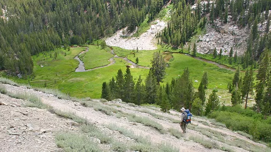
With our longest day yet ahead of us, we’ll start with a hearty breakfast to fuel our upcoming efforts. Today we’ll descend from Silver Pass and Chief Lake, and follow the crystal clear waters of Silver Creek into a lush, subalpine valley sliced by a winding stream. A short, steep ascent takes us to Virginia Lake, where we’ll stop for a picnic lunch and refreshing dip in the snowmelt-fed waters of the lake. After lunch, we’ll follow the John Muir Trail’s rolling ups and downs for several miles, and set up camp near Duck Creek – a picturesque spot that stands out, even in these amazing mountains!
Day 6
Hiking Distance: 11.5 miles
Elevation Gain: 670 feet
Elevation Loss: 2984 feet
Today is another “restful,” mostly downhill hiking day that will help us recuperate from yesterday’s climb. Our camp tonight is in Red’s Meadow, where we’ll arrive in the late afternoon and meet our resupply in the vehicle-accessible campground. The campground has a small store and showers, so it’s a great time to clean up and grab some snacks you’re craving.
Day 7
Hiking Distance: 11 miles
Elevation Gain: 2905 feet
Elevation Loss: 1482 feet
Today is another big hiking day that will take us over a prominent, volcanic ridge and drop us into Shadow Lake. We’ll pass Devil’s Postpile National Monument and take some time to appreciate the bizarre and fascinating geologic features of the area. From Shadow Lake, we’ll ascend again to a breathtaking camping spot along Shadow Creek, where we’re likely to have the mountains all to ourselves.
Day 8
Hiking Distance: 10 miles
Elevation Gain: 2656 feet
Elevation Loss: 1533 feet
Today is arguably the crown jewel hike of the trip, with some of the most stunning views and scenes of the entire John Muir Trail! We’ll traverse below the Ritter Range, one of the most dramatic subranges of the Sierra Nevada. We’ll pass Garnett and Thousand Island Lakes, and camp along a creek with panoramic views of the surrounding mountains.
Day 9
Hiking Distance: 12 miles
Elevation Gain: 1074 feet
Elevation Loss: 2263 feet
Today we’ll tackle the highest point of our 13-day trip: Donahue Pass at 11,050 feet! After the pass we drop into Yosemite National Park, descending through the heart of Yosemite along the breathtaking Lyell Fork of the Tuolumne River. Tonight we camp on the edge of a meadow in the Lyell Fork canyon.
Day 10
Hiking Distance: 13 miles
Elevation Gain: 1591 feet
Elevation Loss: 839 feet
Today’s hike starts with a mostly flat section, ending at the Tuolumne Meadows Trailhead where we’ll enjoy lunch. After lunch we head out through Tuolumne Meadows up to the iconic and stunning Cathedral Lakes. We’ll set up camp, eat dinner and watch the alpenglow of the sunset reflect off the sheer pinnacles of Cathedral Peak, which stands guard over the lakes.
Day 11
Hiking Distance: 10 miles
Elevation Gain: 924 feet
Elevation Loss: 2483 feet
This morning we say a fond farewell to not only the amazing Cathedral Lakes, but also to the high country of the Sierra Nevada that we have been traversing for the past 10 days. We set up camp along Sunrise Creek, where we can watch the sun set over Yosemite’s most iconic feature: Half Dome. We’ll celebrate our final night in the backcountry with a delicious dinner prepared by your guide(s).
Day 12
Hiking Distance: 7 miles
Elevation Gain: 245 feet
Elevation Loss: 4227 feet
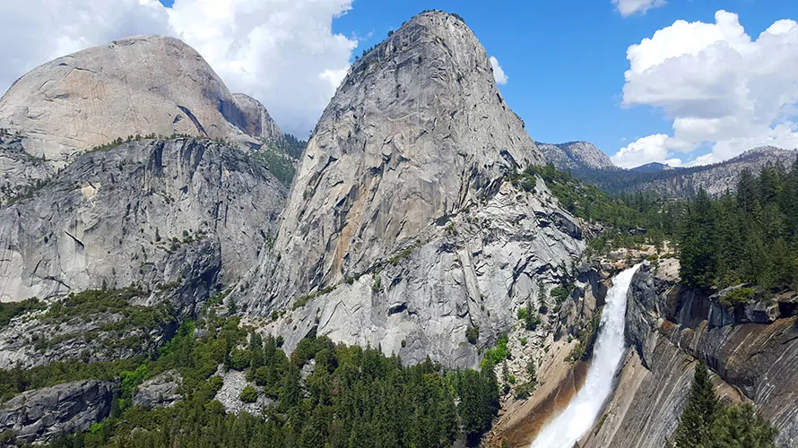
We’ll have a relaxing morning while we break camp and enjoy our final breakfast in the wilderness. Our hike is almost all downhill, and features two of the most dramatic features of Yosemite Valley, Nevada and Vernal Falls. Our plan is to arrive back in Fresno around 4:00 PM.
Trip Dates
Scroll horizontally to view all dates
What's Included
-
Top-of-the-line tent, backcountry sleeping pad and multi-day backpack
-
High quality, synthetic sleeping bag (professionally laundered after every use)
-
Use of trekking poles
-
All meals are included from lunch on day 1 through lunch on the final day
-
Multiple backcountry resupplies
-
Trained hiking guide(s) with years of personal wilderness and hiking experience, medical certifications, and a passion for leading people into breathtaking landscapes. See Guide Bios.
-
Transportation originating and ending in Fresno, CA
-
Bear cannisters for food storage
-
Emergency equipment including a company-issued first-aid kit and communication device
What's Not Included
-
 Clothes, raingear and footwear
 -
Sunscreen, toiletries and personal items
-
Water bottles and a headlamp or flashlight
-
Guide gratuity (industry recommendation is 10-20% of trip cost)
Accommodations
Backcountry Sleeping
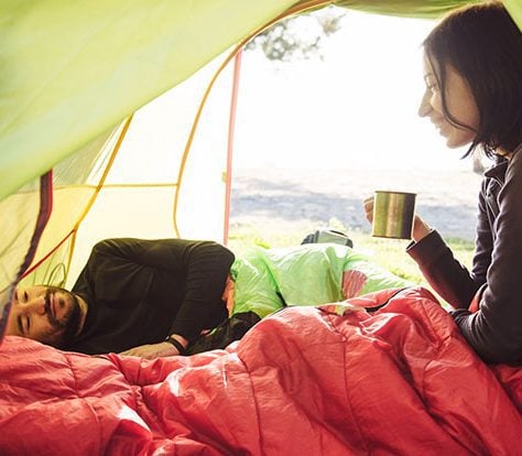
11 Nights TENT CAMPING
Sleeping on backpacking trips is in premier 1-person or 2-person backcountry tents. Solo travelers, and anyone else who requests it, are issued single tents. Top-of-the-line self-inflating sleeping pads and synthetic-fill sleeping bags (professionally laundered after every trip) are also provided.
Backcountry Cuisine
FRESH & DELICIOUS
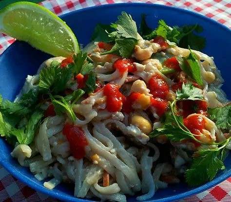
Meals from breakfast Day 1 through lunch the last day are fully included and prepared by your trekking guide. We never use dehydrated backpacking meals, instead serving freshly prepared, delicious backcountry cuisine made with a variety of common and specialty ingredients that travel well in the wilderness.
Amazing Campsites
IN THE ACTION
Campsites vary by destination, trip and even by the individual day of a trip. However, you can expect to camp in beautiful areas that put you right in the action to make the most of your trekking adventure. We carefully design our itineraries with campsites in mind.
Trip Logistics & FAQs
Where Do We Meet?
This trip meets in Fresno, CA at 6:00 pm the evening before Day 1 for a pre-trip orientation meeting. The meeting location is the Fairfield Inn and Suites Hotel near the Fresno International Airport. Your guide will be in contact approximately 10 days prior to coordinate the rendezvous.
Click here to see a printable, downloadable trip information packet with more detailed guidance about flights, shuttles, recommended lodging and more.
Travel to Fresno, CA
Fresno International Airport is a convenient airport to fly into, and the starting and ending point of the trip (Fairfield Inn and Suites Fresno Airport Hotel) is located near the airport. Please arrive in Fresno well before 6:00 PM and don’t plan any departing flights on the final day before 7:00 PM.
Pre and Post Trip on request lodging
We secure limited amounts of pre and post trip lodging in Fresno, CA as an optional add-on for guests of this trip. This lodging is on request, and is available on a first come, first serve basis. If interested, please reach out directly to our team to check availability.
Start/End Times
Your guide will inform you of the Day 1 pick-up time at the orientation meeting. Generally, you can expect it to be between 5 and 7 am, although the exact time will depend on current weather and road conditions. We will be back into Fresno normally around 4 PM (this time is not guaranteed, as a variety of circumstances can influence our exact return time) on the final day.
Safety Precautions
Your safety is our top priority. Our hiking tours are led by professional hiking guides, all of whom are wilderness-certified first responders or EMT’s, each with years of guiding and wilderness experience. Guides adhere to standardized risk management protocols in case of any potential or actual incident, and all tours carry an emergency communication device and comprehensive first-aid kit. Additionally we have a “24/7” system through which guides or guests can reach Wildland support personnel at any time.
If you have any further questions about safety, please contact us at 1-800-715-HIKE (4453) for more information.
Age Restrictions
Age restrictions on this trip are as follows:
- 12 and older to join scheduled tours (mixed groups)
- 10 and older to join private tours, with final approval on a case by case basis
- specific logistical requirements (such as porter or stock assist) determined on a case by case basis
Reviews
You Might Also Like...
"*" indicates required fields
Leave a Reply