Visiting Point Reyes National Seashore

The only National Seashore on the West Coast, Point Reyes National Seashore is a unique slice of federally protected coastline just an hour and a half north of San Francisco. From the endemic Tule Elk, to treacherous ocean tides, and vast views of cliffside shores, Point Reyes is a stop not to miss on your drive up the Pacific coast!
Over 1,500 species of plants and animals call Point Reyes’ 100 square miles of coastal wilderness home. Multiple ecosystems exist here including grasslands, beaches, cliffs, and marshes. The National Seashore also contains rich Native American heritage along with historic buildings and structures left behind by early European settlers.
Humans have inhabited Point Reyes in one form or another for thousands of years. The Coast Miwok Indian Communities fished, collected mussels, oysters and other sea creatures from the ocean and could retreat to Olema Valley for more mellow weather and protection.
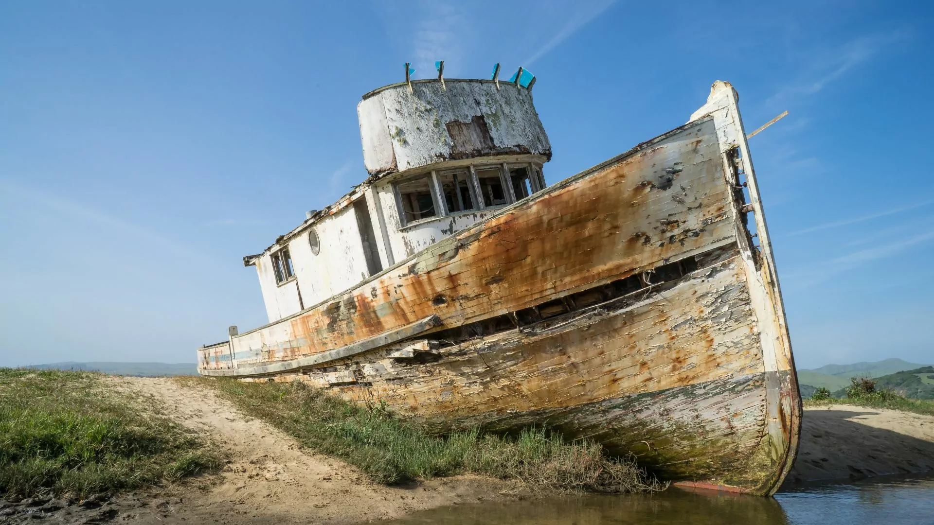
There is debate of whether Sir Francis Drake set foot on the peninsula, but many explorers had their ships wrecked along its treacherous coastline. The San Agustin’s crew were the first European explorers (if we aren’t counting Drake) to set foot on the Peninsula and called it “La Punta de los Reyes.”
From the Spanish Mission period, to a thriving dairy industry, to becoming a protected seashore, Point Reyes has a rich and complicated history that still affects legislation to this day.
Thanks to its vibrant natural resources and snapshot into the past, this park draws more than two million visitors a year. If you’re planning a trip to Point Reyes National Seashore, this guide will explain where to go, what activities to do, and how to make the most of your time!
Where is Point Reyes National Seashore?
Point Reyes National Seashore is located in California, about an hour’s drive north of San Francisco along the Pacific Ocean. California’s wine country of Sonoma and the main city, Santa Rosa, are just an hour’s drive Northwest of here. The National Seashore is situated on the Point Reyes Peninsula, surrounded by Tomales Bay to the northeast and Bolinas Lagoon on the southeast.
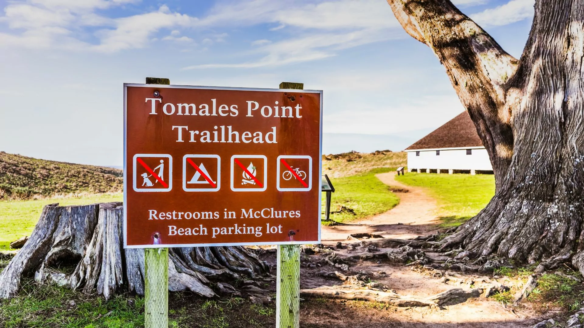
Point Reyes National Seashore is mainly split up by hiking trails, visitor centers, and historic landmarks. The National Seashore is divided by Sir Francis Drake Blvd which trends southwest towards the lighthouse and Pierce Point Road that heads North to dead end at Tomales Bay and McClure’s trail head. Other than Kenneth C. Patrick Visitor Center, the campground and Bear Valley Visitor Center, there are no amenities.
The small towns of Olema and Point Reyes Station are located just outside Point Reyes and have gas and restaurants. From a one-hour visit to a multi-day adventure, there are many ways to get to and explore Point Reyes National Seashore!
How to Get to Point Reyes National Seashore
The most common way would be to fly into the San Francisco Bay area and drive up the coast about an hour. You can take the winding and scenic Highway 1, or follow the inland Highway 101 and then cut west. Santa Rosa and Petaluma both have small airports that are an hour away. If you don’t have a vehicle, you can also take public transportation from San Rafael to the visitor center, but be aware that there is no public transport system within Point Reyes to reach different sites.
Make sure to check for road and entrance closures before your trip. Highway 1 is known to have frequent landslides after big storms and parts of the highway may be rerouted to Highway 101.
Know Before You Go:
When to Visit
Point Reyes National Seashore is open every day of the year from 6:00 a.m.-12:00 a.m. Some facilities like the lighthouse, park stores, and visitor centers have different hours so it’s best to check those hours separately. Every season offers different opportunities and activities!
Spring
In the spring, Point Reyes is teeming with colorful wildflowers and green fields. Common spring flowers to see include the California poppy and lupine. Another perk of spring is that it is not as crowded this time of year, so you may experience more solitude on the trails. In April, to celebrate Earth Day, there are opportunities to volunteer your time to help clean up the trails and work on projects. The average highs in spring are around 65 degrees fahrenheit and the lows are around 46. Typically the days are windy and possibly wet, with an average 3.5 inches of rain fall in March and April.
Summer
Like in the spring, summer also boasts a different variety of wildflowers. Monkey flowers and the common wooly sunflower are just a few of the hundreds of different flowers that bloom here. Exploring the many tidepools is another popular summer activity. The summers are warm and dry at Point Reyes National Seashore with occasional strong guests from the headlands. This season is more crowded since many families are traveling for summer vacation or locals are taking day trips from the Bay Area.
Fall
Autumn is a time for birding at Point Reyes. Almost 490 different avian species have been spotted on the 70,000 acres of habitat and connecting bodies of water. The peninsula is advantageous for birds since it’s 10 miles from the mainland, allowing migrating flocks a place to rest before continuing their journey. There are cliffs, estuaries, grasslands, and forests for birds to find sanctuary in.
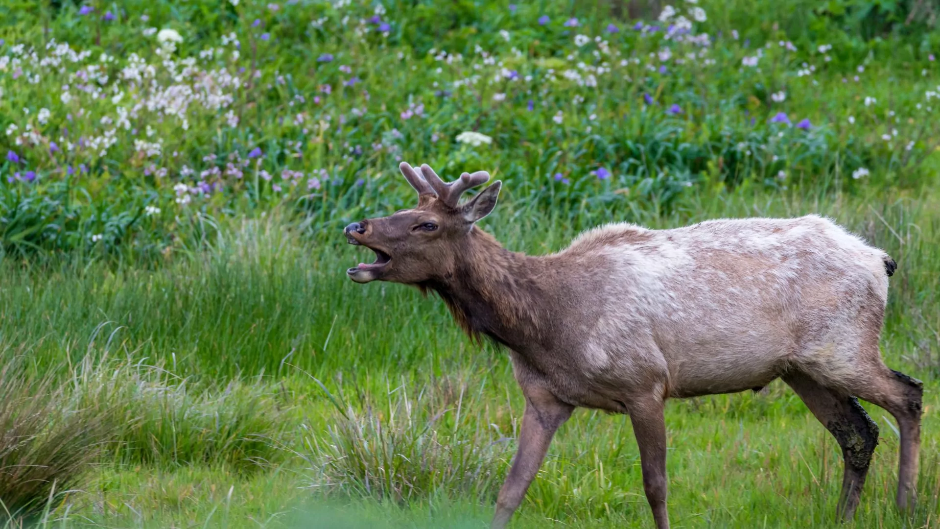
Another animal to view in the fall are the Tule elk. “The rut” occurs in the fall and is a time where the bull elk bugle and spar with each other to win over the females. Some of the clearest coastal days happen in the fall with the storms occurring more frequently later in October. Autumn is also typically less rainy.
Winter
The ocean life peaks here in the winter! While whales can be spotted off of Point Reyes National Seashore all year, gray whales in particular migrate along the coast in the winter months. There are multiple viewing points along the cliffs to watch these incredible animals spout and breach. Another marine mammal that can be viewed in the winter are the elephant seals. December to March is the breeding season for the adult seals. The males fight each other for space on the beach and the female elephant seals usually give birth to their pups at the end of breeding season.
A third wildlife-related reason to visit in the winter is to witness the coho salmon and the steelhead trout spawn. Traditionally, January is the best time to see these two fish spawning. But come prepared for poor weather! The winter is the rainiest season in Point Reyes and windy, cold storms are more frequent at this time.
Point Reyes National Seashore Lodging
The only lodging located within Point Reyes is the Limantour Lodge, offering a combination of dormitory style and private rooms. The surrounding communities offer additional lodging and are within a 20 minute drive. Point Reyes can also be done as a day trip, driving out from your accommodations in a bigger city like Santa Rosa, Oakland or San Francisco. Do note, local lodging fills up quickly in peak summer season and advanced reservations are recommended.
Lodging in Gateway Communities
Point Reyes Station and Olema are small towns a few miles away. They offer a variety of accommodations from hotels, to bed & breakfasts, to cozy countryside farmhouses. The cuisine along the Peninsula is phenomenal. Tomales Bay is known for its Hogback Oysters and other seafood dishes. The grasslands have a history of dairy production so the cheese is state-renowned. There are also multiple picnic areas and tables throughout Point Reyes, so grabbing a picnic lunch from the grocery store and enjoying an ocean view is a great option.
Backcountry Camping
There are five different backcountry campgrounds accessible only by boat or by foot along the National Seashore. To reserve one of these campgrounds, go to Recreation.gov to make your booking. Sites can be reserved up to three months in advance with a limited number of additional sites coming available two weeks ahead of time. Camping fees range from $30 to $90 per site, per night.
Point Reyes Guided Backpacking trip
Coast Campground – This is a bike-in/hike-in campground. It is located within 220 yards of the coast with tidepools 720 yards to the Southeast.The access trail is 1.8 miles.
Sky Campground – This is a bike/hike-in campground. Located on the western side of Mt. Wittenberg, it offers great views of the ocean. It is a steep 4 mile hike down to the beach. The trail to get to this campground is 1.4 miles.
Wildcat Campground – This is a bike/hike-in campground. It is located on a bluff with a short walk to the beach. Depending on which trailhead you start from, it is a 5.5-6.3 mile trek to this campground.
Glen Campground –This is a bike/hike in-campground. This campground is located inland and protected by trees. It is about a 2.5 mile hike to the beach. The shortest route to get there is a 4.6 mile route.
Tomales Bay Campground – This is a boat-in only campground. The site can only be accessed by kayak, canoe, motorboat, or sailboat. It is on the west side National Park beaches
There is no drive-up campground at Point Reyes National Seashore, but the nearby communities offer a variety of different options for camping. California State Parks and Golden Gate National Recreation Area have campgrounds along the coast or off of Highway 1. Further inland, there are a few Sonoma County Regional Parks campgrounds. There are also private campgrounds such as Olema Campground, Lawson’s Landing, and the Petaluma KOA.
What to do in Point Reyes National Seashore
From spending a peaceful afternoon birding, to marveling at an incredible tidefall, to learning about the rich culture of the area–there is something for every traveler at Point Reyes.
Point Reyes National Seashore Hiking Trails
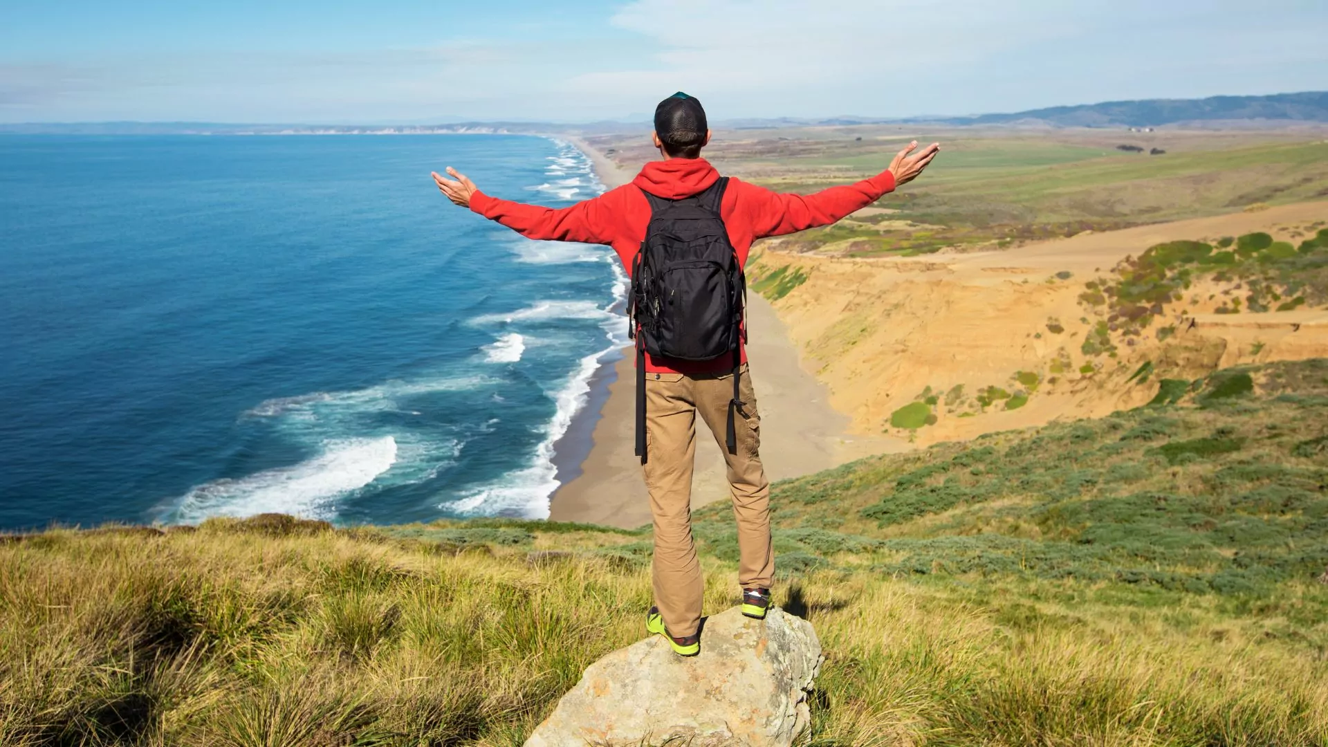
The hikes in Point Reyes can range from skirting the towering, windy bluffs from dipping your toes in the waves along the beach. Combine the variety of trails with the changing seasons, and you have hours of trails to explore.
Tomales Point Trail – With stunning views and plentiful wildlife, the Tomales Point trail is one of the favorite hikes of California locals. The trail is a total of 9.5 miles and is an out and back style. There 1,200ft elevation change of rolling hills until reaching the climax of the hike, an expansive view of the bays at the tip of the peninsula. A Tule elk herd is often seen grazing around the natural springs here and wildflowers are abundant in the warmer seasons.
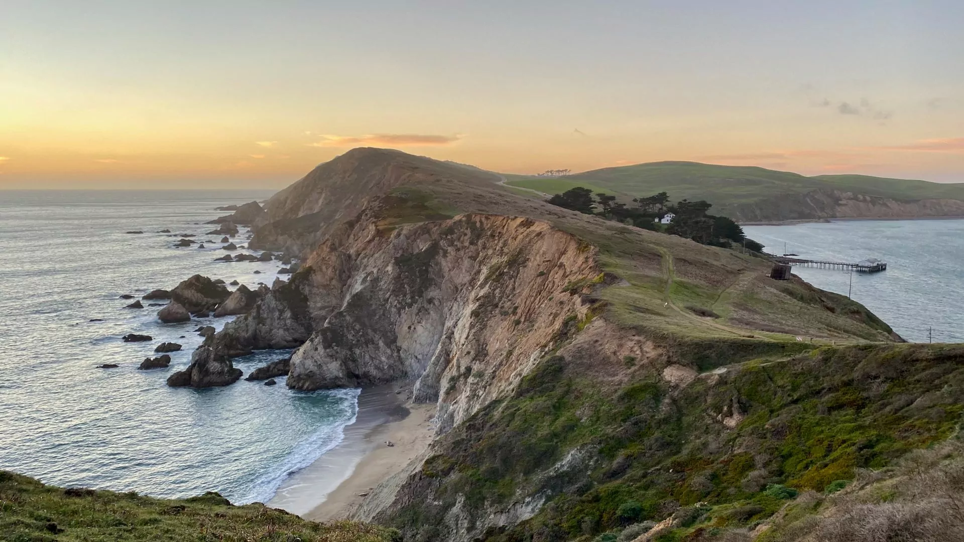
Chimney Rock Trail – If you only have a limited amount of time, the Chimney Rock trail is a great option. The hike is 1.8 miles roundtrip, with 160ft of elevation change on an easy out and back hike. This small effort affords you a view of Drake’s Bay from the beautiful coastal cliffs. Sometimes elephant seal barks can be heard on the beach below!
Backpacking
Point Reyes offers access to some unique backcountry options which can include going by foot or by watercraft. The following backpacking routes utilize some of the backcountry campgrounds detailed above:
Alamere Falls – This is a 13.7 mile, difficult, out and back backpacking trip or a very strenuous one day hike. Book the Wildcat Campground for the overnighter which is 1.1 miles from the base of the falls. The highlight of this trip is Alamere Falls, which is a spectacular tidefall (waterfall that flows into the ocean) off of Wildcat Beach. You can start from three different trailheads, but the quickest is from the Palomarin trailhead. Along the trail there are beautiful views of the Farallon Islands, a few lakes, and the ocean.The elevation change (depending on which trailhead you start from) is approximately 1,800ft.
Bear Valley Visitor Center to Coast Camp – This can be a one night backpacking trip and has a variety of trails/routes to link together. This trek can also be made into a loop by linking the Bear Valley Trail to the Coast Trail to the Woodward Valley trail and ending up back at the Bear Valley Visitor center. You’ll explore some of the lushly forested Phillip Burton Wilderness along with enjoying coastal views. It is about 15 miles in total with an elevation change of 2,000ft.
Scenic Drives
Even though in my opinion, walking is the best way to explore Point Reyes National Seashore, taking a scenic drive can give your weary legs rest and allow visitors to cover more ground.
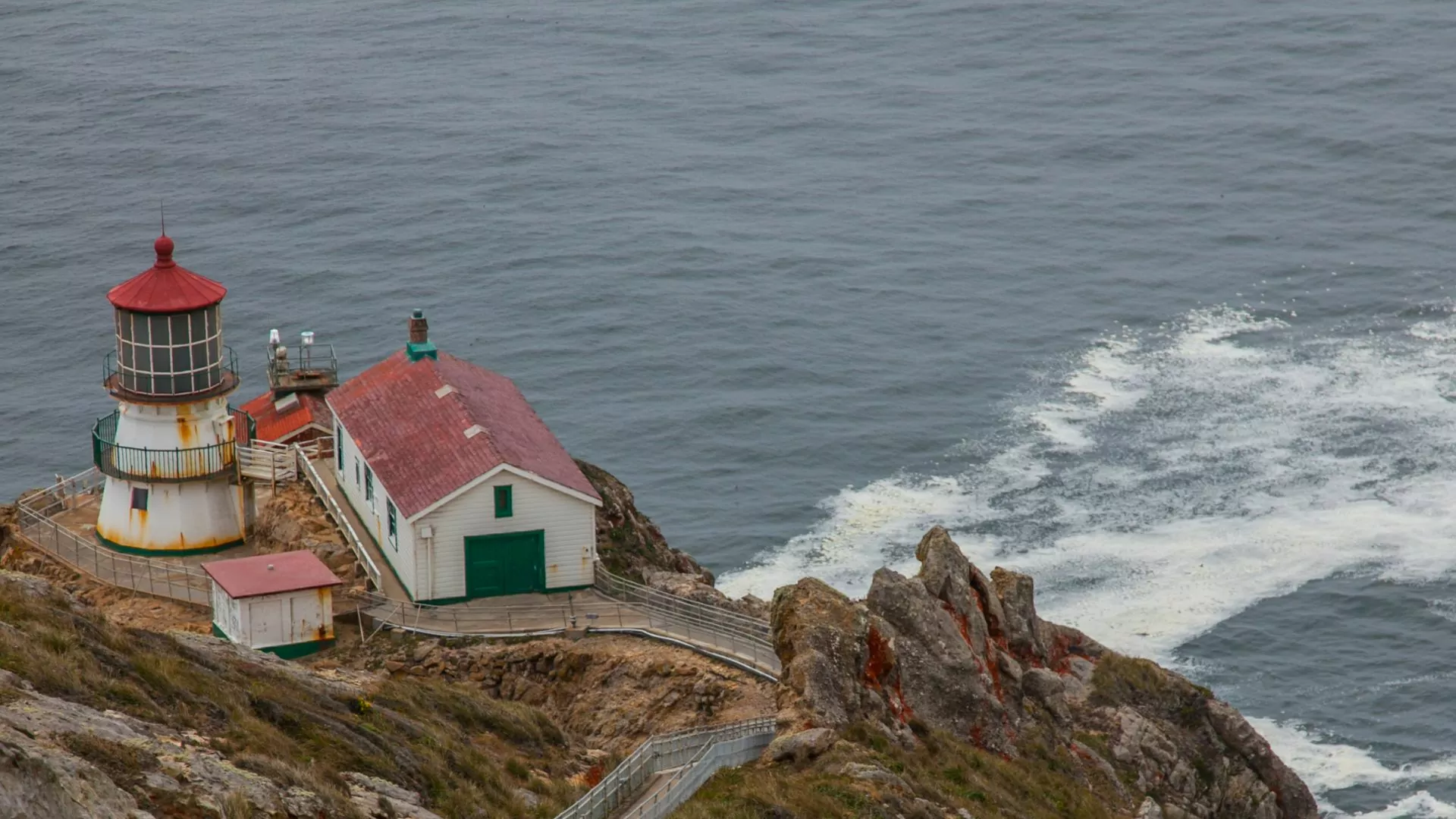
Point Reyes Historic Lighthouse – No trip is complete without a visit to the iconic lighthouse situated at the western-most end of the Point Reyes Headlands. This is the end point of Sir Francis Drake Blvd. a slow, winding road that passes through some ranches. The lighthouse is about 20 miles from the Bear Valley Visitor Center and takes about 45 minutes to reach by car. There is a visitor center at the lighthouse which offers information on the history of the lighthouse as well as on the seasonal whale migrations.
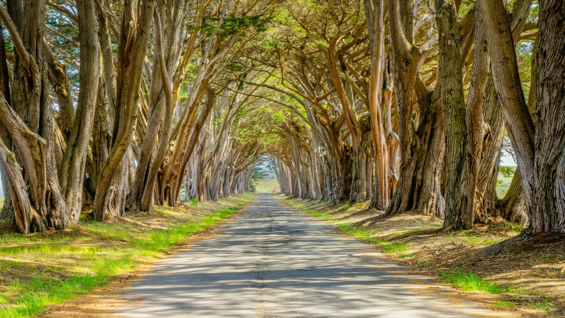
Cypress Tree Tunnel – Another iconic drive is a famous stretch of road in Point Reyes that draws in nature lovers and photographers. The Monterey Cypress trees, which create this road-framing arc, were planted here in the 1930’s and are the entrance to a once profitable receiving station.
Wildlife Viewing
Birders, whale watchers, and wildlife enthusiasts alike flock to Point Reyes in every season to see some of the 500+ types of creatures that call this place home or make it a stop on their long migrations.
Birding – The NPS website says “nearly half the bird species of North America, 490 species, have been spotted here.” Some favorite places to find birds are over Tomales Bay for waterfowl and along the seashore to catch a glimpse of the endangered snowy plover.
Whale Watching – Different types of whales migrate by Point Reyes almost year-round! Summer or fall has humpback, blue, and fin whales. Winter and spring hosts gray whales. Minke whales and Orcas may be seen year-round.
Plan your trip
Point Reyes National Seashore is a local treasure and well kept secret of people in the Bay Area. It isn’t to be missed if you’re passing by. The vibrancy of wildlife, the secluded backcountry campsites, and the rich historical significance are just a few reasons to spend a few days here. Point Reyes has something new to offer around every corner and with each new season.


