
- Home
- Trips
- California Hikes & Tours
- High Sierra Mountain Treks
- John Muir Trail Hikes
- Sequoia & Kings Canyon Hiking Tours
- John Muir Trail: Florence Lake to Mount Whitney
John Muir Trail: Florence Lake to Mount Whitney
Guided Backpacking Trips
15 Days, 14 Nights 115MI / 185KM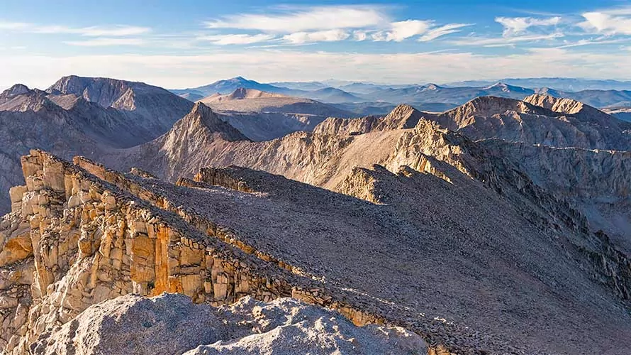
Trip Highlights
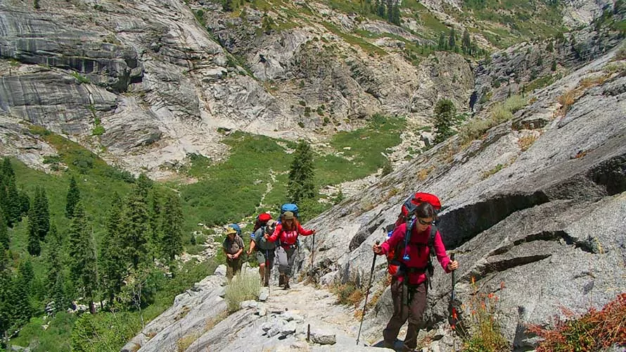
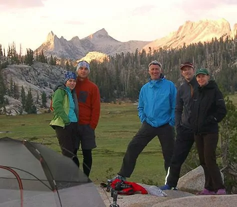
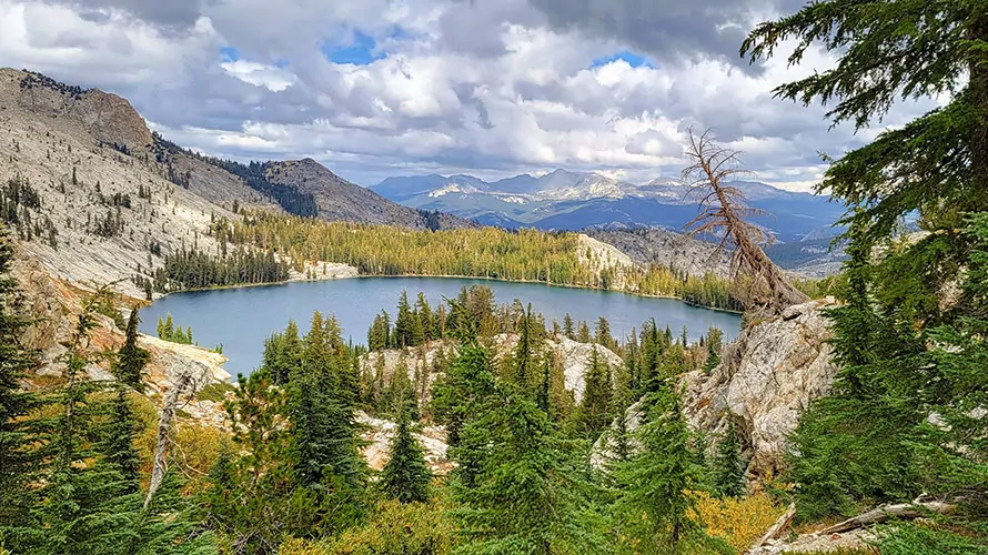
California’s iconic John Muir Trail (JMT) is one of the most famous hiking trails in the world that many people aspire to complete. It travels across the crest of the Sierra Nevada Mountain Range, offering adventurous travelers experiences of gorgeous alpine lakes, peaceful meadows, vibrant wildflowers, impressive mountain cirques, snow-fed streams, sparkling cascades and jagged towering peaks. While the full John Muir Trail connects Mount Whitney and Yosemite Valley, on this trip we hike from the midpoint of the trail at Florence Lake and head south, ending with a summit of Mount Whitney and then exit from the wilderness south of Whitney. We cross over many mountain passes on our unforgettable journey, and traverse the length of Sequoia and Kings Canyon National Parks. Completing this section of the John Muir Trail is a crowning achievement in and of itself, or combine it with the northern section for a full JMT experience!
-
 Epic John Muir Trail
-
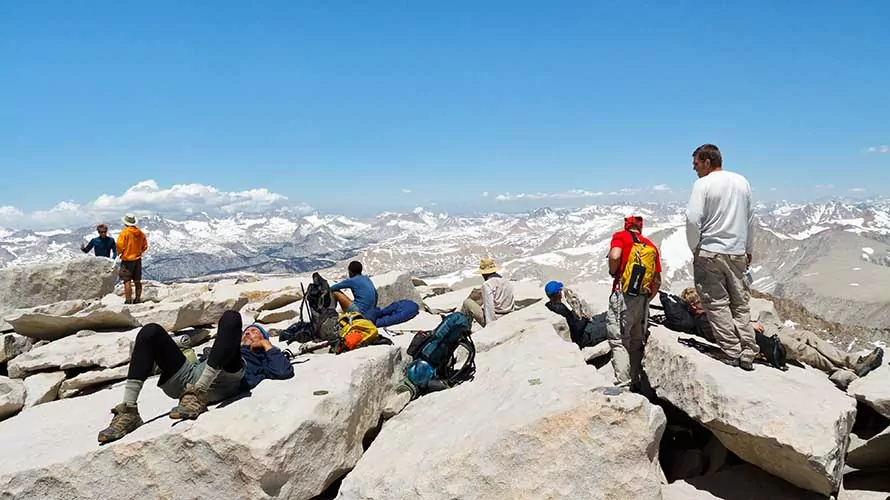
Summit Mt. Whitney
-
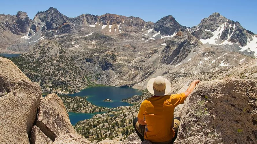
Breathtaking Scenery
-
High Mountain Passes
-
Alpine Streams & Lakes
-
Gorgeous Meadows & Forests
Book This Trip
Trip Details
-

Trip Type
Guided Backpacking Trips -

Trip Length
15 Days, 14 Nights -

Daily Hiking Distance
4-13 Miles -

Group Size
4-12 Guests
Receive a PDF info packet via email which includes:
- day by day itinerary
- logistical and travel information
- gear and clothing lists and more
"*" indicates required fields
Is This Trip Right For me?
This trip features long daily hiking distances with moderate to severe elevation gains and losses for multiple days in a row. Backpack weight is 45+ pounds, and elevations go up over 13,000 feet with multi-day packs, and up to 14,495 feet with daypacks. All of these details combined make this trip a clear Level 5 difficulty expedition. Be prepared for long, challenging days of hiking through absolutely gorgeous country day after day for 16 days.
Difficulty Level
Solitude Level
Trip Itinerary
Please Note: We always do everything in our power to follow the set itinerary, however it can change occasionally based on temporary access restrictions, weather, lodging/campground availability, guest ability/injury, natural events like fires and flooding, and other potential causes. Normal terms and conditions apply to trips with itinerary changes.
Day 1
Shuttle: 3 hours
Hiking Distance: 6-8 miles
Elevation Gain: 1,500 feet
Elevation Loss: 1,050 feet
After breakfast at the hotel, we will meet at 7:00 AM and begin our shuttle to Florence Lake. We will enjoy a scenic boat shuttle across the lake, then embark on the first leg of our expedition. Today is a moderate acclimatizing hike that takes us a bit over 6 miles through pristine meadows along the South Fork of the San Joaquin River. We will set up camp not far from the shores of the San Joaquin River and enjoy our first delicious backcountry dinner prepared by your guide(s).
Day 2
Hiking Distance: 6 miles
Elevation Gain: 1,437 feet
Elevation Loss: 775 feet
Today we will continue the acclimatization process with another moderate day of hiking. From Piute Creek, we hike 6 miles on a relatively flat trail to the confluence of the South Fork of the San Joaquin River and Goddard Canyon. We’ll enjoy a peaceful night’s sleep here in preparation for tomorrow’s ascent into the iconic Evolution Canyon.
Day 3
Hiking Distance: 8 miles
Elevation Gain: 2,820 feet
Elevation Loss: 425 feet
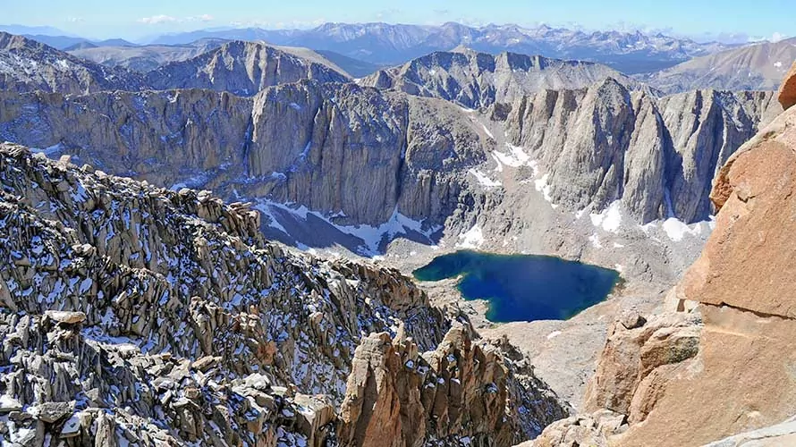
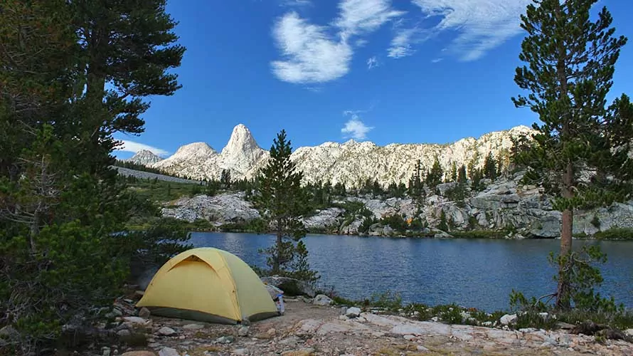
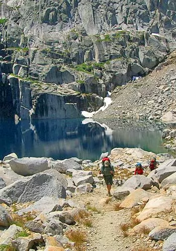
Today’s hike is what many feel is the most breathtaking portion of the trail. After ascending out of the San Joaquin River canyon, we enter Evolution Canyon and then the gorgeous McClure Meadows. Our hike parallels Evolution Creek for several miles today, which is home to abundant amounts of the unique Sierra-specific Golden Trout. Camp tonight is at near the shores of stunning, deep blue Evolution Lake (10,852′), one of the most beautiful spots along the John Muir Trail.
Day 4
Hiking Distance: 13 miles
Elevation Gain: 1,955 feet
Elevation Loss: 1,815 feet
From our camp in the subalpine zone, we climb over Muir Pass (11,955′), taking a deserved break at the nearly century-old stone hut at the top of the pass. Then we hike dowhill on rocky terrain into LeConte Canyon (8,735′), with its impressive, sheer granite cliffs. Here we rendezvous with the first resupply on this trip.
Day 5
Hiking Distance: 11 miles
Elevation Gain: 3,129 feet
Elevation Loss: 1,392 feet
On the way out of LeConte canyon, we hike through Grouse Meadow and then follow the Middle Fork of the Kings River. At the junction of the Kings River and Palisades Creek, we turn east and begin an ascent toward Mather Pass (12,100′). After climbing the Golden Staircase, we camp below Mather Pass at Palisades Lakes (10,600′).
Day 6
Hiking Distance: 9 miles
Elevation Gain: 1,746 feet
Elevation Loss: 2,311 feet
From Palisades Lakes we finish our ascent to the top of Mather Pass (12,100′) and then make our way back down through the Upper Basin, losing approximately 2,000 feet before reaching the South Fork of the Kings River. We will camp near the shores of Kings River tonight, enjoying the peaceful murmur of the rushing water as we drift off to sleep.
Day 7
Hiking Distance: 7 miles
Elevation Gain: 2,278 feet
Elevation Loss: 1,732 feet
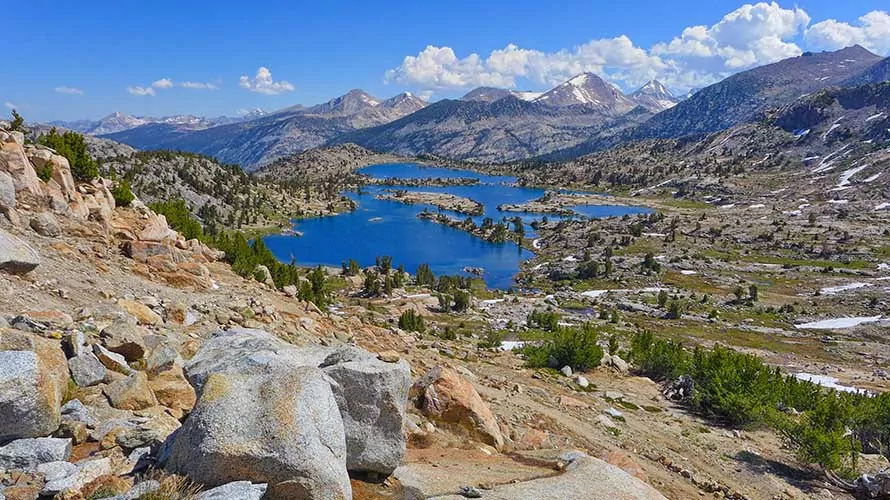
Today we start with an ascent to Marjorie Lakes, a glacier-scoured basin of stark, alpine beauty. We will soak up dazzling views of of gorgeous mountain lakes before ascending Pinchot Pass at 12,130 feet. On the other side of the pass, we’ll descend to the Crater Mountain plateau for the night.
Day 8
Hiking Distance: 8 miles
Elevation Gain: 2,157 feet
Elevation Loss: 2,387 feet
Today we descend into the Woods Creek basin (8,500′), across the “Golden Gate of the Sierra” suspension bridge, and then back up to Arrowhead Lake (10,300′), where we camp beneath the stars.
Day 9
Hiking Distance: 9 miles
Elevation Gain: 2,581′ feet
Elevation Loss: 3,009 feet
On day 9 we continue our epic journey by passing through the Rae Lakes Basin. Next we climb the rocky switchbacks of Glenn Pass (11,978′), followed by a drop into Vidette Meadow where we rendezvous with our second resupply. After re-loading our packs with fresh food and supplies, we’ll continue to Center Basin, hiking amidst the alpine beauty of massive, precipitous ridges.
Day 10
Hiking Distance: 11 miles
Elevation Gain: 3,389 feet
Elevation Loss: 2,367 feet
Today we get an early start and hike uphill to the highest pass on the John Muir Trail – Forester Pass at 13,180 feet. From the high pass, we drop into Tyndall Creek, passing the Diamond Mesa along the way. We’ll set up camp tonight below the awesome Mount Whitney Massif.
Day 11
Hiking Distance: 4 miles
Elevation Gain: 604 feet
Elevation Loss: 1,144 feet
Today is a much-deserved shorter day of hiking, covering 4 miles from Tyndall Creek to Wallace Creek. At scenic Wallace Creek, we enjoy a lazy afternoon to recuperate and enjoy our stunning surroundings, which include a pristine meadow and crystal clear mountain stream.
Day 12
Hiking Distance: 7 miles
Elevation Gain: 1,952 feet
Elevation Loss: 859 feet
Today we ascend to Crabtree Meadow, nestled along the base of the Eastern Sierra and the ideal basecamp for summiting Mount Whitney. We will fuel up with an early evening meal before crawling into our tents just after sunset for some much-needed sleep before our alpine-start summit push.
Day 13
Hiking Distance: 13 miles
Elevation Gain: 3,621 feet
Elevation Loss: 4,769 feet
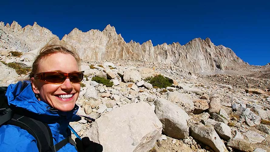
Today we get an early start well before sunrise to reach the high point (literally and figuratively) of the entire trip: a hike-up summit attempt of Mount Whitney (14,495′), the tallest mountain in the continental United States. On the summit we will enjoy 360 degree views that only the highest summit in the contiguous US can provide. After the summit, we will descend and return to camp.
Day 14
Hiking Distance: 9 miles
Elevation Gain: 1,998 feet
Elevation Loss: 1,891 feet
Today is a moderate hike as we descend 2,000 feet and then gain 1,900 feet through Crabtree Meadows on the way to our the final camp at Rock Creek.
Day 15
Hiking Distance: 10 miles
Elevation Gain: 1,722 feet
Elevation Loss: 2,239 feet
Shuttle: 5-6 hours
Our last day on the trail is a long one. We head up from Rock Creek over Cottonwood Pass (11,200′). We’ll stop for a snack around Chicken Spring Lake on the way out of Sequoia National Park with the last few miles taking us through the Golden Trout Wilderness. At the trailhead a picnic lunch awaits, and after that a shuttle back to your hotel in Fresno for a much deserved shower and soft bed. What an incredible adventure it has been!
Trip Dates
Scroll horizontally to view all dates
What's Included
-
Top-of-the-line tent, backcountry sleeping pad and multi-day backpack
-
High quality, synthetic sleeping bag (professionally laundered after every use)
-
Use of trekking poles
-
All meals are included from lunch day 1 through lunch on the final day
-
Multiple backcountry resupplies
-
Trained hiking guide(s) with years of personal wilderness and hiking experience, medical certifications, and a passion for leading people into breathtaking landscapes. See Guide Bios.
-
Transportation originating and ending in Fresno, CA
-
Bear cannisters for food storage
-
Emergency equipment including a company-issued first-aid kit and communication device
What's Not Included
-
 Clothes, raingear and footwear
 -
Sunscreen, toiletries and personal items
-
Water bottles and a headlamp or flashlight
-
Guide gratuity (industry recommendation is 10-20% of trip cost)
Accommodations
Backcountry Sleeping
14 Nights TENT CAMPING
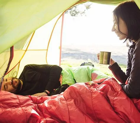
Sleeping on llama treks is in premier 1-person, 2-person or 4-person backcountry tents. Solo travelers, and anyone else who requests it, are issued single tents. Top-of-the-line self-inflating sleeping pads and synthetic-fill sleeping bags (professionally laundered after every trip) are also provided.
Backcountry Cuisine

FRESH & DELICIOUS
Meals from breakfast Day 1 through lunch the last day are fully included and prepared by your trekking guide. We never use dehydrated backpacking meals, instead serving freshly prepared, delicious backcountry cuisine made with a variety of common and specialty ingredients that travel well in the wilderness.
Amazing Campsites
IN THE ACTION
Campsites vary by destination, trip and even by the individual day of a trip. However, you can expect to camp in beautiful areas that put you right in the action to make the most of your trekking adventure. We carefully design our itineraries with campsites in mind.
Trip Logistics & FAQs
Where Do We Meet?
This trip meets in Fresno, CA at 6:00 pm the evening before Day 1 for a pre-trip orientation meeting. The meeting location is the Fairfield Inn and Suites Hotel near the Fresno International Airport. Your guide will be in contact approximately 10 days prior to coordinate the rendezvous.
Click here to see a printable, downloadable trip information packet with more detailed guidance about flights, shuttles, recommended lodging and more.
Travel to Fresno, CA
Fresno International Airport is a convenient airport to fly into, and the starting and ending point of the trip (Fairfield Inn and Suites Fresno Airport Hotel) is located near the airport. Please arrive in Fresno well before 6:00 PM and don’t plan any departing flights on the final day.
Pre and Post Trip on request lodging
We secure limited amounts of pre and post trip lodging in Fresno, CA as an optional add-on for guests of this trip. This lodging is on request, and is available on a first come, first serve basis. If interested, please reach out directly to our team to check availability.
Start/End Times
Your guide will inform you of the Day 1 pick-up time at the orientation meeting. Generally, you can expect it to be between 5 and 7 am, although the exact time will depend on current weather and road conditions. We will be back into Fresno normally around 7 PM (this time is not guaranteed, as a variety of circumstances can influence our exact return time) on the final day.
Safety Precautions
Your safety is our top priority. Our hiking tours are led by professional hiking guides, all of whom are wilderness-certified first responders or EMT’s, each with years of guiding and wilderness experience. Guides adhere to standardized risk management protocols in case of any potential or actual incident, and all tours carry an emergency communication device and comprehensive first-aid kit. Additionally we have a “24/7” system through which guides or guests can reach Wildland support personnel at any time.
If you have any further questions about safety, please contact us at 1-800-715-HIKE (4453) for more information.
Guide Shifts
High Sierra guides work daily shifts from 5 a.m. to 9 p.m. During off hours (9 p.m. to 5 a.m.) the guides’ time is their own, and they are free to sleep, rest, take personal time, postpone guest requests until the next morning, and any other legal, reasonable activity people engage in when not working. We ask all guests to respect the guides’ off-duty hours by not waking or asking anything of them unless there is a true emergency. Also, state law requires that employees receive an uninterrupted 10 minute break every four working hours, so guides are required to take four 10 minute breaks between 5 a.m. and 9 p.m.
Age Restrictions
Age restrictions on this trip are as follows:
- 12 and older to join scheduled tours (mixed groups)
- 10 and older to join private tours, with final approval on a case by case basis
- specific logistical requirements (such as porter or stock assist) determined on a case by case basis
Reviews
You Might Also Like...
"*" indicates required fields
Leave a Reply