
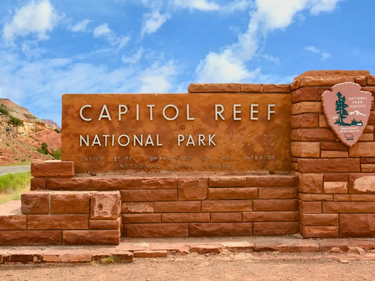
The Ultimate Guide to Capitol Reef National Park
My first trip to Capitol Reef was with two other Wildland Trekking guides, Carmelina and Austin, to scout the 6-day Capitol Reef Trek. As we got further outside our St. George base of operations and into the high elevation desert, we were truly in the middle of nowhere. The nearest traffic light to Capitol Reef National Park is 78 miles away. So far out that, when prepping for a Capitol Reef hiking trip especially, you really don’t want to forget anything.
With this in mind, and as it happened to be April Fools’ Day, Carm and I plotted a prank. We had been tasked with bringing Austin his backcountry food from the Wildland warehouse. Oatmeal, bagels, rice, chicken packets, typical Wildland backcountry fare– all of which we hid in my car’s roof box. When we all met up at the trailhead ready to pack our backpacks for our trek, Carmelina and I pretended to search the car for Austin’s food bag. We were frantic, faking distress.
“You were supposed to grab Austin’s food,” I jabbed at Carmelina.
“No… you said you were gonna put it in the car,” she quipped back.
Austin, ever the peacemaker, started to sweat. “It’s ok guys… I’ll just uh, drive the two hours back to Boulder and see what they have…”
We yelled “APRIL FOOLS!” just as he began to climb into his truck. Instantly, I saw the relief wash over his face. Not only was it a few hours to the nearest grocery store, the unpaved road to the trailhead was quite rough. Therefore, when visiting Capitol Reef National Park, preparation is crucial.
This area of Utah does not have the amenities that the other Utah national parks do or the bustling gateway cities of parks like Arches and Zion. This, and its distance from any major airports, is why Capitol Reef is among Utah’s less-frequented national parks.
How Capitol Reef got its name

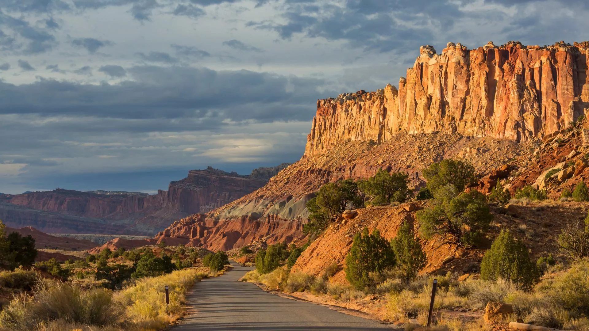
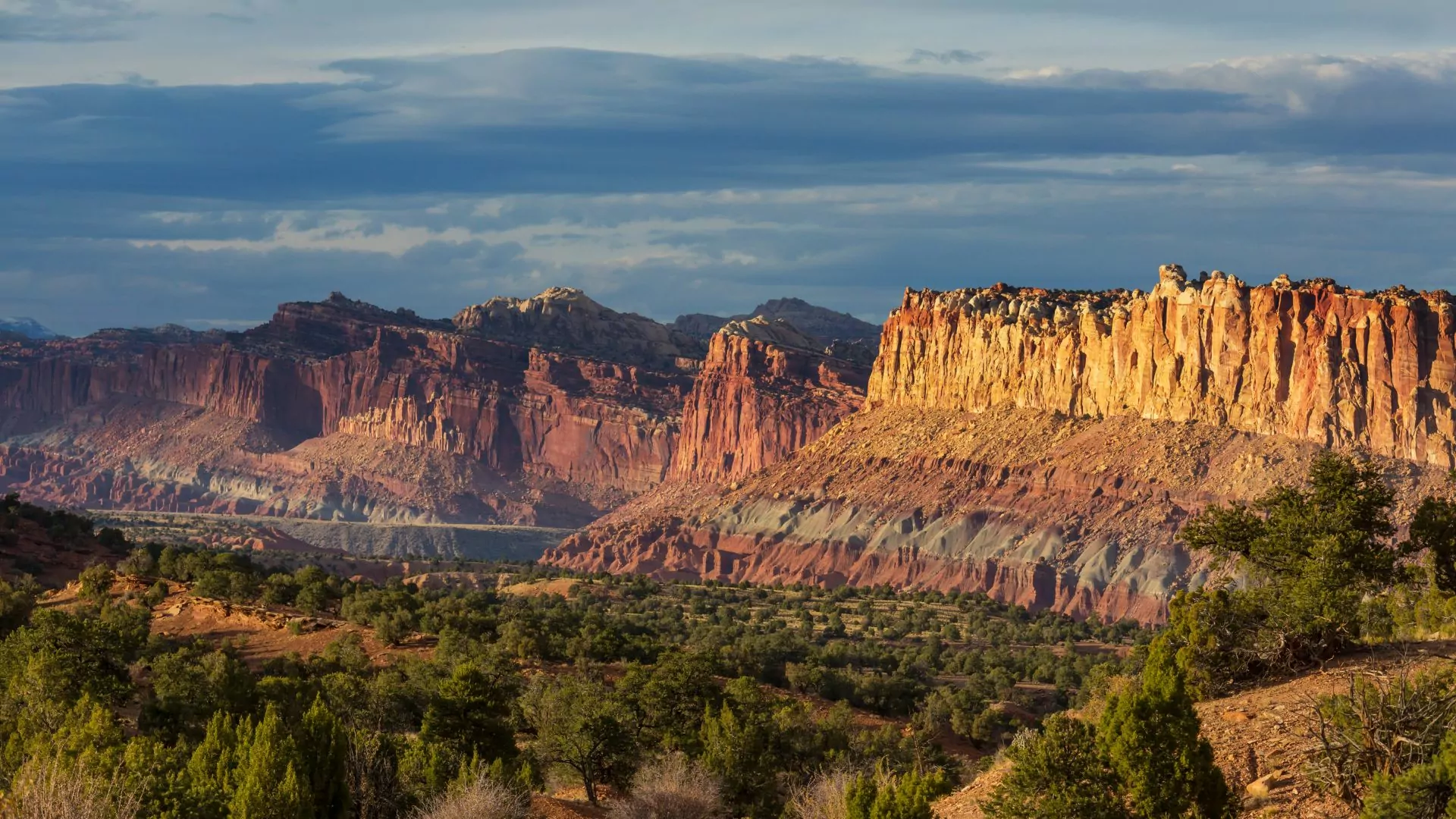
Capitol Reef National Park boasts a funny name that requires a four-part explanation. First, the ”Capitol” part refers to the white, Navajo Sandstone domes that bear a resemblance to capitol buildings. Next, the “Reef” refers to the impassable terrain resembling an ocean reef, that is responsible for the park’s remoteness; namely, the Waterpocket Fold.
The Waterpocket Fold is a unique geologic formation that spans 100 miles north to south, and only 3 miles west to east. It is a monocline formation, or in other words, a large “fold” in only one direction of the rock. The exact forces behind its formation are debated, but most theories suggest a rare type of tectonic plate compression. The Waterpocket Fold is the largest exposed monocline in North America and, due to its impassable nature, was the last area in the lower 48 to be surveyed.
Finally, this feature has many “waterpockets” or potholes–eroded depressions in sandstone that intermittently hold water. Thus, we have the Waterpocket Fold in Capitol Reef National Park.
Capitol Reef National Park receives, on average, 6-7 inches of rain per year, which means it is well within the classification for a desert climate. Popular attractions in this park include unique geology, petroglyphs and other native artifacts, hiking in solitude, pick-your-own fruit orchards, and sweeping night skies.
This one-stop guide will help you plan your visit, including: when to go, where to stay, and what to do. Enjoy!
When to Visit Capitol Reef
Capitol Reef can be enjoyed year round. In fact, each season has something unique to offer.
Fall and Spring
While the spring and fall are ideal for Capitol Reef hiking due to their moderate temperatures, they also see the most crowds. Note that this park saw only 1.4 million visitors in 2024– less than a third of Zion National Parks’s visitation–so crowds aren’t as big of a concern as in other parks. A benefit of visiting Capitol Reef in the spring or fall is also the option to pick fruit in the park’s orchards!
Summer
Summer can be great for exploring the higher elevation areas–just be prepared to hydrate and have adequate sun protection.
Winter
Winter in Capitol Reef is tranquil and gorgeous with the contrast of the snow on red sandstone–but have layers and be prepared for snow on the roads and trails.
Where to Stay in Capitol Reef
Capitol Reef camping is a great way to immerse yourself and your travel companions in the beauty of the area, with options available depending on your group’s needs. The nearby towns also offer plenty of lodging options, for those who want more-comfortable accommodations to balance the ruggedness of the park.
Campgrounds in the park
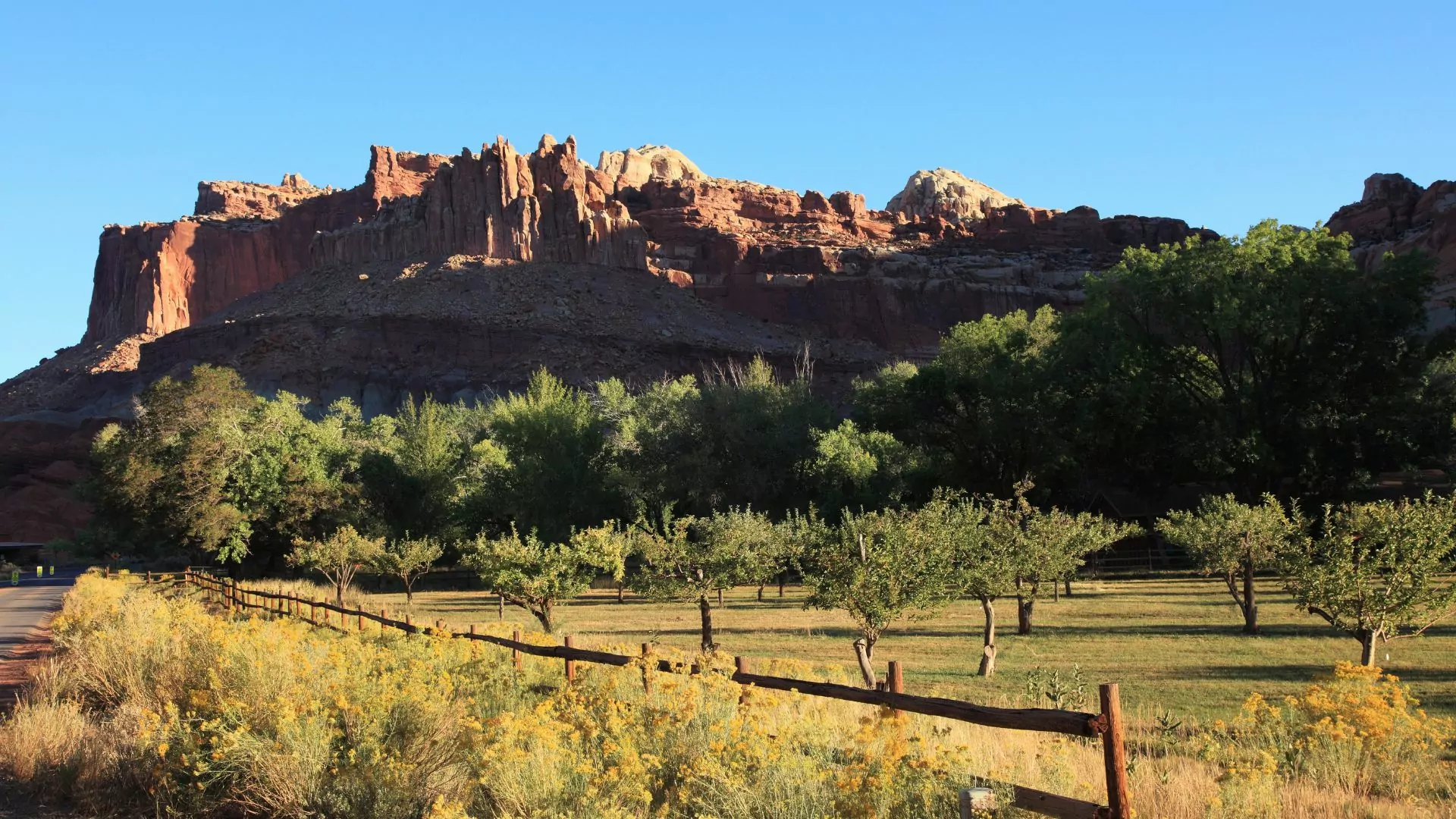
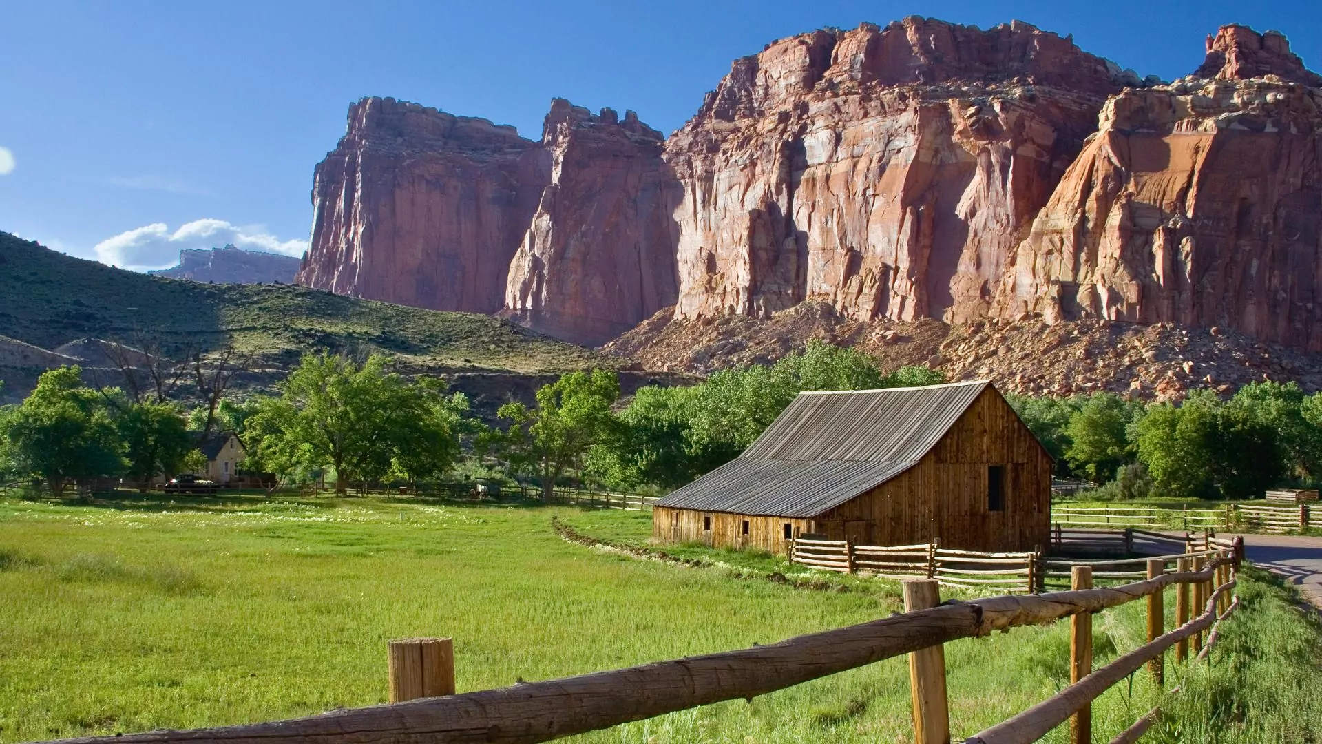
Fruita Campground
The Fruita Campground, an oasis in the desert, is a great choice for Capitol Reef camping. Centrally located in the most popular part of the park, this campground offers 71 tent and RV sites, bathrooms, picnic tables, and fire rings. This popular campground is by reservation only and is a great option for campers who plan ahead and are looking for comfortable amenities. From here, visitors can conveniently access a variety of Capitol Reef hiking such as the Hickman Bridge Trail and Cohab Canyon as well as historic sites such as the orchards, schoolhouse, and a Petroglyph Panel.
Cathedral Valley Campground
Another option for Capitol Reef camping is the Cathedral Valley Campground that offers primitive, secluded sites in the park’s northern region. At 7,000 feet, campers can enjoy cooler temperatures in a lovely Pinyon and Juniper Forest. The 6 sites offered here also come with some amenities including picnic tables, fire rings, and a pit toilet; however, water is not provided at this site. If camping at Cathedral Valley make sure to stock up on water before leaving the visitor’s center.
There is no fee to camp at the Cathedral Valley Campground, but do note that these sites are first-come first-served. Also, a high-clearance vehicle and four-wheel drive is typically recommended, but campers can call the Capitol Reef road hotline at 435-425-3791 to check current conditions. This site is the ideal jumping off point for the Cathedrals Trail and the 58-mile scenic drive. Best of all, the remoteness of the campground means amazing opportunities for stargazing!
Cedar Mesa Campground
Another tucked-away option for Capitol Reef camping is the Cedar Mesa Campground, which is located further south in the park. This is also free and available only on a first-come first-served basis. The Cedar Mesa Campground has 5 sites, with similar amenities to the Cathedral Valley Campground (picnic tables and pit toilets, but no water available). This road is typically accessible for two-wheel drive vehicles, but I do recommend checking the road hotline, just in case.
Dixie-Fishlake National Forest Camping
Want the amenities, but can’t get a Fruita campsite? Luckily, there are Capitol Reef camping options outside of the park, on nearby public lands. The Dixie-Fishlake National Forest is managed by the US Forest Service, and offers more Capitol Reef camping options. These sites can be reserved in advance at recreation.gov.
Singletree Campground
The Singletree Campground is a gorgeous high-elevation campsite at 8,200 feet in a ponderosa pine and aspen forest with views of the Henry Mountains. The campground also boasts many amenities including flush toilets and drinking water, plus a volleyball court and horseshoe pits. From camp, there is also a 1-mile hike to Singletree Falls. This site is located on the south side of the park, near Boulder Mountain. Despite being outside of Capitol Reef, Single Tree Campground is actually closer to the visitor’s center than the park’s Cedar Mesa and Cathedral Valley campgrounds.
Pleasant Creek and Oak Creek Campgrounds
Other nearby options in the Dixie-Fishlake National Forest include the Pleasant Creek and the Oak Creek Campgrounds, both of which are at 8,800 feet and offer drinking water and pit toilets. All three of these campgrounds (Singletree, Pleasant Creek, and Oak Creek) are on the way to the towns of Boulder and Escalante, popular jumping off points for exploring Grand-Staircase Escalante National Monument. This is also the direction of Bryce and Zion National Parks, so these campsites can be a great stop over point when linking up visits to other Utah national parks.
Sunglow Campground
To the west of the park, on the way from Salt Lake City, the Sunglow Campground near the town of Bicknell is another option for Capitol Reef camping. This is in a red box canyon, with cottonwood and juniper trees and is just a few minutes outside of town where dining and other amenities await.
Dispersed Camping
For Capitol Reef camping off the beaten path, there are also dispersed campsites all around the borders of the park. These amenity-less options can be found both in the Dixie-Fishlake National Forest and Bureau of Land Management (BLM) land and are not officially marked as campsites. Instead, campers are required to stay on “previously disturbed” land. One great way to know if land is “previously disturbed” is by fire pits, which can indicate that others have camped in that spot.
It is important to adhere to the principles of Leave No Trace while dispersed camping–for example, the presence of a fire pit does not necessarily mean it is allowed to make a fire. Be sure to check for seasonal fire bans, and follow them! These areas will not have drinking water, trash cans, bathrooms, so campers must plan ahead accordingly. By planning ahead for your camping needs, you will not only enjoy your Capitol Reef camping experience, but also ensure that future generations, and the local flora and fauna can continue to benefit from these precious natural resources.
Staying in nearby towns
The towns surrounding Capitol Reef National Park are quaint, charming, and well worth exploring. They offer a variety of options for camping, glamping, or lodging.
Torrey is the nearest town to Capitol Reef, only 15 minutes from the park entrance. There are many lodging options in Torrey, and a few nice dining options as well. My favorites in Torrey are Capitol Burger and the Wild Rabbit Cafe.
Other nearby towns with lodging options include Teasdale, Bicknell, Grover, and Caineville–all within 30 minutes of the park. The town of Boulder, UT, 1 hour away from the park, is a charming little town with one of my all-time favorite restaurants, Hell’s Backbone Grill and Farm. Though a little further away, Boulder is a worthy addition to a Capitol Reef trip!
Escalante and Capitol Reef Tour
Capitol Reef Hiking
Petroglyph Trail
0.3 Miles| Out-and-back
No Capitol Reef hiking trip is complete without a stop at the Capitol Reef Petroglyph panel. This short, accessible trail is conveniently located in the Fruita Historic District, and follows a boardwalk with a few panels of petroglyphs. Visitors can marvel at these etchings, and create their own theories about what the Fremont and Ancestral Puebloans may have been communicating with these works of art. Please stay on the boardwalk, and never touch ancient artifacts–help keep these cultural resources preserved!
Hickman Bridge Trail
1.7 mi |400ft Elevation Gain |Out-and-back
The Hickman Bridge Trail is an out-and-back packed with amazing geologic features and ancient artifacts. Centrally located in the Fruita Historic District of the park, just 2 miles from the visitor center, this relatively short hike is loaded with exciting sites. A small natural bridge, the Nels Johnson Bridge, comes first, before the namesake of the trail, the Hickman Bridge. This is an incredible natural bridge carved by flowing water that eroded the Kayenta Formation.
Along the way, hikers can marvel at the various artifacts of the Fremont people, such as pit houses and granaries. These people inhabited the area some 1,500 years ago, and mysteriously vanished around 1275 AD. Hikers can also see views of Cohab Canyon, where polygamist people were rumored to have hid from authorities, and Capitol Dome, one of the white navajo sandstone domes that inspired the “Capitol” in the park’s name. At the trailhead, hikers can pick up an interpretative brochure that can help add dimension to the wonders of this trail.
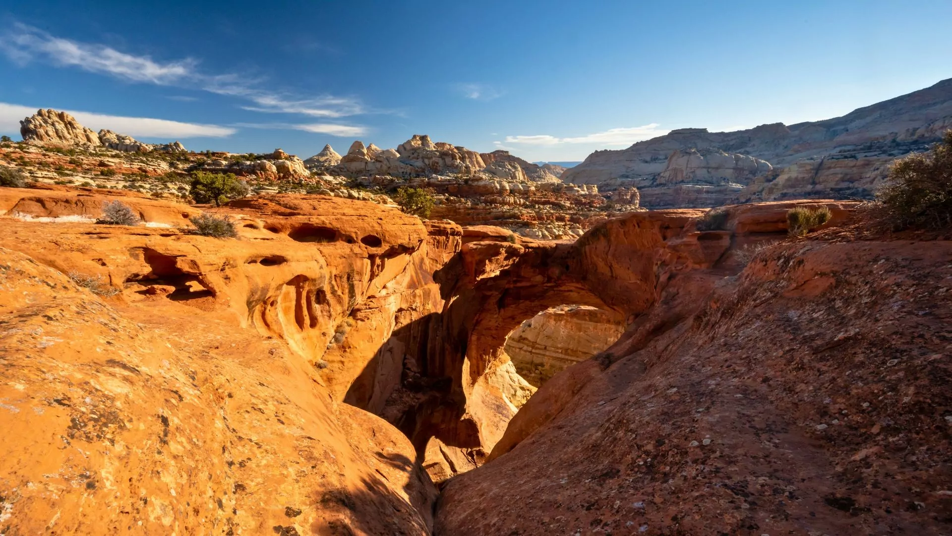
Cassidy Arch
3.4 Miles | 700ft Elevation Gain | Out-and-back
Located off the scenic drive just 5 miles south of the visitor’s center, the Cassidy Arch Trail is an exciting choice to immerse oneself in the geologic wonders of the area. With some scrambling on brightly colored slickrock, hikers can top out the arch and enjoy the views. The Cassidy Arch is named after the infamous train robber Butch Cassidy, who was rumored to have hideouts in the area. Make sure to bring a lot of water and sun protection, as this trail does not provide much shade.
Grand Wash Trail
4.4 Miles | 200ft Elevation Gain | Out-and-back
Nearby to the Cassidy Arch, the Grand Wash Trail is an out-and-back that follows a meandering streambed through looming sandstone cliffs. This trail can be accessed from either side, as there are parking lots on both ends of the trail: Highway 24 and the Grand Wash Road. Hikers might find bighorn sheep impressively grazing on the edges of the cliffs. Note that while the wash is typically dry, flash floods can occur here, so it’s important to be aware of the weather forecast and any flash flood advisories. Also, this trail can have some tricky route finding, so be sure to have a map handy to help with orientation.
Chimney Rock Trail
3.6 Miles | 600ft Elevation Gain | Loop
The Chimney Rock Trail is a lollipop-shaped loop that is 3 miles northeast of the Visitor Center that enables hikers to marvel at the geologic wonders of Capitol Reef. There are amazing views of the imposing Chimney Rock, which is the western edge of the colorful and impressive Waterpocket Fold. Like many other Capitol Reef hiking trails, this trail offers little shade, so be prepared with water, electrolytes, and sun protection!
Cathedrals Trail
2.4 Miles | 300ft Elevation Gain | Out-and-back
In the north end of the park, 50 miles from the Visitor Center, the Cathedral valley is apt for those looking for a true Capitol Reef hiking adventure. The tricky part about this area is the road. Four wheel drive and high clearance is recommended. Cars must be able to ford the Fremont river. While most high clearance vehicles should be able to handle this, it’s best to check the park’s road conditions before embarking on the journey.
Adventurers will be rewarded with incredible views of the cathedrals formations, stratified sandstone that resemble gothic architecture– but brightly colored red orange. This is a worthy hike when camping at the Cathedral Valley campground, and/or to be paired with the Cathedral Valley scenic drive, a 58 mile loop.
Capitol Reef Backpacking
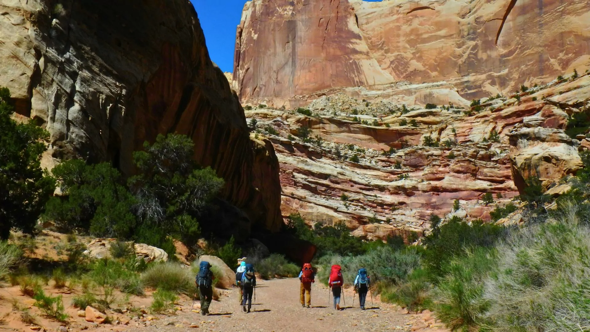
Capitol Reef Trek
32+ Miles | 4,700ft Elevation Gain | 6-Day Through Hike
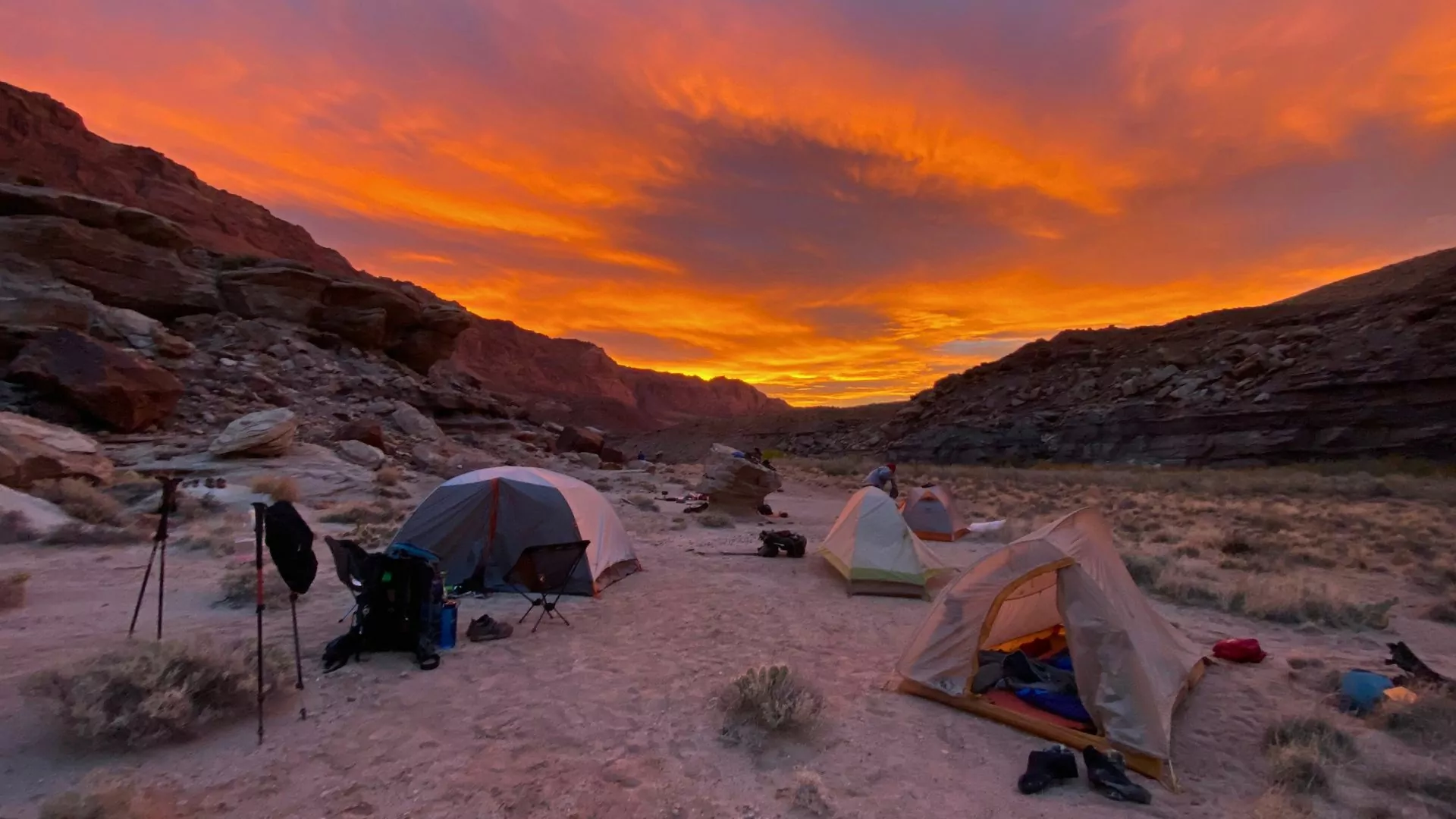
Ready to take your Capitol Reef hiking to the next level? Wildland Trekking’s Capitol Reef trek will get hikers up-close-and-personal with the waterpocket fold in the south end of the park. A highlight of the 6 day trek includes the Halls Creek Narrows, a drainage similar to the Zion Narrows, with a fraction of the crowds.
With sandstone walls rising high on either side, trekkers walk through the water of Halls Creek, exploring the riparian wonders in this desert oasis, and camping nearby. We then head towards the wandering Muley Twist Canyon, so named because it “twists a mule” to get through it. Along the way, we’ll filter water from potholes (natural puddles of rainwater in the sandstone), scramble up to the glorious Brimhall Arch–a unique double arch–and visit Hamburger Rocks, silly-looking hoodoos that do indeed resemble hamburgers.
We also marvel at petroglyphs and cowboy-glyphs as well as the variety of shapes and colors that sandstone has to offer.
Guided Capitol Reef Backpacking
Other Things to Do in Capitol Reef
 In Capitol Reef hiking is not the only fun activity! Visitors can embark on scenic drives, pick fruit from the historic orchards, or emerge at night and gaze at the stars.
Scenic drives
Capitol Reef offers several scenic drives, each with unique landscapes and viewpoints. The park-designated “Scenic Drive” starts from the visitor venter and travels south for 8 miles. This road is paved and suitable for most vehicles. Sights along the way include geologic features such as solution pockets, abandoned mines, petroglyphs from the Fremont people, and a pioneer register from Mormon travellers in the late 1800s.
Another option for a scenic drive is the Cathedral Valley Loop, a 58 mile loop which requires a high clearance vehicle, especially to ford the Fremont River. The Burr Trail Road is a graded road with exciting switchbacks, and can be combined with the Notom-Bullfrog road for a scenic tour of the Waterpocket fold. No matter where you drive, it’s all quite scenic in this area, so you really can’t go wrong!
Fruit picking
Pioneers in Fruita in 1880 planted fruit trees to nourish the growing population. Today, the park honors their heritage by maintaining these orchards and allowing park visitors to pick their own fruit. The Fruita orchards have trees with apple, cherry, peach, plum, and more. These are located all around the Fruita Historic District. Only pick ripe fruit that is labelled as “U-Pick”, and be sure to visit the self-pay station after grabbing your fruit.
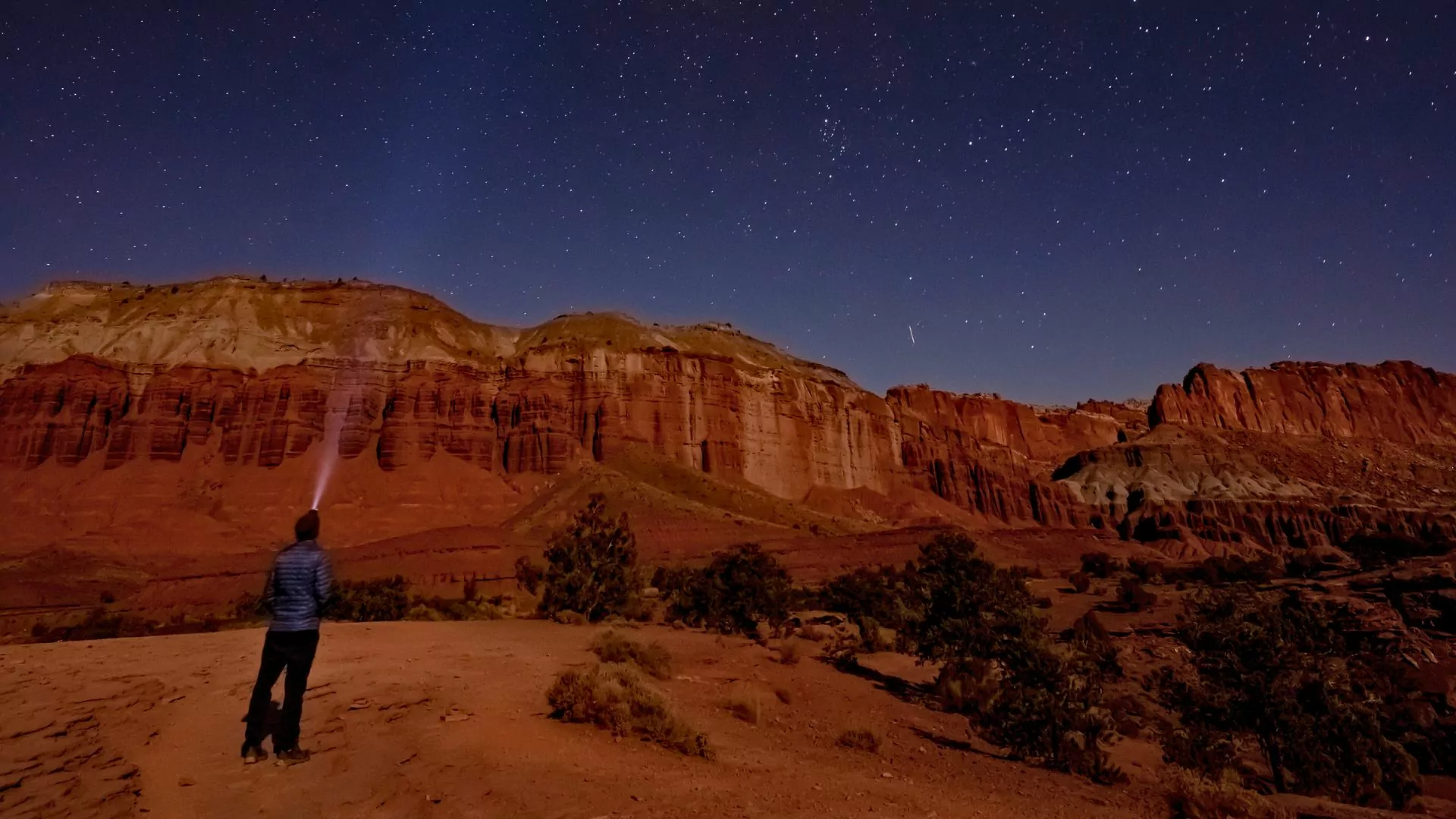
Stargazing
Capitol Reef National Park is an International Dark Sky Park, meaning it is one of the increasingly rare places where we can have unfettered views of the night sky. Ideal stargazing conditions are clear nights around a new moon, so make sure to check the moon phase schedule if you’re interested in stargazing—and hope for cloudless weather. Star maps, especially glow in the dark ones, can be a fun tool to orient and educate visitors about the night sky.
Final Notes
Capitol Reef hiking and camping is remote and extreme. Be sure to be prepared for safety concerns that might come your way! These include: flash floods, extreme heat and cold, excessive sun exposure, water unavailability, exposed cliffs, and rough road conditions. Be sure to plan ahead and talk to a ranger about any safety concerns– or sign up for a Wildland Trekking trip and we can do the safety planning for you.
So go ahead, plan that trip to Capitol Reef, and remember to hide your food and prank your travel buddies– the remoteness of the area will really work in your favor!
