The Fascinating Story of the Grand Staircase

If you’re wandering the labyrinths of the spectacular Grand Staircase-Escalante National Monument, you may find yourself asking: “what is the Grand Staircase anyway?”
For many travelers, the Grand Staircase of the Escalante is a confusing geologic complex. To clear things up, the “Grand Staircase” refers to two things: 1) Grand-Staircase-Escalante National Monument in southern Utah, and 2) the geologic feature made up of various rock layers that form terraces that resemble a set of stairs. When we’re discussing the story of the Grand Staircase, we’re talking about the geologic wonder which spans from Bryce Canyon and into northern Arizona. But how did it form, and how did it get its name?
The Basics of the Grand Staircase
The idea of the Grand Staircase of the Escalante was first conceptualized by geologist Clarence Dutton in 1870. However, the word Escalante goes back even further. It comes from Silvestre Velez de Escalante, a Franciscan Missionary and the first European visitor to the region in 1776. Nowadays, a small town in the middle of Southern Utah bears the name.
But what does the Grand Staircase mean? Geologically speaking, the Grand Staircase of the Escalante is a continuous succession of old to young sedimentary rock layers.
A basic concept in geology is the Law of Superposition which says in “undisturbed rocks, the oldest rocks lie on the bottom and the youngest on top.” Simply put, the Grand Staircase is comprised of all rocks from the bottom of the Grand Canyon (2,400 ft or 740 m) to the top of Bryce Canyon (10,000 ft or 3,050 m). This succession of unbroken rock layers displays more of Earth’s continuous geologic history than any other place on the planet! Continuous is the keyword here. While you’ll find plenty of places in the Western United States and other parts of the world with much larger displays of rock (such as the Himalaya and Andes Mountains), all of those locations had (or have) tectonic forces breaking up those rocks to achieve such great exposures.
A Vast Window to the Past
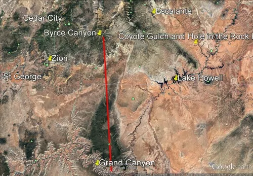
The Grand Canyon and Canyons of the Escalante slice through the Colorado Plateau, a colossal region covering an area of 130,000 square miles roughly centered on the Four Corners region. To better understand the Grand Staircase of the Escalante, one needs to understand the formation of the Colorado Plateau. The red line in the image below represents what is commonly known as the Grand Staircase.
 Around the time of the formation of the Rocky Mountains, the Colorado Plateau was pushed upwards, and miraculously, its rock layers remained structurally sound. (Structurally sound means that the rocks remained unbroken by faults or fractures while they were being pushed upwards.) Most mountainous regions are crisscrossed by faults and fractures, resulting in landscapes where different types and ages of rocks being placed side by side. This mishmash of rocks becomes a difficult puzzle for geologists to resolve as they work out the origin of each type of rock.
Thankfully, this is not the case with the Colorado Plateau rocks. The rock layers of the Colorado Plateau are displayed in a chronological narrative from the depths of the Grand Canyon to the lofty heights of Bryce Canyon. The resulting geologic feature? The Grand Staircase of the Escalante. From nearly 560 million years ago to 45 million years ago, the Colorado Plateau existed over a cavernous basin much like the Marianas Trench. The basin was slowly filled with different types of sediments that — over a long period of time — solidified into sedimentary rock by pressure from above. The neatly layered sedimentary rocks helped to anchor the Colorado Plateau during the gradual uplift of the Rocky Mountains.
The forces of Water and time
If there was only deposition and uplift of the Colorado Plateau, then we wouldn’t be able to see any rocks because they would still be buried underground.
Exposing the rocks of the Colorado Plateau took the driving force of erosion from the Colorado River, which drains an estimated 246,000 square miles of water each year and has an average annual discharge of 473 billion cubic feet. This water now flows through the Grand Canyon. However, this massive discharge resulted in downcutting into the sedimentary rock layers of the Colorado Plateau – at the rate of just 1 mm (or about the thickness of a piece of paper) per year.

If nature had its way, everything would be flat. Flat is the equilibrium for all of Earth’s geologic processes. The Colorado River and hundreds of its tributaries are slowly achieving this by cutting away at the rocks and dispersing them elsewhere. Creeks rushed down gravelly washes and sliced through the sedimentary rock layers to create deep canyons.
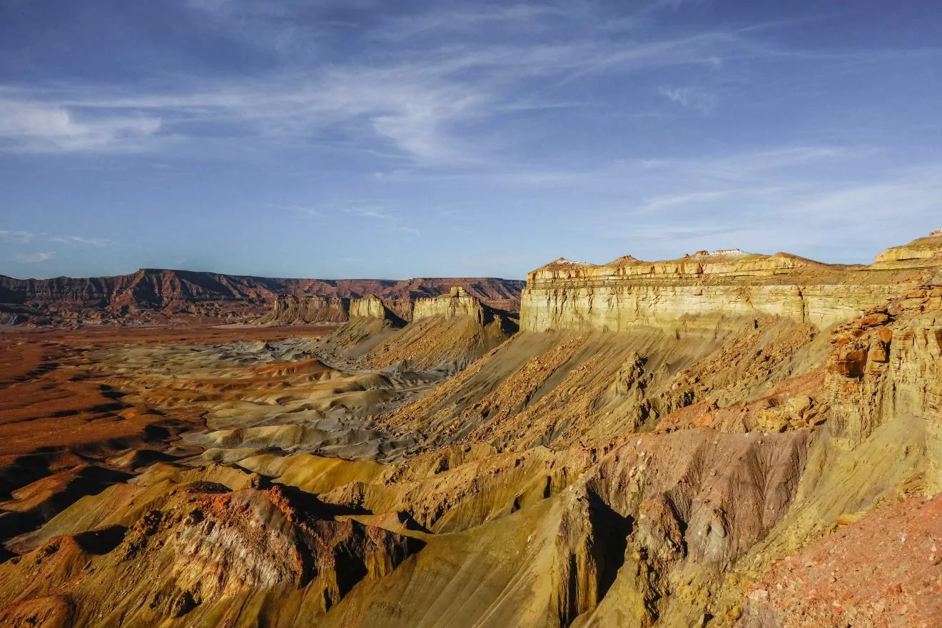
Meanwhile, the canyon walls simultaneously began to erode from wind, ice, and gravity. Because no rock type is alike, these rocks vary based on their ability to resist erosion. As different rock types unevenly wore away, a staircase pattern began to form in this desert landscape. One by one, the unique layers of the Colorado Plateau slowly yielded themselves to the overbearing powers of erosion, revealing the Grand Staircase of the Escalante.
Experiencing the Grand Staircase Today
 So, the Grand Staircase is a geologic feature that has been revealed through millions of years of continuous erosion into the Colorado Plateau. Thankfully, these processes were kind enough to provide hikers with 8 national parks and monuments and more than 14,000 square miles of federally protected land.
Today, you can travel through time as you pass through the layers of the Grand Staircase. From the Vermillion Cliffs near Kanab to the White Cliffs that make up part of Zion’s iconic landforms, these rocks bear witness to past rivers, winds, rain, and time. Wild is waiting on the Colorado Plateau, join us on an adventure.
Alex Wood – The Wildland Trekking Company


