Capitol Reef Backpacking: Beyond the Fold
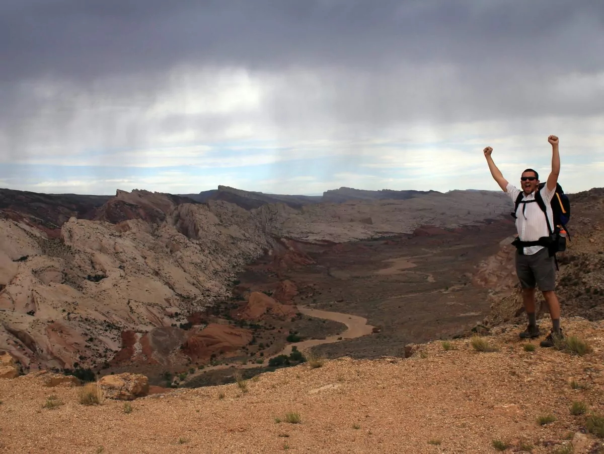
Get off the beaten track. Our six-day Capitol Reef backpacking trip traverses the remote Waterpocket Fold District to the very southern boundary of Capitol Reef National Park. Here are 10 reasons to go:
1. Off the Map
Less than a century ago, the Waterpocket Fold became the last-mapped region in the West. This is the remote country that hid Butch Cassidy and kept local Paiute Indians safe long after pioneers encroached elsewhere. Our seven-hour drive to the trailhead passes through what was the final horse-packing town in America. And even today, this route has an edge-of-the-earth feel that is unworldly.
2. Wagon Tracks
One of the neatest things about backpacking through Canyon Country is witnessing human history first-hand. In 1881, Mormon pioneer and entrepreneur Charles Hall was looking for a better way to cross the Colorado River to serve the settlements along the San Juan River. He created a wagon route up Grand Gulch (Halls Creek) from the Colorado River, through Lower Muley Twist and Silver Falls Canyon to Harris Wash. Our Capitol Reef backpacking trip traces much of this route through Halls Creek and Lower Muley Canyon.
3. The Slide
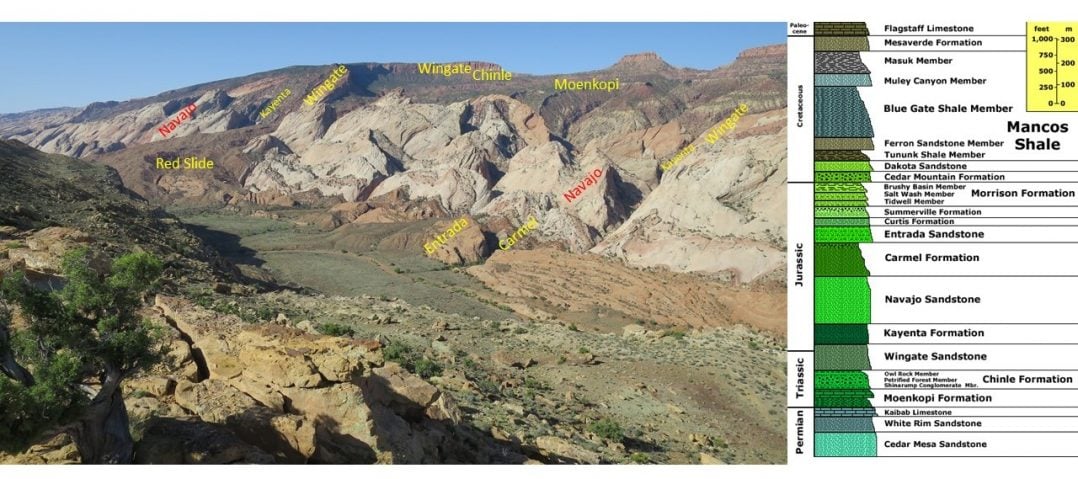
The Red Slide is a break in the edge of the fold, where weakness between the Jurassic/Triassic sandstone layers allowed an 800-ft ramp to form between Halls Creek and the top of the Fold.
4. Slot Canyon Serenity
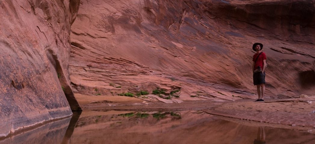
Seven miles from Lake Powell, Halls Creek closes in to form some of the most tremendous canyon “narrows” in Utah.
The Halls Creek Narrows is similar in both scale and spectacle to the famous Virgin River Narrows in Zion National Park. But unlike the Zion Narrows, Halls Creek remains largely untraveled and unknown. Expect to see thousand-foot canyon walls, spectacular hanging gardens, and very few people. In fact, thanks to its extremely remote location, Halls Creek receives just a 10th of a percent of the visitation of its better-known cousin. Our Capitol Reef backpacking trip spends a full day exploring this surreal slot canyon environment.
5. Hamburger Rocks
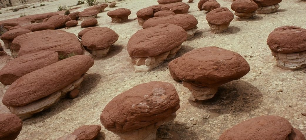
These fat burger-shaped hoodoos (geologic term for a column of rock) grace the postcards and coffee table books for sale at the Capitol Reef National Park Bookstore. But few ever get to see (or feel) these peculiar pygmy pinnacles.
6. Tanks
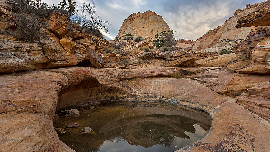
Tanks. Potholes. Tinajas. Waterpockets. All names for eroded holes that host life in the deserts of Canyon Country.
7. Double Arch
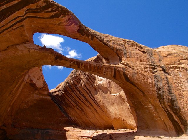
On the first day of our Capitol Reef Backpacking trip, we’ll take a day hike to Brimhall Natural Arch – a stunning example of one of the few double sandstone arches anywhere in the world.
8. Cowboy Cave
More of an alcove than a true cave, this massive overhang served as shelter to generations of travelers. Inscriptions from the 1920s back to 1896 decorate the desert varnished walls, and you can find trinkets like tobacco tins and coffee cans on the sandy floor.
9. The Lower Muley Twist
With “enough turns to twist a Mule,” Lower Muley Canyon provided an amusing segment of Charles Hall’s 1881 “road” to San Juan County (see Wagon Tracks). Still just as isolated as a century ago, the Muley Twist continues to delight backpackers today.
10. The Fold
If a waterpocket is a pothole, then what’s the fold?
Essentially, the Waterpocket Fold is a wrinkle in the earth. Sixty-five million years ago, the same compacting forces that created the the Rocky Mountains also made this monocline fold that sits like a mangled spine in the middle of the remote Colorado Pleateau region. The fold makes up the proverbial “reef” (essentially a barrier) in Capitol Reef National Park.
Our Capitol Reef backpacking trip through the Waterpocket Fold District is one of Canyon Country’s true, off-the-beaten-track pleasures. Trips run March through May and September through October. Space is limited on our small group backpacking tours. For further information, visit our Capitol Reef backpacking trip page, or call 800-533-4453 (HIKE).


