
3 Best Great Smoky Mountains National Park Thru-Hikes
Jump to:
The lure of conquering a thru-hike is calling. You are itching to don your trusty backpack and favorite hiking shoes. The desire to walk for miles and miles deep in the woods is bubbling within you. So what about a Great Smoky Mountains National Park thru-hike?
You may dream of hiking trails like the Appalachian Trail, the Pacific Crest Trail, or the Continental Divide Trail. However, for various reasons, these thru-hikes may not attainable at this time in your life. Never fear, you can lose yourself in the woods and complete a thru-hike without devoting months and months to this goal. Come and lose (or find) yourself in the Great Smoky Mountains National Park and achieve your goal of completing a thru-hike.
The Great Smoky Mountains National Park has three thru-hike options.
- The Classic – Fontana Dam to Davenport Gap along the infamous Appalachian Trail
- The Remote – Twentymile Ranger Station to Davenport Gap along the Benton MacKaye Trail
- The Unique – Fontana Dam to Gatlinburg along a unique path through the Park
All-inclusive Smoky Mountains Backpacking Trips
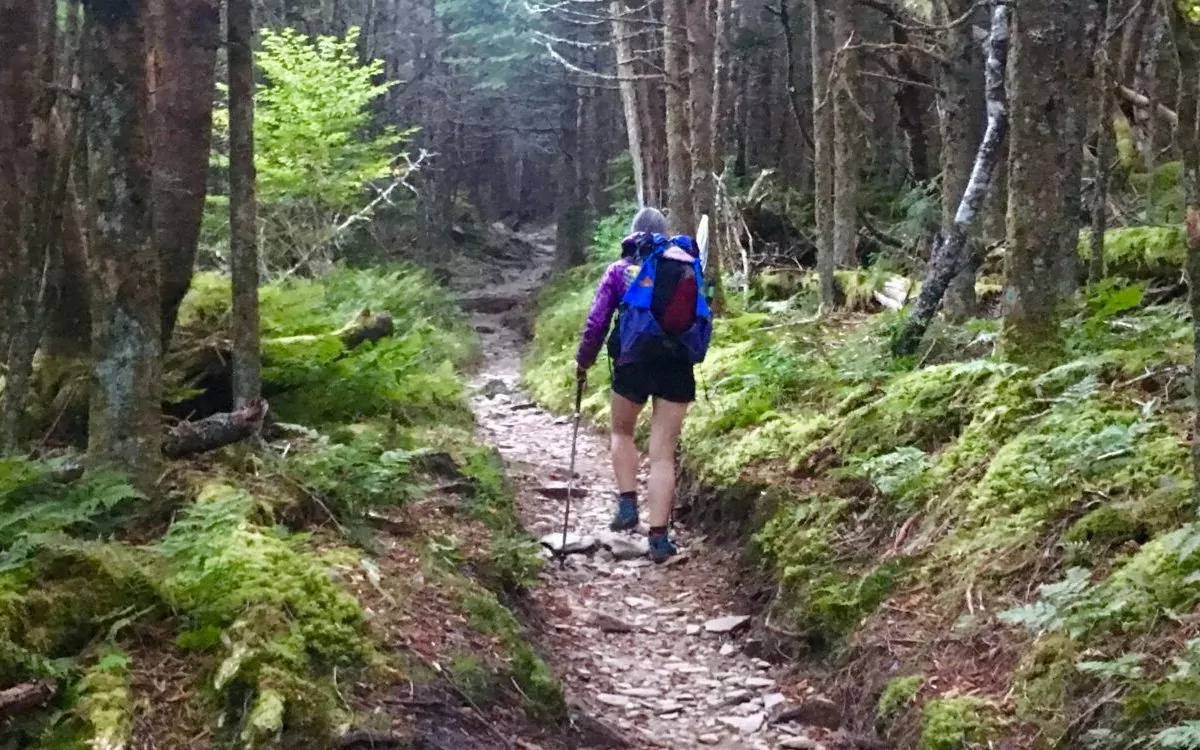
1. The Classic: Appalachian Trail
Difficulty: Strenuous | Days: 7 | Mileage: 71
When a Great Smoky Mountains National Park thru-hike is mentioned in conversation, one immediately thinks of the Appalachian Trail. The AT is the classic hike through the park. It is a 71.6-mile trek from Fontana Dam, North Carolina, to Davenport Gap, Tennessee. Most backpackers follow the infamous AT 2×6 inch white blazes for seven days to complete this adventure.
Flora

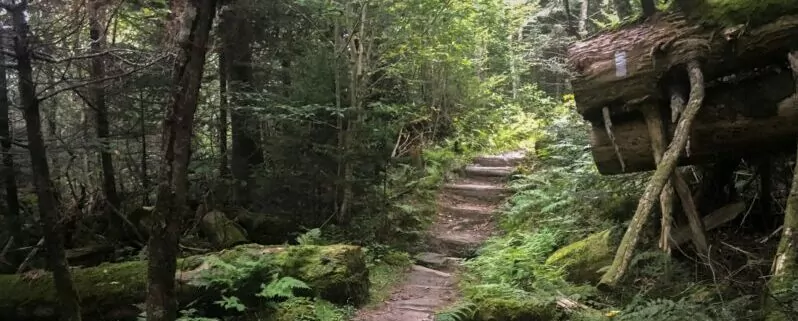
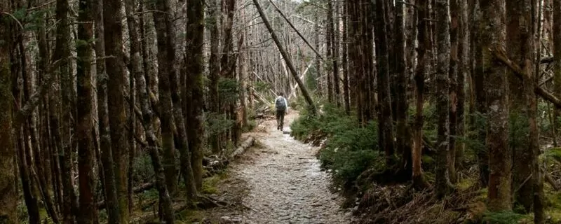
The scenery is epic along the Appalachian Trail in the Great Smoky Mountains National Park, and this thru-hike demonstrates the park’s vegetative diversity. There are over 1600 species of flowering plants and 50 ferns. You will hike through five different types of forests: Cove Hardwood, Spruce Fir, Northern Hardwood, Pine and Oak, and Hemlock. When you are not in a forest, you will find yourself among heath or grassy balds. Wildflowers bloom in abundance along this hike in all seasons except winter.
View Points
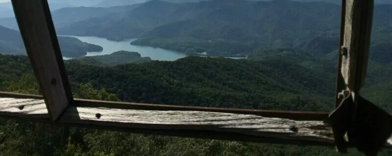
ShuckStack Fire Tower
Start off your thru-hike with an excellent view of Fontana Lake by taking the small detour to climb Shuckstack Fire Tower at mile 4 of your trek. The climb up the rickety metal fire tower will get your heart pumping. The view is breathtaking.
Clingman’s Dome
This hike starts at an elevation of 1800 feet. Over the coming days, you will steadily climb to a max elevation of 6,643 feet. The peak of your 6,643-foot climb is Clingman’s Dome, the highest point in Great Smoky Mountains National Park.
Newfound Gap
After Clingman’s Dome, you will walk across the only road along your trek—Highway 441—at Newfound Gap. This is an excellent place to have a friend meet you for a resupply. Newfound Gap, the “halfway” point in your backpacking adventure, is located on the North Carolina and Tennessee border. It is also the site where President Franklin D. Roosevelt formally declared the Great Smoky Mountains a National Park. This dedication was televised on September 2, 1940.
Charlies Bunion
Continuing north from Newfound Gap, you will soon pass Charlie’s Bunion. Charlie’s Bunion is a unique rock outcrop: it resulted from a massive logging fire followed by torrential rains. Once again, views are abundant from this vantage point. So take off your pack, snap a few photos, eat, and take a rest before continuing north along the AT.
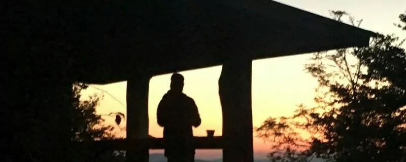
Mt. Cammerer
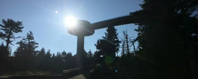
The last “big” view will be on the last day of this trek. Don’t skip the 0.6-mile detour to Mt. Cammerer. It is worth every extra step. The western-style fire lookout is unique in its octagonal design. The Civil Conservation Corps constructed this fire tower in the late 1930s out of hand-cut stone quarried only 100 yards down the mountain. It was fully restored in 1995.
Seasons

Summer
A large portion of this hike is above 4500 feet. Air temperatures are cooler at this elevation, making this a wonderful option for a summer trek.
Spring
Be prepared for a crowded trail and jam-packed shelters if you are hiking in the spring. This is the height of the AT thru-hiking season in the park. You will be sharing the trail with adventurers attempting to complete an Appalachian Trail thru-hike in its entirety, giving you the true AT “thru-hike” experience.
Fall
Fall is an excellent time for this adventure. Your eyes will feast on autumnal colors. You may meet an AT southbound thru-hiker or two. Their legs will be strong and swift, as 20+ mile-hiking days are now easy for them. Be sure to pack for cold weather because temperatures will drop significantly at night and snow is always a possibility.
Winter
This thru-hike is possible in the winter. Make sure you have winter gear and know how to use it. Snow, ice, and below-freezing temperatures are a reality. The views will be fantastic. The trails will be sparse with other hikers. If you take this on as a winter hike, go with the understanding that emergency help may not be possible due to closed roads and inclement weather.
Award Winning USA Hiking Vacations
Camping
When completing “The Classic” AT thru-hike through the Great Smoky Mountains National Park, you can leave your tent at home. You are required to stay in one of the 12 shelters along the Appalachian Trail. This requirement reduces the human impact in the National Park and helps preserve its vast and delicate ecosystem. To complete this 71.6-mile hike through the Park, a General Backcountry Permit is required. You do not have to qualify for the AT Thru-Hikers Permit. The AT Thru-Hikers Permit is for hikers that begin and end their trek at least 50 miles outside the GSMNP.
Food and Water
Please keep the black bears safe and hang your food on the bear hangs provided at the shelters at night.
Water is usually plentiful in the Park; however, filtering is recommended.
Suggested Itinerary
Night |
Point of Interest/Shelters |
Mileage |
Elevation in feet |
| Fontana Dam, NC | 1800 | ||
| Shuckstack Tower | 4 | 3800 | |
| #1 | Mollies Ridge Shelter | 10.6 | 4570 |
| Rocky Top | 17.2 | 5440 | |
| #2 | Derrick Knob Shelter | 22.3 | 4880 |
| #3 | Double Springs Gap Shelter | 29.5 | 5505 |
| Clingman’s Dome | 32 | 6643 | |
| Newfound Gap | 41.3 | 5046 | |
| #4 | Icewater Springs Shelter | 43.3 | 5920 |
| Charlies Bunion | 44.1 | 5905 | |
| #5 | Tri-Corner Knob Shelter | 55.9 | 5920 |
| #6 | Cosby Shelter | 63.6 | 4700 |
| Mt Cammerer | 66.4 | 5000 | |
| Davenport Gap, TN | 71.4 | 1975 |
If you have only one week and want to complete a thru-hike, do not hesitate to come and hike “The Classic” thru-hike along the AT in the Great Smoky Mountains National Park. Not only will you have an unforgettable seven days of hiking with outstanding landscapes, but you will also complete the most difficult southern section of the Appalachian Trail. Pick a week. Pack your backpack. Come fulfill your dream.
2. The Remote: Benton MacKaye Trail

Difficulty: Strenuous | Days: 9 – 10 | Mileage: 97
Look no further than the Benton MacKaye Trail for a remote, backcountry thru-hike in the Great Smoky Mountains National Park. The BMT allows hikers to explore the northeast corner of the Park. The section of trail within the National Park is approximately 97 miles long and is usually completed in nine days.
History of The Benton MacKaye Trail
Benton MacKaye, a forester and land preservation advocate, is the “Father of the Appalachian Trail.” The AT was his brainchild. He presented his idea in a 1921 article called “An Appalachian Trail: A Project in Regional Planning.” The Benton MacKaye Trail was built and named in his honor.
The BMT is a 300-mile trail originating on Spring Mountain in Georgia and terminating in Davenport Gap, Tennessee. The BMT is blazed with white diamond trail markers. These blazes have the words Benton MacKaye Trail printed on a green background.
This trail is remote. In addition, it is beautiful. It follows Benton MacKaye’s original proposed route of the Appalachian Trail through the Park.
BMT through the Great Smoky Mountains National Park
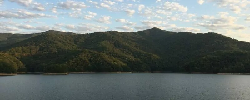
Lake Fontana
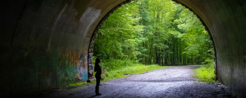
The Benton MacKaye trail enters the Great Smoky Mountains National Park at the Twentymile Ranger Station. It meanders near Lake Fontana for more than 27 miles and even passes through a tunnel (you will need headlamps) before joining the Noland Divide Trail. The Noland Divide Trail leads to the Deep Creek Area of the GSMNP where the Benton MacKaye Trail now merges with the Mountain to Sea Trail.
Mountain to Sea Trail
On the Mountain to Sea portion on the BMT, you will begin your first true climb. You will ascend 2500 feet over approximately eight miles before the downhill trek into Smokemont Campground. Leaving Smokemont Campground, the trail heads north to Mount Sterling Fire Tower.
Mount Sterling
Mount Sterling is the highest point of elevation on the Benton MacKaye Trail at 5,820-feet. When compared with the Appalachian Trail hike through the Park, the BMT is a lower-elevation hike. The BMT ascends to elevations of 5000 or above only twice over the 97-mile trek.
Mount Sterling Fire Tower
Mount Sterling Fire Tower sits on top of Mount Sterling. It is still used by the National Park Service as a radio communications tower. Plan to stop and take a break here. The tower was originally built in 1935. The top cab remains open to the public; however, the best views are from the stairs just below the cab because the tower’s windows need a good washing.
Big Creek
After visiting the fire tower, continue north on the Benton MacKaye Trail into the Big Creek area of the Great Smoky Mountain National Park. You are nearing the end of your journey. The trail ends in Davenport Gap, Tennessee, after rejoining the Appalachian Trail at its terminus.
Trout Fishing
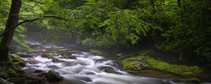
Pack your backpacking fishing rod for this thru-hike in the Great Smoky Mountains National Park. The BMT crosses multiple trout streams within the Park including Eagle Creek, Hazel Creek, Forney Creek, Noland Creek, and Big Creek. Fishing is allowed all year and in all streams; however, a fishing license is required from either Tennessee or North Carolina. Both state licenses are valid in the Park’s boundaries. Pick up your permit before entering the Park because licenses are not available within the GSMNP.
Registration and Permits
Before heading out on the Benton MacKaye Trail, fill out a self-registration form. The self-registration station is located at the Twentymile Ranger Station for north-bounders and at the Big Creek Ranger Station for south-bounders.
A backcountry camping permit is required for hiking in the Great Smoky Mountains National Park. Unlike on an AT thru-hike in the Park, this hike will require tent camping. Tent camping is allowed only in designated campsites. Your permit will register you for specific nights at specific campsites and shelters. Backcountry permit holders are not allowed to use tents at shelters. These rules are in place to protect the Park’s fragile ecosystem and limit human impact.
Resupply

There are five access points to the Benton MacKaye Trail. I recommend scheduling two resupplies on the 97-mile hike. This will lighten your overall pack weight.
Schedule your first resupply after the first third of your hike. Plan to meet your Trail Angel at the Road to Nowhere Tunnel parking lot, mile 37.3. The second resupply point is at the Smokemont Campground, mile 63.5.
These resupplies are excellent for motivation. Little treats like cold drinks, fried chicken, fresh fruit, and salad refuel not only your body but also your soul. Don’t forget to pack clean socks and underwear in your resupply boxes. Send your dirty clothes and items that you are not using home with your Trail Angel. Keep your pack as light as possible.
Suggested Itinerary:
Night |
Point of Interest/Shelters |
Mileage |
Elevation in feet |
| #1 | Campsite 90 | 8.2 | 1760 |
| #2 | Campsite 81 | 16.6 | 1800 |
| #3 | Campsite 98 | 27.9 | 1720 |
| Road to Nowhere Tunnel | 37 | 2320 | |
| 1st resupply point: Lake View Drive | 37.3 | 2079 | |
| #4 | Campsite 65 | 39.1 | 2040 |
| #5 | Campsite 56 | 50.7 | 2405 |
| #6 | Campsite 52 | 58 | 5000 |
| 2nd resupply point: Smokemont Campground | 63.5 | 2180 | |
| #7 | Campsite 47: 14.9 mile day with a good climb | 72.9 | 3620 |
| #8 | Laurel Gap Shelter | 83.0 | 5490 |
| Mount Sterling Fire Tower | 83.7 | 5842 | |
| #9 | Campsite 38 | 88.9 | 5820 |
| Davenport Gap, TN | 96.8 | 2000 |
If you are interested in completing a thru-hike through the Great Smoky Mountains National Park on which few others embark, come and hike the Benton MacKaye Trail. The BMT offers solitude plus views, wildlife, and fishing. This 97-mile section can be completed between two weekends and is a great option for those looking to hike something other than the Appalachian Trail through the GSMNP.
Hike Mount Sterling with a Guide
Guided Mount Sterling hikes are available, and are a stress-free, exciting way to do this trip. The tour company handles permits, gear, transportation, meals, and provides a professional guide so you can focus 100% on enjoying your adventure. Read more…
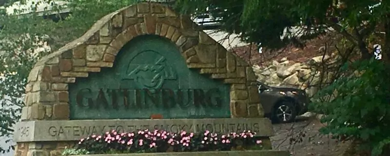
3. The Unique: Fontana Dam to Gatlinburg
Difficulty: Strenuous | Days: 5 | Mileage: 65
Interested in a unique thru-hiking experience through the Great Smoky Mountains National Park? Want a hike with ample points-of-interest? Would you like to meet other thru-hikers along your journey? Dust off your pack and de-cobweb your trekking poles. Hike Fontana Dam to Gatlinburg, a 65-mile thru-hike from North Carolina to Tennessee.
Route
Fontana Dam to Mount LeConte
This 65-mile trek through the Great Smoky Mountains National Park starts on the Appalachian Trail at Fontana Dam. In fact, the AT crosses the top of the dam. You will follow and hike the AT for about 44 miles until you reach the Boulevard Trail. The Boulevard Trail leads you to the top of Mount LeConte.
Mount LeConte to Gatlinburg
On top of Mount LeConte, you will decide your route down towards Gatlinburg. Pick one of the following three trails to lead you down the mountain: Bullhead Trail, Trillium Gap Trail, or Rainbow Falls. After reaching the shared parking lot for these three trails, hop on the Sugarlands Trail. Hike the Sugarlands Trail to the Gatlinburg Trail. The Gatlinburg Trail will take you directly into Gatlinburg, Tennessee, where your thru-hike will be complete. Here, ample choices of hot food and cold beverages will be at your fingertips.
Points of Interest
This hike consists of one must-see destination after another. You will continually have something to look forward to, keeping your motivation and stoke level high.
Fontana Dam To Newfound Gap
- Fontana Dam: the highest dam east of the Rockies.
- Shuckstack Tower: (0.1-mile side-trail) a 60-foot fire tower built in 1934 with remnants of a one-room cabin. It is one of four fire towers remaining in the National Park.
- Rocky Top: a rocky peak with 360-degree panoramic views of Fontana Lake and Cades Cove.
- Clingman’s Dome: this dome is the highest point in the Great Smoky Mountains National Park. It is located within both North Carolina and Tennessee.
- Newfound Gap: the site where President Franklin D Roosevelt formally dedicated the park on September 2, 1940.
Newfound Gap to LeConte Lodge
- Charlies Bunion: (0.5-mile round trip detour) a rock outcropping named after Charlie Conner’s bunion by Horace Kephart. Both men were influential in the formation of the Great Smoky Mountain National Park. This viewpoint stands at an elevation of around 6000 feet.
- Jump Off: (1-mile round trip detour) an unofficial National Park trail marked with a sign, offering views of Charlies Bunion, Mount Guyot and the Appalachian Trail upon a 1000-foot cliff.
- LeConte Lodge: the highest guest lodge in the Eastern United States accessible only by hiking.
- Cliff Tops: (located near Mt. LeConte Lodge) At 6,555 feet in elevation, this is the best destination for sunsets and for views of Clingman’s Dome.
- Myrtle Point: (0.4 miles one-way from the lodge) At 6,200 feet in elevation, the point is a great sunrise spot when atop Mt. LeConte.
Mount LeConte to Sugarlands Visitor Center
- The Pulpit (Bullhead Trail): a cairn built by the Civilian Conservation Corp in the mid-1930s, which allows hikers to stand above the rhododendron and take in the views.
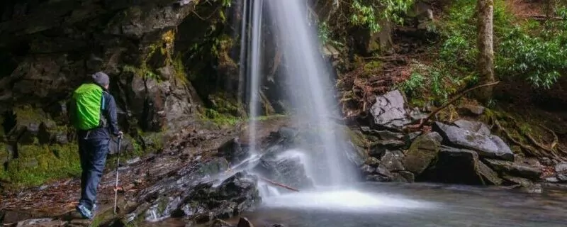
- Grotto Falls (Trillium Gap Trail – the Llama trail): the only waterfall in the Great Smoky Mountains National Park behind which you can walk.
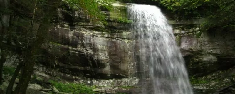
- Rainbow Falls (Rainbow Falls Trail): an 80-foot waterfall that produces rainbows on sunny afternoons.
- Sugarlands Visitor Center: One of four Great Smoky Mountains Visitor Centers; amenities include a 20-minute movie about the Park, natural history exhibits, restrooms, cold drinks, and a gift shop.
Choose your own adventure down Mount LeConte
1. Bullhead Trail
The Pulpit
This trail was closed due to fire damage. However, thanks to the hard work of trail maintainers, it reopened on October 25, 2018. Prior to the fires, this 7.2-mile hike existed in a rhododendron tunnel. The only viewpoint was at The Pulpit. The Pulpit is a large rock cairn built by the Civil Conservation Corps in the 1930s which allowed hikers to climb up and see over the rhododendron forest. Now, the cairn is unnecessary. There are views aplenty along most of the trail. In fact, my hike was extremely slow because of the number of times I stopped just to stare in awe and proclaim that this was now my favorite trail.
Use Caution
In my opinion, the Bullhead Trail is a must-do trail. Hike it sooner than later before the rhododendron regrows into its full glory. However, consider alternative trails on windy days. Falling trees are a real possibility. Between the forest fire and the wooly adelgid (an aphid-like insect that is killing the hemlocks by draining the trees of their sap), dead trees are abundant in this area. But on calm wind days, choose this route down from atop Mt. LeConte.
2. Trillium Gap Trail
Those familiar with the different hikes down from Mt. LeConte know that the Trillium Gap Trail is special for two reasons: Grotto Falls and the llamas. The 6.5-mile trail has scenic views along the way and a unique waterfall. It is a rocky trail. It is perfect for those who want a bit of a challenge with great rewards.
Llamas
Yes, I did say that this trail was known for the llamas. The LeConte Lodge is remote without roads leading to the top. In fact, before the Lodge opens in March every year, a helicopter drops supplies off near the summit. For the rest of LeConte Lodge’s season, a team of eight llamas hauls needed supplies up to the top. Three times a week – Monday, Wednesday, and Friday – these hard-working llamas bring food, supplies, and clean linens up to the Lodge and then carry the dirty linens and trash back to town.
Meeting the llamas is a real treat. Each llama has his/her own personality. I personally witnessed that they can be extremely picky eaters. The llamas begin their day no later than 6 am. By lunchtime, they typically arrive at the lodge where they are rewarded with a pancake treat. However, not all llamas like pancakes. To round out their snack, the llamas are also offered carrots and apples. Amazingly, I witnessed a few llamas sticking up their noses and refusing these sweet treats. But to meet the llamas and watch their eating antics, you must hike to the top of Mount LeConte.
Brushy Mountain
I do recommend that you take the short (about one-third of a mile) hike to the summit of Brushy Mountain. It’s a great place to take a break, eat a snack, and enjoy the majestic view of Mount LeConte and the eastern side of the Great Smoky Mountains.
Grotto Falls
At 1.3 miles from the end of this trail, you will be rewarded with a 25-foot waterfall named Grotto Falls. Trillium Gap Trail literally leads you directly behind the falls. Watch your footing as you walk behind this natural beauty. The path will be slippery. In the winter, when temperatures plummet below freezing, ice and icicles will be present.
3. Rainbow Falls Trail
The Rainbow Falls Trail is believed to be the oldest route to and from Mount LeConte’s summit. It is over 6.7 miles long. It is rocky and steep. So, why would you choose to trek this difficult trail when there are other shorter and less steep options? You choose this route to survey the lush vegetation, to gaze at amazing views, and to see the highest, single-drop waterfall in the Great Smoky Mountains National Park.
Rocky Spur
At 1.3 miles down Rainbow Falls Trail from Mount LeConte Lodge, there is a side trail leading to Rocky Spur. It is a short side trip that you do not want to skip. This spur trail leads to an outcrop where you can lay your eyes upon the Roaring Fork Valley.
Rainbow Falls
Once back on Rainbow Falls Trail, the falls are located 2.7 miles from the end of this trail. Rainbow Falls are just over 80-feet tall. On sunny days, a rainbow often forms in the mist giving Rainbow Falls its name.
LeConte Creek
The lower section of Rainbow Falls Trail follows along beside the LeConte Creek. LeConte Creek is also known as Mill Creek because of the large number of gristmills that formally operated along this creek. The trail will twist and turn periodically, taking you across the creek by way of foot-logs.
Seasons
Pick any season. You will enjoy trekking along the Rainbow Falls Trail.
In the summer months, it is an excellent route to follow down from Mount LeConte’s peak. The trail leads through dense forests and rhododendron/mountain laurel tunnels. Even on the hottest of days, the temperature will be cooler than on the more exposed Bullhead Trail. During the fall, the forest and views will be swathed in autumnal colors.
In winter, when the temperatures plummet below freezing, the lower portions of the trail leading from the falls will be covered in ice; as a result, Rainbow Falls will exhibit impressive ice structures. Springtime brings blooming rhododendron, mountain laurel, and sand myrtle, as well as, an abundance of wildflowers. Springtime also brings plentiful rain. Immediately after a good rain, when the sun comes out again from behind the clouds, the awesomeness of Rainbow Falls is at its full glory.
Resupply

Trail Angel Resupplies
There is only one good resupply point on this trek. Arrange to meet your trail angel at Newfound Gap. This is the only point on your hike where you will cross a road. It’s a good idea to have your Trail Angel bring you dinner. You have three more miles to hike to your shelter. This way, you can arrive at the shelter, have a snack, hang your food, and climb into bed. No fuss with dinner prep or clean up!
Food on Mount LeConte
On top of Mount LeConte, the LeConte Lodge does have some food and beverage options. They sell snack foods, cookie bars, and sack lunches to eat and hot chocolate, coffee, and lemonade to drink. The prices are steep, but they do accept debit and credit cards. No advanced notice is needed to purchase a brown bag lunch for your last day on the trail. The LeConte Lodge will be opened from March 23 through November 24, 2020.
Camping

For this 65-mile unique hike through the Great Smoky Mountains National Park, you will not need to carry a tent. Therefore, your pack weight will be lighter. For this hike, you will stay in shelters along the Appalachian Trail and on top of Mount LeConte. This requirement is to reduce human impact in the National Park and help preserve its vast and delicate ecosystem. Advanced reservations at each shelter are required and are made through the National Park.
AT Thru-Hikers
You will meet AT thru-hikers while on this unique trail through the Great Smoky Mountains National Park. Depending on the season, these AT trail hikers may be north or southbound. AT section hikers will also be found in abundance.
Southbound AT Hiker
The southbound AT hiker will quietly sneak into the shelter after completing their daily 20-30 miles. Their legs are strong. They are nearing the end of their 2100-mile journey.
Northbound AT Hiker
The northbound AT hiker is starting to get their trail legs. They are now hiking their second state and will most likely be quicker on their feet than you. Please move aside and wish them a safe journey as they pass, heading towards Katahdin in Maine.
AT Section Hiker
The AT section hiker will be moving your speed. You will be sharing shelters with them night after night. They will become your “trail family” while you are on your journey. These companions will be your support group, sharing in your lows and highs. Food and supplies will be shared among your family. Life-long friendships will be formed.
Suggested Itinerary
Night |
Shelters |
Daily Mileage |
| #1 | Mollies Ridge Shelter | 11.8 |
| #2 | Derrick Knob Shelter | 12.1 |
| #3 | Double Spring Shelter | 7.4 |
| #4 | Icewater Spring Shelter | 13.6 |
| #5 | Mount LeConte Shelter | 6 |
| Gatlinburg | 14.1 | |
| Total mileage: 65 |
Completing this unique 65-mile thru-hike from Fontana Dam to Gatlinburg through the Great Smoky Mountains National Park is an unforgettable experience. Numerous points-of-interest crammed into 65-miles of hiking makes this route through the National Park an excellent choice. Experiencing a taste of the Appalachian Trail is an added bonus and may further fuel your desire to complete the entire Appalachian Trail.
The Choice is Yours
Whatever route through the National Park you choose—the Classic, the Remote, or the Unique—you will not be disappointed. Your love of hiking will be only strengthened. The memories will be everlasting. Your backpack will never remain in the closet for long.
Inspired Exploration with Wildland Trekking
Wildland Trekking Hiking Adventures
As the world’s premier hiking and trekking company, Wildland believes in connecting people to fantastic environments in amazing ways. Wildland Trekking Company offers an array of incredible hiking and trekking experiences in 9 states and 11 countries. Read more about our world-class destinations.
To learn more about our guided backpacking trips and all of our award-winning hiking vacations, please visit our website or connect with one of our Adventure Consultants: 800-715-HIKE.

